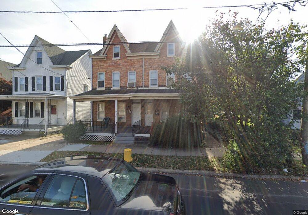
1957 S Broad St Trenton, NJ 08610
Franklin Park NeighborhoodEstimated Value: $270,082 - $315,000
--
Bed
--
Bath
1,766
Sq Ft
$165/Sq Ft
Est. Value
About This Home
This home is located at 1957 S Broad St, Trenton, NJ 08610 and is currently estimated at $292,271, approximately $165 per square foot. 1957 S Broad St is a home located in Mercer County with nearby schools including Lalor Elementary School, Richard C. Crockett Middle School, and Hamilton West-Watson High School.
Ownership History
Date
Name
Owned For
Owner Type
Purchase Details
Closed on
Sep 30, 2005
Sold by
Hennessy Michael
Bought by
Clugston Kenneth and Clugston Sharon
Current Estimated Value
Home Financials for this Owner
Home Financials are based on the most recent Mortgage that was taken out on this home.
Original Mortgage
$133,000
Outstanding Balance
$71,591
Interest Rate
5.85%
Mortgage Type
Purchase Money Mortgage
Estimated Equity
$220,680
Purchase Details
Closed on
Jun 26, 2000
Sold by
Cortesini Investments Llc
Bought by
Hennessy Michael and Clugston Kenneth
Home Financials for this Owner
Home Financials are based on the most recent Mortgage that was taken out on this home.
Original Mortgage
$96,723
Interest Rate
8.18%
Mortgage Type
FHA
Purchase Details
Closed on
Mar 8, 2000
Sold by
Cortesini Edward
Bought by
Cortesini Investments Llc
Create a Home Valuation Report for This Property
The Home Valuation Report is an in-depth analysis detailing your home's value as well as a comparison with similar homes in the area
Home Values in the Area
Average Home Value in this Area
Purchase History
| Date | Buyer | Sale Price | Title Company |
|---|---|---|---|
| Clugston Kenneth | $89,000 | -- | |
| Hennessy Michael | $98,000 | -- | |
| Cortesini Investments Llc | $49,432 | -- |
Source: Public Records
Mortgage History
| Date | Status | Borrower | Loan Amount |
|---|---|---|---|
| Open | Clugston Kenneth | $133,000 | |
| Previous Owner | Hennessy Michael | $96,723 |
Source: Public Records
Tax History Compared to Growth
Tax History
| Year | Tax Paid | Tax Assessment Tax Assessment Total Assessment is a certain percentage of the fair market value that is determined by local assessors to be the total taxable value of land and additions on the property. | Land | Improvement |
|---|---|---|---|---|
| 2025 | $4,454 | $126,400 | $25,200 | $101,200 |
| 2024 | $4,175 | $126,400 | $25,200 | $101,200 |
| 2023 | $4,175 | $126,400 | $25,200 | $101,200 |
| 2022 | $4,109 | $126,400 | $25,200 | $101,200 |
| 2021 | $5,085 | $126,400 | $25,200 | $101,200 |
| 2020 | $4,630 | $126,400 | $25,200 | $101,200 |
| 2019 | $4,494 | $126,400 | $25,200 | $101,200 |
| 2018 | $4,434 | $126,400 | $25,200 | $101,200 |
| 2017 | $4,237 | $126,400 | $25,200 | $101,200 |
| 2016 | $3,358 | $124,200 | $23,000 | $101,200 |
| 2015 | $4,631 | $88,900 | $12,400 | $76,500 |
| 2014 | $4,570 | $88,900 | $12,400 | $76,500 |
Source: Public Records
Map
Nearby Homes
- 1961 S Broad St
- 604 Schiller Ave
- 1857 S Broad St
- 1856 S Broad St
- 2033 Genesee St
- 34 Sewell Ave
- 218 Sewell Ave
- 109 E Park Ave
- 1816 Chambers St
- 238 Grand Ave
- 314 Joseph St
- 316 W Park Ave
- 229 Parkinson Ave
- 429 Wilfred Ave
- 323 Wilfred Ave
- 27 Westcott Ave
- 229 Wilfred Ave
- 27 Annabelle Ave
- 11 Panfili Ln
- 949 Schiller Ave
- 1959 S Broad St
- 1949 S Broad St
- 1947 S Broad St
- 1921 S Broad St
- 1945 S Broad St
- 256 Lafayette Ave
- 254 Lafayette Ave
- 260 Lafayette Ave
- 252 Lafayette Ave
- 250 Lafayette Ave
- 262 Lafayette Ave
- 0 Chambers St
- 248 Lafayette Ave
- 242 Lafayette Ave
- 266 Lafayette Ave
- 1935 S Broad St
- 238 Lafayette Ave
- 1933 S Broad St
- 294 Lafayette Ave
- 230 Lafayette Ave