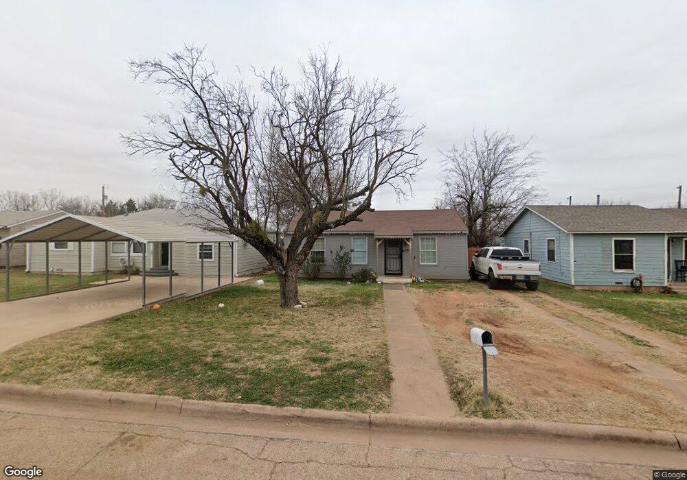
1957 Sandefer St Abilene, TX 79603
Sears Park NeighborhoodEstimated Value: $83,000 - $102,000
Studio
1
Bath
884
Sq Ft
$103/Sq Ft
Est. Value
About This Home
This home is located at 1957 Sandefer St, Abilene, TX 79603 and is currently estimated at $90,750, approximately $102 per square foot. 1957 Sandefer St is a home located in Taylor County with nearby schools including Ortiz Elementary School, Mann Middle School, and Abilene High School.
Ownership History
Date
Name
Owned For
Owner Type
Purchase Details
Closed on
May 20, 2011
Sold by
Cortez Rudolph
Bought by
Sanchez Ramon and Sanchez Agustina
Current Estimated Value
Home Financials for this Owner
Home Financials are based on the most recent Mortgage that was taken out on this home.
Original Mortgage
$33,500
Interest Rate
4.91%
Mortgage Type
Seller Take Back
Purchase Details
Closed on
Mar 23, 2011
Sold by
Sanchez Julia A Cortez
Bought by
Cortez Rudolph
Home Financials for this Owner
Home Financials are based on the most recent Mortgage that was taken out on this home.
Original Mortgage
$33,500
Interest Rate
4.91%
Mortgage Type
Seller Take Back
Create a Home Valuation Report for This Property
The Home Valuation Report is an in-depth analysis detailing your home's value as well as a comparison with similar homes in the area
Home Values in the Area
Average Home Value in this Area
Purchase History
| Date | Buyer | Sale Price | Title Company |
|---|---|---|---|
| Sanchez Ramon | -- | None Available | |
| Cortez Rudolph | -- | None Available |
Source: Public Records
Mortgage History
| Date | Status | Borrower | Loan Amount |
|---|---|---|---|
| Closed | Sanchez Ramon | $33,500 |
Source: Public Records
Tax History
| Year | Tax Paid | Tax Assessment Tax Assessment Total Assessment is a certain percentage of the fair market value that is determined by local assessors to be the total taxable value of land and additions on the property. | Land | Improvement |
|---|---|---|---|---|
| 2025 | $370 | $38,211 | -- | -- |
| 2023 | $370 | $31,579 | $0 | $0 |
| 2022 | $729 | $28,708 | $0 | $0 |
| 2021 | $704 | $27,579 | $2,800 | $24,779 |
| 2020 | $651 | $23,725 | $2,800 | $20,925 |
| 2019 | $612 | $23,162 | $3,500 | $19,662 |
| 2018 | $592 | $22,982 | $3,500 | $19,482 |
| 2017 | $567 | $22,825 | $3,500 | $19,325 |
| 2016 | $560 | $22,544 | $3,500 | $19,044 |
| 2015 | $532 | $22,228 | $3,500 | $18,728 |
| 2014 | $532 | $21,972 | $0 | $0 |
Source: Public Records
Map
Nearby Homes
- 926 Clinton St
- 2102 Swenson St
- 1741 University Blvd
- 2517 Ball St
- 310 Meadow Valley Rd
- 2233 Amy Lyn Ave
- 2117 Shelton St
- 1734 Park Ave
- 1726 Park Ave
- 2010 Vogel Ave
- 1782 N 15th St
- 1417 Lowden St
- 2781 Beech St Unit A & B
- 1950 Burger St
- 1910 Burger St
- 2209 N Mockingbird Ln
- 1950 Fannin St
- 1557 Burger St
- 2441 Westmoreland St
- 201 Westmoreland St
- 1949 Sandefer St
- 1965 Sandefer St
- 1973 Sandefer St
- 1941 Sandefer St
- 1981 Sandefer St
- 1925 Sandefer St
- 1918 Sandefer St
- 1934 Sandefer St
- 1902 Sandefer St
- 1917 Sandefer St
- 1909 Sandefer St
- 2218 Old Anson Rd
- 2226 Old Anson Rd
- 2321 Old Anson Rd
- 2234 Old Anson Rd
- 2038 Ambler Ave
- 2302 Clinton St
- 1901 Sandefer St
- 1925 Ambler Ave
- 1941 University Blvd
Your Personal Tour Guide
Ask me questions while you tour the home.