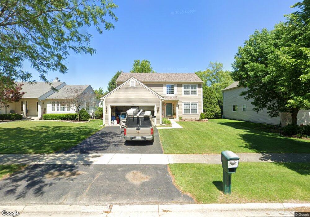
1958 Conway Ln Aurora, IL 60503
Far Southeast NeighborhoodEstimated Value: $444,067 - $471,000
4
Beds
4
Baths
2,069
Sq Ft
$223/Sq Ft
Est. Value
About This Home
This home is located at 1958 Conway Ln, Aurora, IL 60503 and is currently estimated at $461,517, approximately $223 per square foot. 1958 Conway Ln is a home located in Kendall County with nearby schools including The Wheatlands Elementary School, Bednarcik Jr. High School, and Oswego East High School.
Ownership History
Date
Name
Owned For
Owner Type
Purchase Details
Closed on
Jun 12, 1997
Sold by
The Northern Trust Company
Bought by
Rodriguez Sergio and Rodriguez Norma L
Current Estimated Value
Home Financials for this Owner
Home Financials are based on the most recent Mortgage that was taken out on this home.
Original Mortgage
$151,000
Interest Rate
7.32%
Purchase Details
Closed on
Jan 24, 1997
Sold by
Binder Francis C and Binder Arlet J
Bought by
Thatcher Treber and Thatcher Karen
Create a Home Valuation Report for This Property
The Home Valuation Report is an in-depth analysis detailing your home's value as well as a comparison with similar homes in the area
Home Values in the Area
Average Home Value in this Area
Purchase History
| Date | Buyer | Sale Price | Title Company |
|---|---|---|---|
| Rodriguez Sergio | $176,500 | -- | |
| Thatcher Treber | $41,000 | -- |
Source: Public Records
Mortgage History
| Date | Status | Borrower | Loan Amount |
|---|---|---|---|
| Previous Owner | Rodriguez Sergio | $151,000 |
Source: Public Records
Tax History
| Year | Tax Paid | Tax Assessment Tax Assessment Total Assessment is a certain percentage of the fair market value that is determined by local assessors to be the total taxable value of land and additions on the property. | Land | Improvement |
|---|---|---|---|---|
| 2024 | $10,241 | $121,269 | $28,223 | $93,046 |
| 2023 | $9,396 | $108,276 | $25,199 | $83,077 |
| 2022 | $9,396 | $99,335 | $23,118 | $76,217 |
| 2021 | $8,815 | $90,304 | $21,016 | $69,288 |
| 2020 | $8,732 | $88,533 | $20,604 | $67,929 |
| 2019 | $8,723 | $86,555 | $20,604 | $65,951 |
| 2018 | $8,364 | $83,564 | $19,892 | $63,672 |
| 2017 | $8,106 | $77,018 | $18,334 | $58,684 |
| 2016 | $7,766 | $73,003 | $17,378 | $55,625 |
| 2015 | $8,000 | $69,526 | $16,550 | $52,976 |
| 2014 | -- | $65,590 | $15,613 | $49,977 |
| 2013 | -- | $66,253 | $15,771 | $50,482 |
Source: Public Records
Map
Nearby Homes
- 1935 Chesterfield Ln
- 1973 Eastwick Ln
- 1733 Stable Ln
- 1739 Baler Ave
- 1745 Baler Ave
- 1744 Stable Ln
- 1752 Stable Ln
- 1748 Stable Ln
- 1740 Baler Ave
- 1715 Baler Ave
- 1738 Baler Ave
- 1733 Baler Ave
- 1853 Baler Ave
- 2060 Lyndhurst Ln
- 1900 Canyon Creek Dr
- 2084 Canyon Creek Ct
- 1633 Fredericksburg Ln Unit 2
- 1800 Diamond Creek Ln Unit 1
- 1830 Canyon Creek Dr
- 2208 Grand Pointe Trail
- 1966 Conway Ln Unit 1
- 1950 Conway Ln
- 1925 Eastwick Ln Unit 1
- 1933 Eastwick Ln
- 1974 Conway Ln
- 1917 Eastwick Ln
- 1942 Conway Ln Unit 1
- 1941 Eastwick Ln
- 1909 Eastwick Ln Unit 1
- 1961 Conway Ln Unit 1
- 1953 Conway Ln
- 1969 Conway Ln
- 1934 Conway Ln
- 1982 Conway Ln
- 1945 Conway Ln
- 1949 Eastwick Ln
- 1901 Eastwick Ln Unit 1
- 1977 Conway Ln
- 1937 Conway Ln Unit 1
- 1926 Conway Ln
Your Personal Tour Guide
Ask me questions while you tour the home.