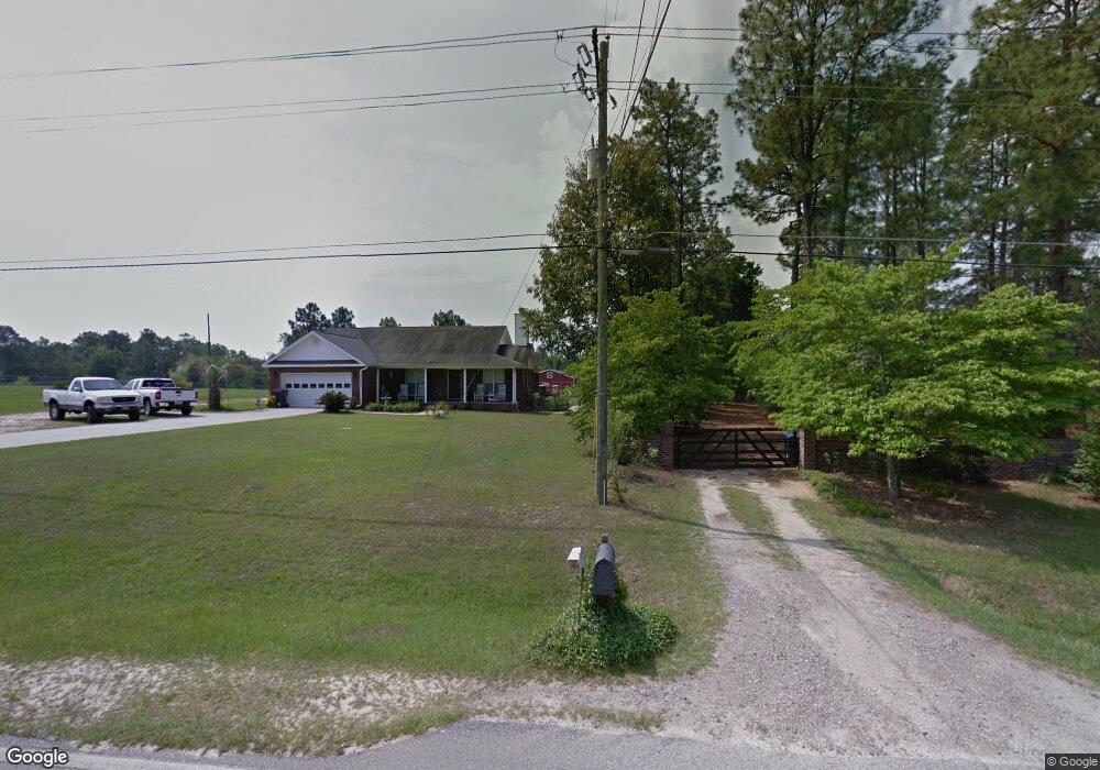
1958 Mcdade Rd Hephzibah, GA 30815
McDade NeighborhoodEstimated Value: $217,455 - $290,000
3
Beds
2
Baths
1,556
Sq Ft
$164/Sq Ft
Est. Value
About This Home
This home is located at 1958 Mcdade Rd, Hephzibah, GA 30815 and is currently estimated at $255,114, approximately $163 per square foot. 1958 Mcdade Rd is a home located in Richmond County with nearby schools including Goshen Elementary School, Pine Hill Middle School, and Johnson Magnet.
Ownership History
Date
Name
Owned For
Owner Type
Purchase Details
Closed on
Oct 30, 2003
Sold by
Twing Jason B and Twing Stephanie A
Bought by
Conner David W and Conner Phyllis M
Current Estimated Value
Home Financials for this Owner
Home Financials are based on the most recent Mortgage that was taken out on this home.
Original Mortgage
$100,625
Outstanding Balance
$21,882
Interest Rate
6%
Mortgage Type
Purchase Money Mortgage
Estimated Equity
$233,232
Purchase Details
Closed on
Sep 14, 2001
Sold by
Mrc Construction Company Inc
Bought by
Twing Jason B and Twing Stephanie A
Home Financials for this Owner
Home Financials are based on the most recent Mortgage that was taken out on this home.
Original Mortgage
$109,077
Interest Rate
6.97%
Mortgage Type
VA
Create a Home Valuation Report for This Property
The Home Valuation Report is an in-depth analysis detailing your home's value as well as a comparison with similar homes in the area
Home Values in the Area
Average Home Value in this Area
Purchase History
| Date | Buyer | Sale Price | Title Company |
|---|---|---|---|
| Conner David W | $115,000 | -- | |
| Twing Jason B | $105,900 | -- |
Source: Public Records
Mortgage History
| Date | Status | Borrower | Loan Amount |
|---|---|---|---|
| Open | Conner David W | $100,625 | |
| Previous Owner | Twing Jason B | $109,077 |
Source: Public Records
Tax History Compared to Growth
Tax History
| Year | Tax Paid | Tax Assessment Tax Assessment Total Assessment is a certain percentage of the fair market value that is determined by local assessors to be the total taxable value of land and additions on the property. | Land | Improvement |
|---|---|---|---|---|
| 2024 | $3,355 | $91,704 | $4,200 | $87,504 |
| 2023 | $1,846 | $80,324 | $4,200 | $76,124 |
| 2022 | $2,736 | $88,568 | $4,200 | $84,368 |
| 2021 | $1,911 | $54,298 | $4,200 | $50,098 |
| 2020 | $1,882 | $54,298 | $4,200 | $50,098 |
| 2019 | $1,991 | $54,298 | $4,200 | $50,098 |
| 2018 | $1,592 | $49,078 | $4,200 | $44,878 |
| 2017 | $1,809 | $49,078 | $4,200 | $44,878 |
| 2016 | $1,810 | $49,078 | $4,200 | $44,878 |
| 2015 | -- | $49,078 | $4,200 | $44,878 |
| 2014 | -- | $50,158 | $4,200 | $45,958 |
Source: Public Records
Map
Nearby Homes
- 1894 Mcdade Rd
- 2031 Mcdade Rd
- 1943 McDade Farm Rd Unit F
- 1898 McDade Farm Rd
- 3926 Union Grove Cir
- 2039 McDade Farm Rd
- 1775 Brown Rd
- 4152 Big Oak Dr
- 1807 Mcdade Rd
- 3405 Southern Ridge Ct
- 1018 Cedarview Cir
- 4065 Old Waynesboro Rd
- 2319 Peach Blossom Pass
- 2053 Brown Rd
- 4129 Markwalter Rd
- 4149 Markwalter Rd
- 2107 Brown Rd
- 3819 Clanton Rd
- 2013 Pondcypress Ct
- 4071 Burning Tree Ln
- 1987 Mcdade Rd
- 1991 Mcdade Rd
- 1992A Mcdade Rd
- 1954 McDade Farm Rd
- 1952 McDade Farm Rd
- 1849 Mcdade Rd
- 2032 Mcdade Rd
- 1908 Mcdade Rd
- 1908&10 Mcdade Rd
- 0 Mcdade Rd
- 1894 Mcdade Rd
- 1950 Mcdade Rd
- 1953 Mcdade Rd
- 1948 Mcdade Rd
- 1955 McDade Farm Rd
- 1961 McDade Farm Rd
- 1902 Mcdade Rd
- 1966 Mcdade Rd
- 1946 Mcdade Rd