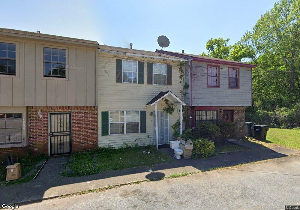
1958 Springlake Ct Birmingham, AL 35215
Estimated Value: $92,000 - $114,000
2
Beds
2
Baths
1,152
Sq Ft
$89/Sq Ft
Est. Value
About This Home
This home is located at 1958 Springlake Ct, Birmingham, AL 35215 and is currently estimated at $102,333, approximately $88 per square foot. 1958 Springlake Ct is a home located in Jefferson County with nearby schools including Chalkville Elementary School, Clay-Chalkville Middle School, and Clay-Chalkville High School.
Ownership History
Date
Name
Owned For
Owner Type
Purchase Details
Closed on
Nov 30, 2006
Sold by
Carter Cassondra L Horsley and Carter Michael E
Bought by
Embry Laquita
Current Estimated Value
Home Financials for this Owner
Home Financials are based on the most recent Mortgage that was taken out on this home.
Original Mortgage
$72,900
Outstanding Balance
$43,634
Interest Rate
6.33%
Mortgage Type
Purchase Money Mortgage
Estimated Equity
$58,699
Purchase Details
Closed on
Oct 17, 1997
Sold by
Melville Camile O and Melville Anthony
Bought by
Horsley Cassondra L
Home Financials for this Owner
Home Financials are based on the most recent Mortgage that was taken out on this home.
Original Mortgage
$50,051
Interest Rate
7.55%
Mortgage Type
FHA
Create a Home Valuation Report for This Property
The Home Valuation Report is an in-depth analysis detailing your home's value as well as a comparison with similar homes in the area
Home Values in the Area
Average Home Value in this Area
Purchase History
| Date | Buyer | Sale Price | Title Company |
|---|---|---|---|
| Embry Laquita | $72,900 | None Available | |
| Horsley Cassondra L | $51,000 | Alabama Title Co Inc |
Source: Public Records
Mortgage History
| Date | Status | Borrower | Loan Amount |
|---|---|---|---|
| Open | Embry Laquita | $72,900 | |
| Previous Owner | Horsley Cassondra L | $50,051 |
Source: Public Records
Tax History Compared to Growth
Tax History
| Year | Tax Paid | Tax Assessment Tax Assessment Total Assessment is a certain percentage of the fair market value that is determined by local assessors to be the total taxable value of land and additions on the property. | Land | Improvement |
|---|---|---|---|---|
| 2024 | $942 | $19,780 | -- | -- |
| 2022 | $861 | $17,180 | $2,240 | $14,940 |
| 2021 | $777 | $15,500 | $2,240 | $13,260 |
| 2020 | $711 | $14,200 | $2,240 | $11,960 |
| 2019 | $711 | $14,200 | $0 | $0 |
| 2018 | $686 | $13,700 | $0 | $0 |
| 2017 | $291 | $6,860 | $0 | $0 |
| 2016 | $291 | $6,860 | $0 | $0 |
| 2015 | $291 | $6,860 | $0 | $0 |
| 2014 | $517 | $6,180 | $0 | $0 |
| 2013 | $517 | $6,180 | $0 | $0 |
Source: Public Records
Map
Nearby Homes
- 1937 Springlake Ct
- 1834 Oakleaf Ln
- 668 20th Ct NE
- 1824 Stonehenge Dr
- 4269 Fieldstone Way
- 1857 Woodvine Ln
- 1810 Oakleaf Ln
- 915 Rich Rd
- 4604 Fairfax Ct
- 1010 Cannon Cir
- 1804 Stonehenge Dr
- 1833 Eastridge Dr
- 1929 Westridge Dr
- 513 20th Ave NE
- 1720 Big Mountain Cir
- 1212 Sweetwater Cir
- 1836 Westridge Dr
- 500 20th Ave NE
- 2212 Shirley Dr
- 421 19th Terrace NE
- 1956 Springlake Ct
- 1954 Springlake Ct
- 1952 Springlake Ct
- 1950 Springlake Ct
- 1955 Springlake Ct
- 1957 Springlake Ct
- 1953 Springlake Ct
- 1951 Springlake Ct
- 1922 Springlake Ct
- 1949 Springlake Ct
- 1920 Springlake Ct
- 1918 Springlake Ct
- 1916 Springlake Ct
- 1924 Springlake Ct
- 1914 Springlake Ct
- 1959 Springlake Ct
- 1947 Springlake Ct
- 1945 Springlake Ct
- 1941 Springlake Ct
- 1910 Springlake Ct