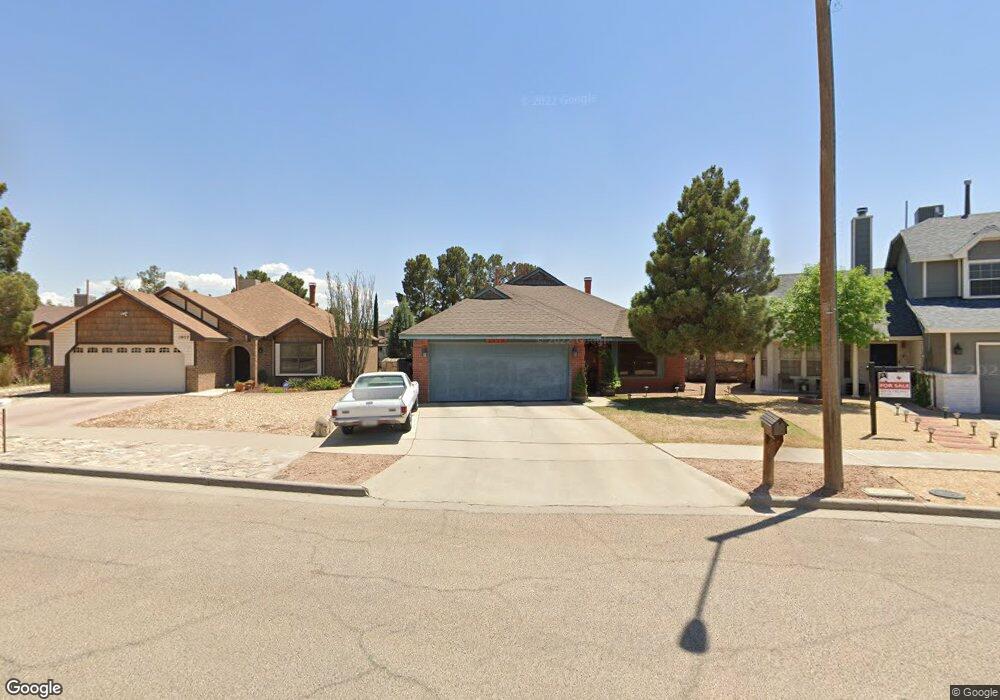
1959 Dana Bree Dr El Paso, TX 79936
O'Shea Keleher NeighborhoodEstimated Value: $215,989 - $234,000
3
Beds
2
Baths
1,495
Sq Ft
$149/Sq Ft
Est. Value
About This Home
This home is located at 1959 Dana Bree Dr, El Paso, TX 79936 and is currently estimated at $223,497, approximately $149 per square foot. 1959 Dana Bree Dr is a home located in El Paso County with nearby schools including O'shea Keleher Elementary School, William D Slider Middle School, and Montwood High School.
Ownership History
Date
Name
Owned For
Owner Type
Purchase Details
Closed on
Apr 25, 2000
Sold by
Zubia James D and Zubia Selina W
Bought by
Talamantes Christopher and Talamantes Magdalena M
Current Estimated Value
Home Financials for this Owner
Home Financials are based on the most recent Mortgage that was taken out on this home.
Original Mortgage
$75,874
Outstanding Balance
$26,307
Interest Rate
8.19%
Mortgage Type
FHA
Estimated Equity
$197,190
Create a Home Valuation Report for This Property
The Home Valuation Report is an in-depth analysis detailing your home's value as well as a comparison with similar homes in the area
Home Values in the Area
Average Home Value in this Area
Purchase History
| Date | Buyer | Sale Price | Title Company |
|---|---|---|---|
| Talamantes Christopher | -- | -- |
Source: Public Records
Mortgage History
| Date | Status | Borrower | Loan Amount |
|---|---|---|---|
| Open | Talamantes Christopher | $75,874 |
Source: Public Records
Tax History Compared to Growth
Tax History
| Year | Tax Paid | Tax Assessment Tax Assessment Total Assessment is a certain percentage of the fair market value that is determined by local assessors to be the total taxable value of land and additions on the property. | Land | Improvement |
|---|---|---|---|---|
| 2025 | $2,269 | $199,503 | -- | -- |
| 2024 | $2,269 | $181,366 | -- | -- |
| 2023 | $2,171 | $164,878 | $0 | $0 |
| 2022 | $4,341 | $149,889 | $0 | $0 |
| 2021 | $4,289 | $147,413 | $25,646 | $121,767 |
| 2020 | $3,932 | $123,875 | $20,707 | $103,168 |
| 2018 | $3,628 | $124,060 | $20,707 | $103,353 |
| 2017 | $3,397 | $118,931 | $20,707 | $98,224 |
| 2016 | $3,308 | $115,797 | $20,707 | $95,090 |
| 2015 | $2,946 | $115,797 | $20,707 | $95,090 |
| 2014 | $2,946 | $115,074 | $20,707 | $94,367 |
Source: Public Records
Map
Nearby Homes
- 11663 Clear Lake Way
- 11539 Clear Lake Way
- 1733 Karl Wyler Dr
- 1935 Bay City Place
- 2029 Greenlee Dr
- 11654 Bob Mitchell Dr
- TBD 001 Montwood Dr
- TBD 006 Montwood Dr
- TBD 003 Montwood Dr
- TBD 004 Montwood Dr
- TBD 005 Montwood Dr
- TBD 002 Montwood Dr
- 1690 Leroy Bonse Dr
- 2078 Gus Moran St
- 1904 Ralph Janes Place
- 11709 Ronald McNair Dr
- 3655 George Dieter Dr
- 11506 James Grant Dr
- 1808 Neil Armstrong Ln
- 1639 Brian Ray Cir
- 1957 Dana Bree Dr
- 1961 Dana Bree Dr
- 11507 Clear Lake Way
- 1955 Dana Bree Dr
- 11507 Clear Lake Cir
- 11509 Clear Lake Way
- 11505 Clear Lake Way
- 1963 Dana Bree Dr
- 1963 Dana Bree Dr Unit o
- 1963 Dana Bree Dr
- 11513 Clear Lake Way
- 11505 Clear Lake Cir
- 11503 Clear Lake Cir Unit 1
- 11503 Clear Lake Cir
- 11503 Clear Lake Way
- 1953 Dana Bree Dr
- 1953 Dana Bree Dr Unit 1
- 1964 Dana Bree Dr
- 11681 Clear Lake Way
- 1965 Dana Bree Dr