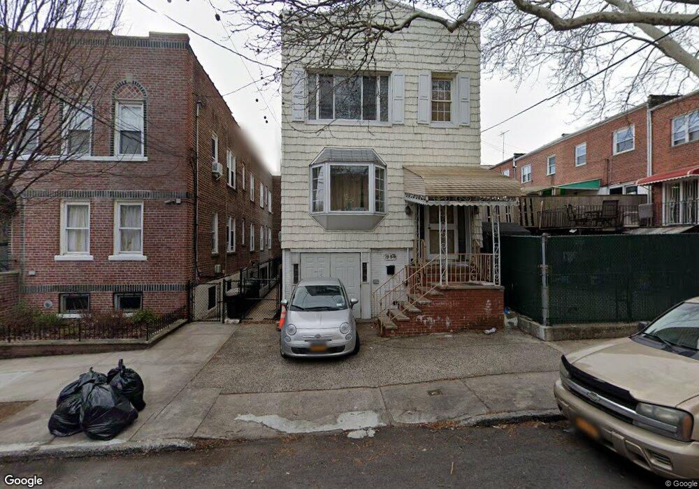
1959 Lurting Ave Bronx, NY 10461
Morris Park NeighborhoodEstimated Value: $754,746 - $901,000
--
Bed
--
Bath
2,347
Sq Ft
$357/Sq Ft
Est. Value
About This Home
This home is located at 1959 Lurting Ave, Bronx, NY 10461 and is currently estimated at $838,187, approximately $357 per square foot. 1959 Lurting Ave is a home located in Bronx County with nearby schools including P.S. 083 The Donald Hertz School and Children's Aid College Preparatory Charter School.
Ownership History
Date
Name
Owned For
Owner Type
Purchase Details
Closed on
Jul 5, 2000
Sold by
Aviles Evelyn
Bought by
Lopez Evelyn
Current Estimated Value
Home Financials for this Owner
Home Financials are based on the most recent Mortgage that was taken out on this home.
Original Mortgage
$104,000
Interest Rate
7.96%
Purchase Details
Closed on
Nov 10, 1999
Sold by
Aviles Robert and Aviles Evelyn
Bought by
Aviles Evelyn
Create a Home Valuation Report for This Property
The Home Valuation Report is an in-depth analysis detailing your home's value as well as a comparison with similar homes in the area
Home Values in the Area
Average Home Value in this Area
Purchase History
| Date | Buyer | Sale Price | Title Company |
|---|---|---|---|
| Lopez Evelyn | -- | -- | |
| Lopez Evelyn | -- | -- | |
| Aviles Evelyn | -- | The Title Guarantee Company | |
| Aviles Evelyn | -- | The Title Guarantee Company |
Source: Public Records
Mortgage History
| Date | Status | Borrower | Loan Amount |
|---|---|---|---|
| Previous Owner | Lopez Evelyn | $104,000 |
Source: Public Records
Tax History Compared to Growth
Tax History
| Year | Tax Paid | Tax Assessment Tax Assessment Total Assessment is a certain percentage of the fair market value that is determined by local assessors to be the total taxable value of land and additions on the property. | Land | Improvement |
|---|---|---|---|---|
| 2025 | $7,008 | $38,467 | $6,495 | $31,972 |
| 2024 | $7,008 | $36,290 | $7,211 | $29,079 |
| 2023 | $3,192 | $34,237 | $6,937 | $27,300 |
| 2022 | $3,091 | $47,040 | $9,300 | $37,740 |
| 2021 | $3,174 | $44,100 | $9,300 | $34,800 |
| 2020 | $3,097 | $41,160 | $9,300 | $31,860 |
| 2019 | $2,870 | $37,500 | $9,300 | $28,200 |
| 2018 | $2,610 | $28,531 | $6,856 | $21,675 |
| 2017 | $2,630 | $28,200 | $8,554 | $19,646 |
| 2016 | $2,443 | $27,540 | $9,300 | $18,240 |
| 2015 | $1,385 | $26,714 | $9,903 | $16,811 |
| 2014 | $1,385 | $25,202 | $9,897 | $15,305 |
Source: Public Records
Map
Nearby Homes
- 1059 Neill Ave
- 1963 Hone Ave
- 1054 Lydig Ave
- 1088 Lydig Ave
- 1958 Colden Ave
- 1917 Lurting Ave
- 2116 Paulding Ave
- 2037 Radcliff Ave
- 1903 Tomlinson Ave
- 1859 Hone Ave
- - Lydig Ave
- 1004 Rhinelander Ave
- 1116 Rhinelander Ave
- 2166 Paulding Ave
- 1855 Williamsbridge Rd
- 1925 Bogart Ave
- 1832 Haight Ave
- 2129 Muliner Ave
- 2080 Matthews Ave
- 1819 Haight Ave
- 1955 Lurting Ave
- 1064 Neill Ave
- 1062 Neill Ave
- 1066 Neill Ave
- 1068 Neill Ave
- 1953 Lurting Ave
- 1058 Neill Ave
- 1954 Hone Ave
- 1951 Lurting Ave
- 1952 Hone Ave
- 1056 Neill Ave Unit 1
- 1056 Neill Ave Unit 2
- 1056 Neill Ave
- 1950 Hone Ave
- 1948 Hone Ave
- 1945 Lurting Ave
- 1054 Neill Ave Unit GF
- 1054 Neill Ave
- 1946 Hone Ave
- 1960 Lurting Ave