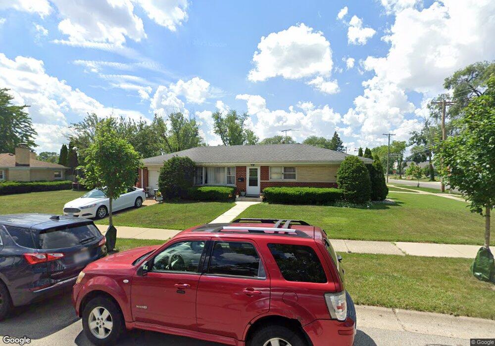
1959 Maple St Des Plaines, IL 60018
Estimated Value: $339,000 - $368,000
3
Beds
1
Bath
1,042
Sq Ft
$338/Sq Ft
Est. Value
About This Home
This home is located at 1959 Maple St, Des Plaines, IL 60018 and is currently estimated at $352,035, approximately $337 per square foot. 1959 Maple St is a home located in Cook County with nearby schools including South Elementary School, Algonquin Middle School, and Maine West High School.
Ownership History
Date
Name
Owned For
Owner Type
Purchase Details
Closed on
Sep 3, 2024
Sold by
Muro Heraclio Murillo
Bought by
Muro Heraclio Murillo and Delmuro Ma Del
Current Estimated Value
Purchase Details
Closed on
Aug 17, 2016
Sold by
Muro Heraclio Murillo and Montoya Teresa
Bought by
Muro Heraclio Murillo
Purchase Details
Closed on
Nov 12, 2008
Sold by
Uli Alan E and Uli Richard P
Bought by
Murillo Heraclio Muro and Montoya Teresa
Home Financials for this Owner
Home Financials are based on the most recent Mortgage that was taken out on this home.
Original Mortgage
$212,199
Interest Rate
6.48%
Mortgage Type
FHA
Purchase Details
Closed on
Mar 15, 2002
Sold by
Lasalle Bank National Assn
Bought by
Alfonse R Uli Living Trust
Create a Home Valuation Report for This Property
The Home Valuation Report is an in-depth analysis detailing your home's value as well as a comparison with similar homes in the area
Home Values in the Area
Average Home Value in this Area
Purchase History
| Date | Buyer | Sale Price | Title Company |
|---|---|---|---|
| Muro Heraclio Murillo | -- | None Listed On Document | |
| Muro Heraclio Murillo | -- | None Listed On Document | |
| Muro Heraclio Murillo | -- | None Available | |
| Murillo Heraclio Muro | $215,000 | Fatic | |
| Alfonse R Uli Living Trust | -- | -- |
Source: Public Records
Mortgage History
| Date | Status | Borrower | Loan Amount |
|---|---|---|---|
| Previous Owner | Murillo Heraclio Muro | $212,199 |
Source: Public Records
Tax History
| Year | Tax Paid | Tax Assessment Tax Assessment Total Assessment is a certain percentage of the fair market value that is determined by local assessors to be the total taxable value of land and additions on the property. | Land | Improvement |
|---|---|---|---|---|
| 2025 | $5,981 | $31,000 | $7,020 | $23,980 |
| 2024 | $5,981 | $26,000 | $5,850 | $20,150 |
| 2023 | $5,810 | $26,000 | $5,850 | $20,150 |
| 2022 | $5,810 | $26,000 | $5,850 | $20,150 |
| 2021 | $4,431 | $17,745 | $4,875 | $12,870 |
| 2020 | $4,425 | $17,745 | $4,875 | $12,870 |
| 2019 | $4,443 | $19,939 | $4,875 | $15,064 |
| 2018 | $5,309 | $21,187 | $4,290 | $16,897 |
| 2017 | $5,233 | $21,187 | $4,290 | $16,897 |
| 2016 | $5,194 | $21,187 | $4,290 | $16,897 |
| 2015 | $4,879 | $18,761 | $3,705 | $15,056 |
| 2014 | $4,792 | $18,761 | $3,705 | $15,056 |
| 2013 | $4,655 | $18,761 | $3,705 | $15,056 |
Source: Public Records
Map
Nearby Homes
- 1721 Prospect Ave
- 1922 Fargo Ave
- 1640 S River Rd
- 1445 Everett Ave
- 1645 Illinois St
- 1689 S Elm St
- 1696 S Elm St
- 1370 Fargo Ave Unit E
- 2220 S Chestnut St
- 1641 E Touhy Ave
- 1629 E Touhy Ave
- 1990 Berry Ln
- 1700 E Forest Ave
- 38 E Touhy Ave
- 2469 Parkwood Ln
- 2600 S Scott St
- 2609 Eisenhower Dr
- 700 Florence Dr
- 2646 Maple St
- 1738 Lunt Ave
- 1967 Maple St
- 1821 Stockton Ave
- 1975 Maple St
- 1800 Stockton Ave
- 1830 Stockton Ave
- 1831 Stockton Ave
- 1983 Maple St
- 1797 Stockton Ave
- 1795 Stockton Ave
- 1798 Stockton Ave
- 1820 Howard Ave
- 1921 Maple St
- 1840 Stockton Ave
- 1841 Stockton Ave
- 1796 Stockton Ave
- 1785 Stockton Ave
- 1991 Maple St
- 1830 Howard Ave
- 1783 Stockton Ave
- 1786 Stockton Ave
Your Personal Tour Guide
Ask me questions while you tour the home.