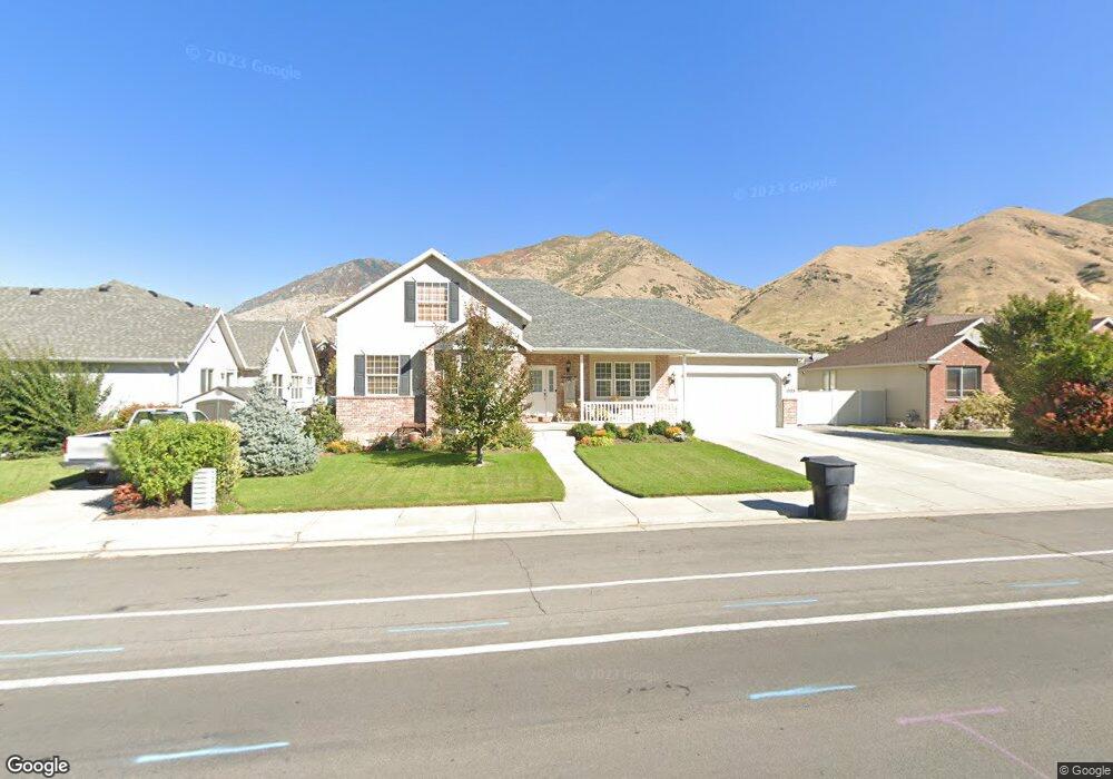
1959 River Bottom Rd Springville, UT 84663
East Hobble Creek NeighborhoodEstimated Value: $554,000 - $762,000
5
Beds
5
Baths
3,543
Sq Ft
$187/Sq Ft
Est. Value
About This Home
This home is located at 1959 River Bottom Rd, Springville, UT 84663 and is currently estimated at $661,655, approximately $186 per square foot. 1959 River Bottom Rd is a home located in Utah County with nearby schools including Hobble Creek School, Springville High School, and Springville Junior High School.
Ownership History
Date
Name
Owned For
Owner Type
Purchase Details
Closed on
Oct 28, 2009
Sold by
Briggs John William and Briggs Allowee H
Bought by
Briggs Cordell H and Briggs Starla
Current Estimated Value
Home Financials for this Owner
Home Financials are based on the most recent Mortgage that was taken out on this home.
Original Mortgage
$256,410
Outstanding Balance
$167,426
Interest Rate
5%
Mortgage Type
FHA
Estimated Equity
$494,229
Purchase Details
Closed on
Mar 29, 2005
Sold by
Esquivel Bryan L and Esquivel Jenny L
Bought by
Briggs John William and Briggs Allowee H
Purchase Details
Closed on
Oct 5, 2001
Sold by
Av Pinn Llc
Bought by
Esquivel Bryan L and Esquivel Jenny L
Purchase Details
Closed on
Jul 13, 2001
Sold by
Hunter Valley West Lc
Bought by
Av Pinn Llc
Home Financials for this Owner
Home Financials are based on the most recent Mortgage that was taken out on this home.
Original Mortgage
$167,200
Interest Rate
7.26%
Mortgage Type
Construction
Create a Home Valuation Report for This Property
The Home Valuation Report is an in-depth analysis detailing your home's value as well as a comparison with similar homes in the area
Home Values in the Area
Average Home Value in this Area
Purchase History
| Date | Buyer | Sale Price | Title Company |
|---|---|---|---|
| Briggs Cordell H | -- | Title One | |
| Briggs John William | -- | Fidelity Land & Title | |
| Esquivel Bryan L | -- | Title West Title Co | |
| Av Pinn Llc | -- | Title West Title Co |
Source: Public Records
Mortgage History
| Date | Status | Borrower | Loan Amount |
|---|---|---|---|
| Open | Briggs Cordell H | $256,410 | |
| Previous Owner | Av Pinn Llc | $167,200 |
Source: Public Records
Tax History Compared to Growth
Tax History
| Year | Tax Paid | Tax Assessment Tax Assessment Total Assessment is a certain percentage of the fair market value that is determined by local assessors to be the total taxable value of land and additions on the property. | Land | Improvement |
|---|---|---|---|---|
| 2025 | $3,043 | $324,060 | $249,500 | $339,700 |
| 2024 | $3,043 | $311,795 | $0 | $0 |
| 2023 | $3,022 | $309,925 | $0 | $0 |
| 2022 | $3,315 | $333,905 | $0 | $0 |
| 2021 | $2,820 | $442,100 | $161,600 | $280,500 |
| 2020 | $2,595 | $394,400 | $129,300 | $265,100 |
| 2019 | $2,488 | $384,900 | $125,600 | $259,300 |
| 2018 | $2,432 | $359,000 | $125,600 | $233,400 |
| 2017 | $2,126 | $166,705 | $0 | $0 |
| 2016 | $2,142 | $164,670 | $0 | $0 |
| 2015 | $1,974 | $155,100 | $0 | $0 |
| 2014 | $1,903 | $148,610 | $0 | $0 |
Source: Public Records
Map
Nearby Homes
- 695 E 1700 N
- 59 E 775 S Unit 21
- 51 E 775 S Unit 20
- 662 E 1700 N
- 715 E 1700 N
- 1567 N 600 E Unit 26
- 2295 E 700 S Unit 8
- 2295 E 700 S Unit 18
- 687 S 2080 E
- 61 E 750 S Unit 2
- 66 E 750 S Unit 23
- 868 E 1400 N
- 2541 Stonebury Loop Rd
- 2572 Stonebury Loop Rd
- 645 S Red Devil Dr
- 1206 E 1150 S
- 1138 N 1000 E
- 1447 N 1350 St E Unit 5
- 1577 N 1350 St E Unit 1
- 1477 N 1350 St E Unit 4
- 1099 Wildflower Way
- 1965 River Bottom Rd
- 1958 E 1075 S Unit 160
- 1958 E 1075 S
- 1964 Thistle Tree Dr
- 1089 Wildflower Way
- 1975 River Bottom Rd
- 1958 Thistle Tree Dr
- 1960 River Bottom Rd
- 1966 E 1100 S
- 1974 Thistle Tree Dr
- 1109 Wildflower Way
- 1966 River Bottom Rd
- 1943 E 900 S
- 1943 River Bottom Rd
- 1090 Wildflower Way
- 1096 Valley Sage Dr
- 1976 River Bottom Rd
- 1092 Valley Sage Dr
- 1108 Wildflower Way