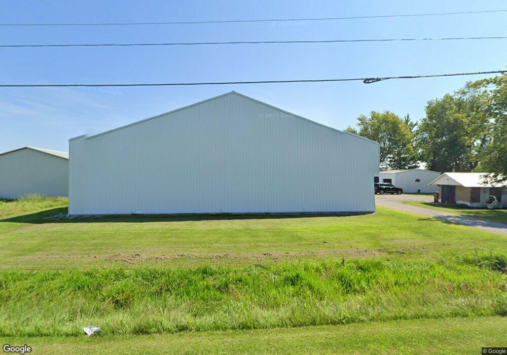
1959 State Route 125 Hamersville, OH 45130
Estimated Value: $31,000 - $181,000
--
Bed
--
Bath
--
Sq Ft
0.68
Acres
About This Home
This home is located at 1959 State Route 125, Hamersville, OH 45130 and is currently estimated at $106,000. 1959 State Route 125 is a home located in Brown County with nearby schools including Western Brown High School.
Ownership History
Date
Name
Owned For
Owner Type
Purchase Details
Closed on
Oct 16, 2006
Sold by
Malicote Brien S and Malicote Rhonda
Bought by
Mckinney Scott
Current Estimated Value
Purchase Details
Closed on
Jan 9, 2002
Sold by
Mcclusky John
Bought by
Malicote Brien S and Malicote Rhonda G
Purchase Details
Closed on
Oct 17, 2000
Sold by
Baker Anthony A
Bought by
Mccluskey John and Mccluskey Joann
Purchase Details
Closed on
Jan 3, 1997
Sold by
Adkins Roger
Bought by
Baker Anthony A
Home Financials for this Owner
Home Financials are based on the most recent Mortgage that was taken out on this home.
Original Mortgage
$7,500
Interest Rate
9%
Mortgage Type
New Conventional
Create a Home Valuation Report for This Property
The Home Valuation Report is an in-depth analysis detailing your home's value as well as a comparison with similar homes in the area
Home Values in the Area
Average Home Value in this Area
Purchase History
| Date | Buyer | Sale Price | Title Company |
|---|---|---|---|
| Mckinney Scott | $15,000 | Lawyers Title Cincinnati Inc | |
| Malicote Brien S | $13,000 | -- | |
| Mccluskey John | $9,500 | -- | |
| Baker Anthony A | $7,900 | -- |
Source: Public Records
Mortgage History
| Date | Status | Borrower | Loan Amount |
|---|---|---|---|
| Previous Owner | Baker Anthony A | $7,500 |
Source: Public Records
Tax History Compared to Growth
Tax History
| Year | Tax Paid | Tax Assessment Tax Assessment Total Assessment is a certain percentage of the fair market value that is determined by local assessors to be the total taxable value of land and additions on the property. | Land | Improvement |
|---|---|---|---|---|
| 2024 | $416 | $12,700 | $6,880 | $5,820 |
| 2023 | $396 | $9,640 | $5,500 | $4,140 |
| 2022 | $329 | $9,640 | $5,500 | $4,140 |
| 2021 | $326 | $9,640 | $5,500 | $4,140 |
| 2020 | $308 | $8,390 | $4,780 | $3,610 |
| 2019 | $327 | $8,390 | $4,780 | $3,610 |
| 2018 | $292 | $8,390 | $4,780 | $3,610 |
| 2017 | $182 | $5,260 | $5,260 | $0 |
| 2016 | $182 | $5,260 | $5,260 | $0 |
| 2015 | $184 | $5,260 | $5,260 | $0 |
| 2014 | $172 | $4,780 | $4,780 | $0 |
| 2013 | $171 | $4,780 | $4,780 | $0 |
Source: Public Records
Map
Nearby Homes
- 1873 Ohio 125
- ac Ohio 774
- 3363 Ohio 774
- 1740 Yankeetown Rd
- 0 St Rt 774 Unit 1841964
- 49-acres Yankeetown Rd
- 23-acres Yankeetown Rd
- acres Yankeetown Rd
- 0 Ohio 774
- 0 Fite Ave
- 0 Main St Unit 1850509
- 2953 N Feesburg Rd
- 9488 Daugherty Marks Rd
- 0 Colthar Rd Unit 1822757
- 9291 Daugherty Marks Rd
- 3275 White Oak Valley Rd
- 11475 Colthar Rd
- 2012 Bethel Maple Rd
- 2018 Bethel Maple Rd
- 0 Old 47 Club Rd
- 1959 State Route 125
- 1959 State Route 125
- 1959 State Route 125
- 1959 State Route 125
- 1959 State Route 125
- 1959 State Route 125
- 1959 State Route 125
- 1959 State Route 125
- 1959 State Route 125
- 1959 State Route 125
- 1959 State Route 125
- 1959 State Route 125
- 1959 State Route 125
- 1959 State Route 125
- 1959 State Route 125
- 1959 State Route 125
- 1959 State Route 125
- 1959 State Route 125
- 1919 State Route 125
- 1919 State Route 125