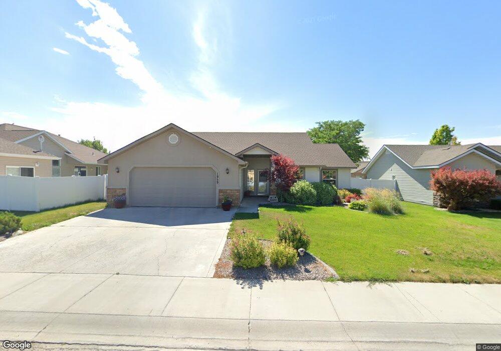
1959 Talus Loop Twin Falls, ID 83301
Estimated Value: $414,000 - $452,000
3
Beds
2
Baths
1,787
Sq Ft
$241/Sq Ft
Est. Value
About This Home
This home is located at 1959 Talus Loop, Twin Falls, ID 83301 and is currently estimated at $431,344, approximately $241 per square foot. 1959 Talus Loop is a home located in Twin Falls County with nearby schools including Rock Creek Elementary School, Robert Stuart Junior High School, and Canyon Ridge High School.
Ownership History
Date
Name
Owned For
Owner Type
Purchase Details
Closed on
Oct 31, 2017
Sold by
Hornbacher Karrie
Bought by
Hornbacher David
Current Estimated Value
Home Financials for this Owner
Home Financials are based on the most recent Mortgage that was taken out on this home.
Original Mortgage
$15,000
Outstanding Balance
$12,533
Interest Rate
3.83%
Mortgage Type
Credit Line Revolving
Estimated Equity
$418,811
Purchase Details
Closed on
Feb 16, 2007
Sold by
Stamm Michael E and Stamm Gina M
Bought by
Hornbacher David and Hornbacher Karrie
Home Financials for this Owner
Home Financials are based on the most recent Mortgage that was taken out on this home.
Original Mortgage
$15,000
Interest Rate
6.19%
Mortgage Type
Future Advance Clause Open End Mortgage
Create a Home Valuation Report for This Property
The Home Valuation Report is an in-depth analysis detailing your home's value as well as a comparison with similar homes in the area
Home Values in the Area
Average Home Value in this Area
Purchase History
| Date | Buyer | Sale Price | Title Company |
|---|---|---|---|
| Hornbacher David | -- | Pioneer Title Co Of Tw | |
| Hornbacher David | -- | Twin Falls Title |
Source: Public Records
Mortgage History
| Date | Status | Borrower | Loan Amount |
|---|---|---|---|
| Open | Hornbacher David | $15,000 | |
| Closed | Hornbacher David | $15,000 |
Source: Public Records
Tax History Compared to Growth
Tax History
| Year | Tax Paid | Tax Assessment Tax Assessment Total Assessment is a certain percentage of the fair market value that is determined by local assessors to be the total taxable value of land and additions on the property. | Land | Improvement |
|---|---|---|---|---|
| 2025 | $2,042 | $339,189 | $61,606 | $277,583 |
| 2024 | $2,056 | $342,698 | $61,606 | $281,092 |
| 2023 | $1,944 | $360,272 | $61,606 | $298,666 |
| 2022 | $2,782 | $367,993 | $63,471 | $304,522 |
| 2021 | $2,385 | $283,417 | $58,351 | $225,066 |
| 2020 | $2,356 | $254,425 | $58,351 | $196,074 |
| 2019 | $2,553 | $242,913 | $53,783 | $189,130 |
| 2018 | $2,547 | $236,000 | $38,598 | $197,402 |
| 2017 | $2,203 | $217,532 | $38,598 | $178,934 |
| 2016 | $1,890 | $188,556 | $0 | $0 |
| 2015 | $1,930 | $188,556 | $38,598 | $149,958 |
| 2012 | -- | $169,678 | $0 | $0 |
Source: Public Records
Map
Nearby Homes
- 234 Canyon Crest Dr W
- 323 Arrowhead Path
- 333 Arrowhead Path
- 2137 Settlers Ln
- 215 Los Lagos
- 513 Falling Leaf Ln
- 222 Avenida Del Rio Dr
- 521 Falling Leaf Ln
- 527 Falling Leaf Ln
- 542 Falling Leaf Ln
- 548 Falling Leaf Ln
- 2230 Stricker Place
- 1935 Hampton Way
- 2252 Detweiler Place
- 154 Avenida Del Rio Dr W
- 139 Los Lagos
- 434 Park View Loop
- 2043 Prospector Way
- 635 Canyon Crest Dr W
- 1948 Red Rock Way
- 328 Canyon Crest Dr W
- 1971 Talus Loop
- 1958 Canyon Trail Way
- 1970 Canyon Trail Way
- 1950 Canyon Trail Way
- 1983 Talus Loop
- 1960 Talus Loop
- 1972 Talus Loop
- 1982 Canyon Trail Way
- 310 Canyon Crest Dr W
- 329 Canyon Crest Dr W
- 4230 N 2734 E
- 4236 N 2734 E
- 2515 E 3500 N
- 1984 Talus Loop
- 343 Canyon Crest Dr W
- 1995 Talus Loop
- 1994 Canyon Trail Way
- 1957 Canyon Trail Way
- 1938 Talus Loop