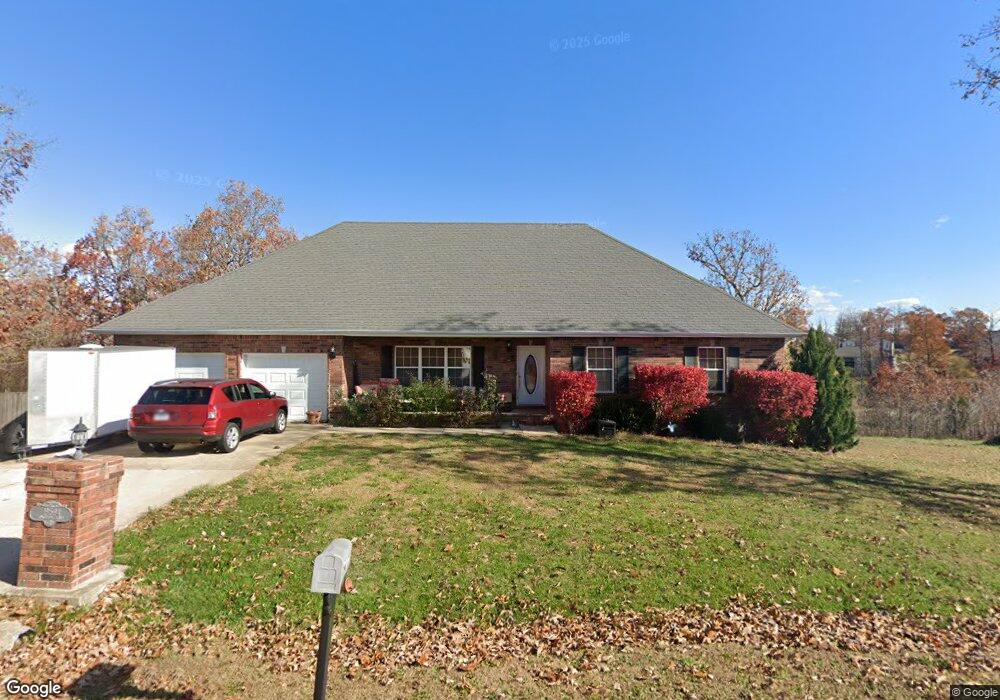
19594 Longview Rd Waynesville, MO 65583
Estimated Value: $381,000 - $476,000
4
Beds
4
Baths
5,712
Sq Ft
$74/Sq Ft
Est. Value
About This Home
This home is located at 19594 Longview Rd, Waynesville, MO 65583 and is currently estimated at $422,295, approximately $73 per square foot. 19594 Longview Rd is a home located in Pulaski County with nearby schools including Waynesville East Elementary School, Freedom Elementary School, and Waynesville Sixth Grade Center.
Ownership History
Date
Name
Owned For
Owner Type
Purchase Details
Closed on
Feb 20, 2014
Sold by
Greg A Greg A and Price Rhonda K
Bought by
Britt Sinjin R and Britt Becky L
Current Estimated Value
Home Financials for this Owner
Home Financials are based on the most recent Mortgage that was taken out on this home.
Original Mortgage
$260,482
Outstanding Balance
$195,275
Interest Rate
4.44%
Mortgage Type
Stand Alone Refi Refinance Of Original Loan
Estimated Equity
$227,020
Purchase Details
Closed on
Mar 8, 2006
Sold by
Four J Land And Cattle Co
Bought by
Price Rhonda K and Price Greg A
Home Financials for this Owner
Home Financials are based on the most recent Mortgage that was taken out on this home.
Original Mortgage
$240,052
Interest Rate
6.21%
Mortgage Type
VA
Create a Home Valuation Report for This Property
The Home Valuation Report is an in-depth analysis detailing your home's value as well as a comparison with similar homes in the area
Home Values in the Area
Average Home Value in this Area
Purchase History
| Date | Buyer | Sale Price | Title Company |
|---|---|---|---|
| Britt Sinjin R | -- | -- | |
| Price Rhonda K | -- | None Available |
Source: Public Records
Mortgage History
| Date | Status | Borrower | Loan Amount |
|---|---|---|---|
| Open | Britt Sinjin R | $260,482 | |
| Previous Owner | Price Rhonda K | $240,052 |
Source: Public Records
Tax History
| Year | Tax Paid | Tax Assessment Tax Assessment Total Assessment is a certain percentage of the fair market value that is determined by local assessors to be the total taxable value of land and additions on the property. | Land | Improvement |
|---|---|---|---|---|
| 2025 | $2,313 | $58,961 | $5,700 | $53,261 |
| 2024 | $23 | $53,169 | $4,750 | $48,419 |
| 2023 | $2,259 | $53,169 | $4,750 | $48,419 |
| 2022 | $2,084 | $53,169 | $4,750 | $48,419 |
| 2021 | $2,061 | $53,169 | $4,750 | $48,419 |
| 2020 | $2,016 | $49,630 | $0 | $0 |
| 2019 | $2,016 | $50,863 | $0 | $0 |
| 2018 | $2,015 | $50,863 | $0 | $0 |
| 2017 | $2,013 | $49,630 | $0 | $0 |
| 2016 | $1,911 | $50,860 | $0 | $0 |
| 2015 | -- | $50,860 | $0 | $0 |
| 2014 | $1,901 | $50,860 | $0 | $0 |
Source: Public Records
Map
Nearby Homes
- 21056 Lacombe Rd
- 0 Laduff Rd
- 18989 Ladera Rd
- 19590 Lilly Ln
- 20611 London Ln
- 20607 London Ln
- 20565 London Ln
- 20517 Luna Rd
- 21046 Larson Rd
- 0 Tbd Address Unit 23071485
- 19545 Lenox Ln
- 21062 Larson Rd
- 19257 Lambert Ln
- 19252 Lambert Ln
- 21805 Revere Ln
- 19580 Lyle Ln
- 19892 Lucky Ln
- 21104 Larson Rd
- 19436 Laney Rd
- 19420 Laney Rd
- 0Lot 19 Longview Rd
- 19600 Longview Dr
- 19607 Longview Rd
- 19606 Longview Rd
- 19611 Longview Rd
- 19757 Ladera Rd
- 19617 Longview Rd
- 19675 Ladera Rd
- 196684 Lannigan
- 19627 Ladera Rd
- 19940 Lannigan Rd
- 19541 Ladera Rd
- 19618 Longview Rd
- 19866 Ladera Rd
- 19908 Ladera Rd
- 19623 Longview Rd
- 19774 Ladera Rd
- 19714 Ladera Rd
- 19883 Lannigan Rd
- 19507 Ladera Rd
Your Personal Tour Guide
Ask me questions while you tour the home.