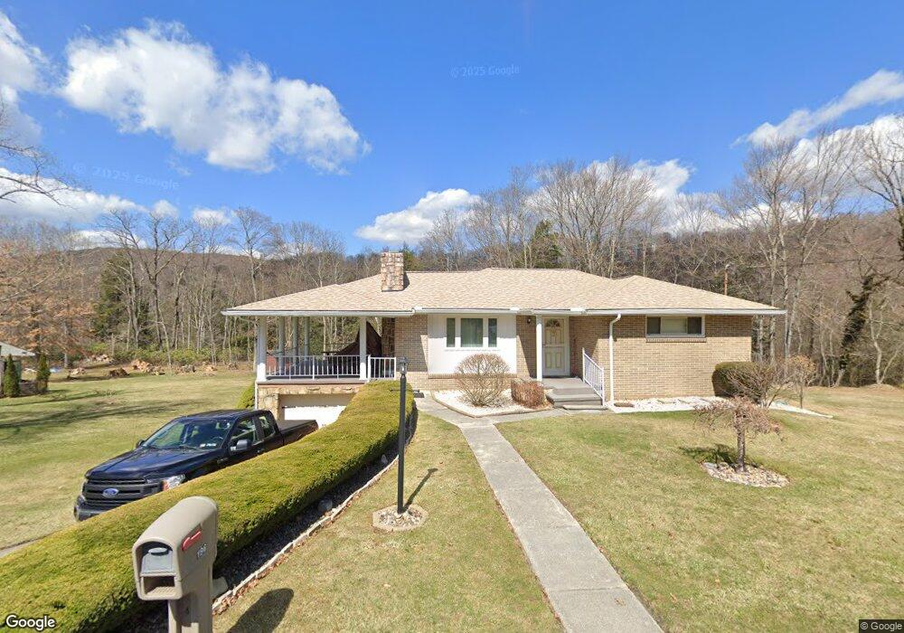
196 Amsite Rd South Fork, PA 15956
Estimated Value: $111,000 - $218,938
3
Beds
2
Baths
1,016
Sq Ft
$155/Sq Ft
Est. Value
About This Home
This home is located at 196 Amsite Rd, South Fork, PA 15956 and is currently estimated at $157,985, approximately $155 per square foot. 196 Amsite Rd is a home located in Cambria County with nearby schools including Forest Hills Elementary School.
Ownership History
Date
Name
Owned For
Owner Type
Purchase Details
Closed on
May 10, 2018
Sold by
Stefanik Teresa M
Bought by
Lutsko Randall L and Lutsko Donna G
Current Estimated Value
Home Financials for this Owner
Home Financials are based on the most recent Mortgage that was taken out on this home.
Original Mortgage
$97,500
Outstanding Balance
$26,704
Interest Rate
4.4%
Mortgage Type
Purchase Money Mortgage
Estimated Equity
$131,281
Purchase Details
Closed on
Aug 31, 2006
Bought by
Stefanik Teressa M
Create a Home Valuation Report for This Property
The Home Valuation Report is an in-depth analysis detailing your home's value as well as a comparison with similar homes in the area
Home Values in the Area
Average Home Value in this Area
Purchase History
| Date | Buyer | Sale Price | Title Company |
|---|---|---|---|
| Lutsko Randall L | $132,000 | -- | |
| Stefanik Teressa M | $128,600 | -- |
Source: Public Records
Mortgage History
| Date | Status | Borrower | Loan Amount |
|---|---|---|---|
| Open | Lutsko Randall L | $97,500 |
Source: Public Records
Tax History Compared to Growth
Tax History
| Year | Tax Paid | Tax Assessment Tax Assessment Total Assessment is a certain percentage of the fair market value that is determined by local assessors to be the total taxable value of land and additions on the property. | Land | Improvement |
|---|---|---|---|---|
| 2025 | $728 | $18,910 | $990 | $17,920 |
| 2024 | $1,744 | $18,910 | $990 | $17,920 |
| 2023 | $1,688 | $18,910 | $990 | $17,920 |
| 2022 | $1,655 | $18,910 | $990 | $17,920 |
| 2021 | $1,702 | $18,910 | $990 | $17,920 |
| 2020 | $1,702 | $18,910 | $990 | $17,920 |
| 2019 | $1,702 | $18,910 | $990 | $17,920 |
| 2018 | $1,614 | $17,930 | $990 | $16,940 |
| 2017 | $1,623 | $17,930 | $990 | $16,940 |
| 2016 | $619 | $17,930 | $990 | $16,940 |
| 2015 | $529 | $17,930 | $990 | $16,940 |
| 2014 | $529 | $17,930 | $990 | $16,940 |
Source: Public Records
Map
Nearby Homes
- 779 Lake St
- 512 Broad St
- 448 4th St
- 219 1st St
- 464 Locust St
- 0 Crown St
- 507 Willow St
- 378 Locust St
- 100 Tunnel St
- 227 Martin Rd
- 2079 Oakridge Dr
- Lot 3 Fifty Acre Rd
- 1141 Beech Hill Rd
- 1182 Forest Hills Dr
- 333 Peaceful Valley Rd
- 0 Mount Airy Dr Unit 1716723
- 0 Mount Airy Dr Unit 75145
- 203 Pine Bluff Rd
- 2498 Portage St
- 170 Caitlyn Dr