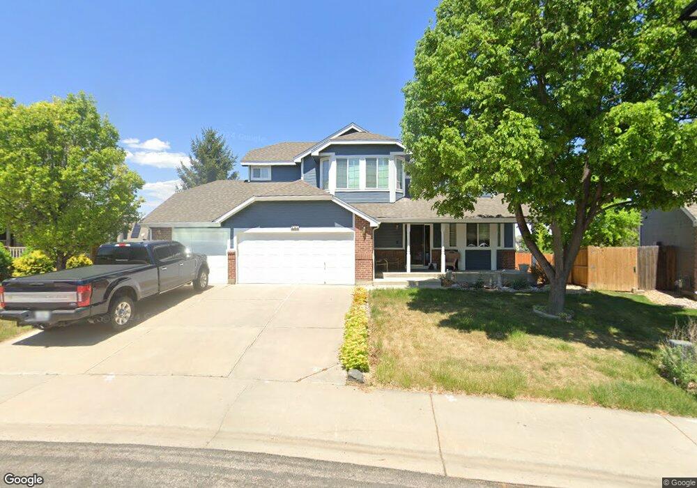
196 Becker Cir Johnstown, CO 80534
Estimated Value: $495,000 - $540,000
4
Beds
4
Baths
2,605
Sq Ft
$200/Sq Ft
Est. Value
About This Home
This home is located at 196 Becker Cir, Johnstown, CO 80534 and is currently estimated at $521,348, approximately $200 per square foot. 196 Becker Cir is a home located in Weld County with nearby schools including Pioneer Ridge Elementary School, Milliken Middle School, and Roosevelt High School.
Ownership History
Date
Name
Owned For
Owner Type
Purchase Details
Closed on
Oct 17, 2019
Sold by
Entrup Maureen Ann
Bought by
Mccluskey Mark R and Potter Cynthia O
Current Estimated Value
Home Financials for this Owner
Home Financials are based on the most recent Mortgage that was taken out on this home.
Original Mortgage
$293,520
Outstanding Balance
$254,880
Interest Rate
3.4%
Mortgage Type
New Conventional
Estimated Equity
$266,468
Purchase Details
Closed on
Dec 2, 2016
Sold by
Entrup Robert H
Bought by
Robert H Entrup Revocable Trust
Purchase Details
Closed on
Nov 30, 2000
Sold by
Advocate Land Company Inc
Bought by
Entrup Robert H
Home Financials for this Owner
Home Financials are based on the most recent Mortgage that was taken out on this home.
Original Mortgage
$144,996
Interest Rate
7.84%
Create a Home Valuation Report for This Property
The Home Valuation Report is an in-depth analysis detailing your home's value as well as a comparison with similar homes in the area
Home Values in the Area
Average Home Value in this Area
Purchase History
| Date | Buyer | Sale Price | Title Company |
|---|---|---|---|
| Mccluskey Mark R | $366,900 | None Available | |
| Robert H Entrup Revocable Trust | -- | None Available | |
| Entrup Robert H | $200,252 | Title America | |
| Advocate Land Company Inc | -- | Title America |
Source: Public Records
Mortgage History
| Date | Status | Borrower | Loan Amount |
|---|---|---|---|
| Open | Mccluskey Mark R | $293,520 | |
| Previous Owner | Entrup Robert H | $144,996 |
Source: Public Records
Tax History
| Year | Tax Paid | Tax Assessment Tax Assessment Total Assessment is a certain percentage of the fair market value that is determined by local assessors to be the total taxable value of land and additions on the property. | Land | Improvement |
|---|---|---|---|---|
| 2025 | $3,040 | $32,280 | $7,060 | $25,220 |
| 2024 | $2,855 | $34,530 | $5,700 | $28,830 |
| 2023 | $2,855 | $34,860 | $5,750 | $29,110 |
| 2022 | $2,910 | $27,130 | $5,560 | $21,570 |
| 2021 | $3,136 | $27,910 | $5,720 | $22,190 |
| 2020 | $2,849 | $26,090 | $5,150 | $20,940 |
| 2019 | $2,054 | $24,050 | $5,150 | $18,900 |
| 2018 | $1,808 | $21,150 | $4,460 | $16,690 |
| 2017 | $1,838 | $21,150 | $4,460 | $16,690 |
| 2016 | $1,734 | $19,950 | $3,580 | $16,370 |
| 2015 | $1,758 | $19,950 | $3,580 | $16,370 |
| 2014 | $1,392 | $16,300 | $3,580 | $12,720 |
Source: Public Records
Map
Nearby Homes
Your Personal Tour Guide
Ask me questions while you tour the home.