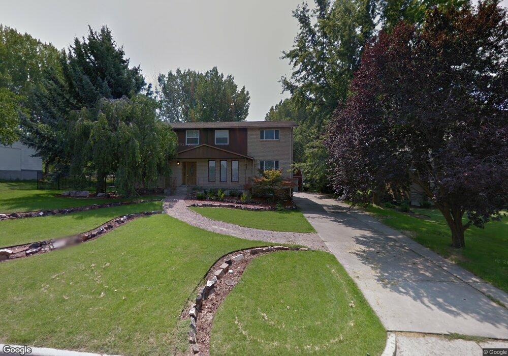
196 E 1050 N Kaysville, UT 84037
Estimated Value: $904,000 - $1,076,000
6
Beds
3
Baths
3,200
Sq Ft
$315/Sq Ft
Est. Value
About This Home
This home is located at 196 E 1050 N, Kaysville, UT 84037 and is currently estimated at $1,006,820, approximately $314 per square foot. 196 E 1050 N is a home located in Davis County with nearby schools including Creekside Elementary School, Fairfield Junior High School, and Davis High School.
Ownership History
Date
Name
Owned For
Owner Type
Purchase Details
Closed on
Aug 8, 2011
Sold by
Hopper John D and Hopper Jeanne J
Bought by
Mason Gregory A and Mason Marilee
Current Estimated Value
Home Financials for this Owner
Home Financials are based on the most recent Mortgage that was taken out on this home.
Original Mortgage
$357,050
Outstanding Balance
$245,946
Interest Rate
4.46%
Mortgage Type
VA
Estimated Equity
$760,874
Purchase Details
Closed on
May 16, 1996
Sold by
Shelby Todd L and Shelby Donna R
Bought by
Astle Nelson L
Home Financials for this Owner
Home Financials are based on the most recent Mortgage that was taken out on this home.
Original Mortgage
$81,400
Interest Rate
7.8%
Create a Home Valuation Report for This Property
The Home Valuation Report is an in-depth analysis detailing your home's value as well as a comparison with similar homes in the area
Home Values in the Area
Average Home Value in this Area
Purchase History
| Date | Buyer | Sale Price | Title Company |
|---|---|---|---|
| Mason Gregory A | -- | Bonneville Superior Titl | |
| Astle Nelson L | -- | Security Title Company |
Source: Public Records
Mortgage History
| Date | Status | Borrower | Loan Amount |
|---|---|---|---|
| Open | Mason Gregory A | $357,050 | |
| Previous Owner | Astle Nelson L | $81,400 |
Source: Public Records
Tax History Compared to Growth
Tax History
| Year | Tax Paid | Tax Assessment Tax Assessment Total Assessment is a certain percentage of the fair market value that is determined by local assessors to be the total taxable value of land and additions on the property. | Land | Improvement |
|---|---|---|---|---|
| 2024 | -- | $463,100 | $261,250 | $201,850 |
| 2023 | $1,775 | $817,000 | $501,808 | $315,192 |
| 2022 | $1,775 | $476,300 | $269,772 | $206,528 |
| 2021 | $745 | $622,000 | $353,294 | $268,706 |
| 2020 | $331 | $545,000 | $333,297 | $211,703 |
| 2019 | $236 | $520,000 | $293,748 | $226,252 |
| 2018 | $98 | $488,000 | $267,883 | $220,117 |
| 2016 | $2,784 | $217,690 | $96,435 | $121,255 |
| 2015 | $2,901 | $216,425 | $96,435 | $119,990 |
| 2014 | $2,690 | $204,820 | $96,435 | $108,385 |
| 2013 | $2,416 | $175,919 | $100,533 | $75,386 |
Source: Public Records
Map
Nearby Homes
- 250 E 950 N
- 298 S Bing Cherry Way
- 928 E Mutton Hollow Rd
- 1578 E Maple Way
- 1199 E Pheasant View Dr
- 285 E 500 N
- 425 E 500 N
- 1913 E 75 S
- 222 S Derrah Dr
- 694 S Pheasant View Dr
- 457 N 150 E
- 1168 Holmes Creek Ln
- 1135 Holmes Creek Ln
- 593 N 150 W
- 400 N 100 E
- 680 N Stonne Ln
- 159 S 1000 E
- 772 N Crimson Ln
- 890 E Brookshire Dr
- 1093 N Bedford Dr
- 182 E 1050 N
- 216 E 1050 N
- 164 E 1050 N
- 232 E 1050 N
- 187 E 1050 N
- 217 E 1050 N
- 244 E 1050 N Unit 16
- 244 E 1050 N
- 167 E 1050 N
- 246 E 1050 N
- 148 E 1050 N
- 1295 E Orchard Ridge Ln
- 1328 E Orchard Ridge Ln
- 1336 E Orchard Ridge Ln
- 1348 E Orchard Ridge Ln
- 1305 E Orchard Ridge Ln
- 1360 E Orchard Ridge Ln
- 151 E 1050 N
- 251 E 950 N
- 237 E 1050 N