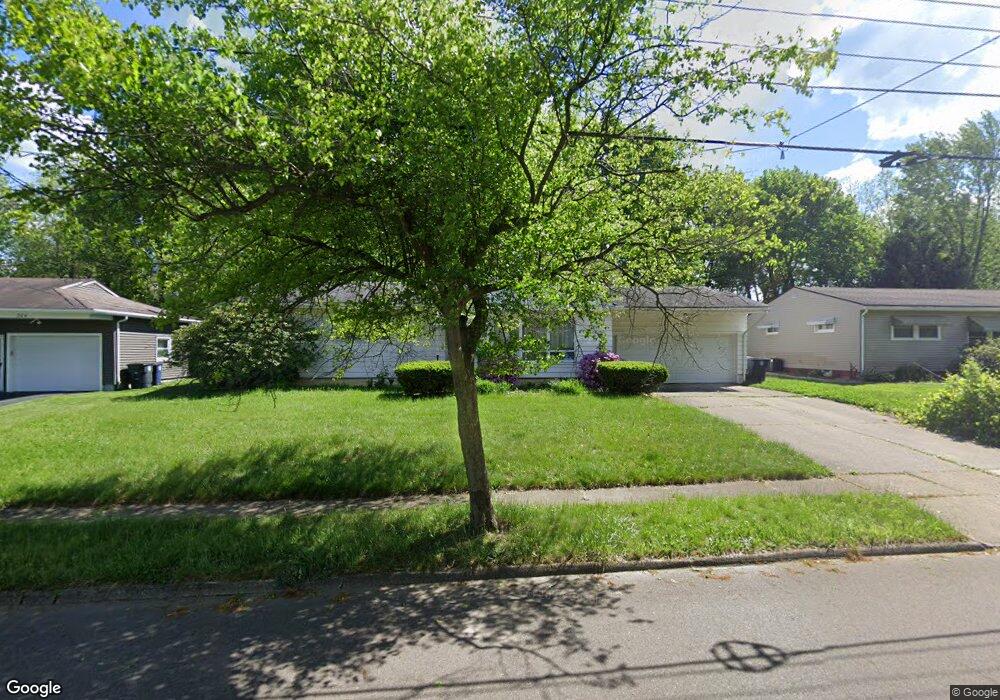
196 E Ralston Ave Akron, OH 44301
Firestone Park NeighborhoodEstimated Value: $163,000 - $186,000
3
Beds
1
Bath
1,271
Sq Ft
$137/Sq Ft
Est. Value
About This Home
This home is located at 196 E Ralston Ave, Akron, OH 44301 and is currently estimated at $174,082, approximately $136 per square foot. 196 E Ralston Ave is a home located in Summit County with nearby schools including Kenmore Garfield Community Learning Center, Main Preparatory Academy, and Eagle Elementary.
Ownership History
Date
Name
Owned For
Owner Type
Purchase Details
Closed on
Sep 28, 2015
Sold by
Mullins Julie L
Bought by
Bonyo Patrick O
Current Estimated Value
Purchase Details
Closed on
Feb 14, 2005
Sold by
Gruver Robert A and Gruver Eleanor C
Bought by
Bonyo Patrick O and Mullins Julie L
Home Financials for this Owner
Home Financials are based on the most recent Mortgage that was taken out on this home.
Original Mortgage
$112,238
Interest Rate
5.83%
Mortgage Type
FHA
Purchase Details
Closed on
Dec 1, 1994
Sold by
Mary Florin Trst
Bought by
Gruser Eleanor C and Gruser Robert A
Create a Home Valuation Report for This Property
The Home Valuation Report is an in-depth analysis detailing your home's value as well as a comparison with similar homes in the area
Home Values in the Area
Average Home Value in this Area
Purchase History
| Date | Buyer | Sale Price | Title Company |
|---|---|---|---|
| Bonyo Patrick O | $45,420 | Wigley Title Agency Inc | |
| Bonyo Patrick O | $114,000 | Wigley Title Agency Inc | |
| Gruser Eleanor C | $77,000 | -- |
Source: Public Records
Mortgage History
| Date | Status | Borrower | Loan Amount |
|---|---|---|---|
| Previous Owner | Bonyo Patrick O | $112,238 |
Source: Public Records
Tax History
| Year | Tax Paid | Tax Assessment Tax Assessment Total Assessment is a certain percentage of the fair market value that is determined by local assessors to be the total taxable value of land and additions on the property. | Land | Improvement |
|---|---|---|---|---|
| 2024 | $2,477 | $43,198 | $12,849 | $30,349 |
| 2023 | $2,477 | $43,198 | $12,849 | $30,349 |
| 2022 | $2,178 | $31,364 | $9,310 | $22,054 |
| 2021 | $2,180 | $31,364 | $9,310 | $22,054 |
| 2020 | $2,148 | $31,360 | $9,310 | $22,050 |
| 2019 | $2,381 | $31,790 | $9,310 | $22,480 |
| 2018 | $2,350 | $31,790 | $9,310 | $22,480 |
| 2017 | $2,387 | $31,790 | $9,310 | $22,480 |
| 2016 | $2,389 | $31,790 | $9,310 | $22,480 |
| 2015 | $2,387 | $31,790 | $9,310 | $22,480 |
| 2014 | $2,368 | $31,790 | $9,310 | $22,480 |
| 2013 | $2,422 | $33,280 | $9,310 | $23,970 |
Source: Public Records
Map
Nearby Homes
- 231 E Dresden Ave
- 1835 Thornapple Ave
- 106 Selden Ave
- 76 Clinton Ave
- 244 E Catawba Ave
- 248 E Catawba Ave
- 1878 Carter Ave Unit 1880
- 1810 Carter Ave
- 41 W Woodsdale Ave
- 416 Rockys Run Rd
- 367 Wayne Ave
- 30 Youtz Ave
- 2069 Penguin Ave
- 502 E Woodsdale Ave
- 14 E Dartmore Ave
- 1595 Evergreen Ave
- 127 Palmetto Ave
- 29 E Dartmore Ave
- 1699 Redwood Ave
- 178 Mission Dr
- 188 E Ralston Ave
- 204 E Ralston Ave
- 182 E Ralston Ave
- 210 E Ralston Ave
- 201 E Ralston Ave
- 191 E Ralston Ave
- 185 E Ralston Ave
- 174 E Ralston Ave
- 1914 Thane Ave
- 1936 Thane Ave
- 1946 Thane Ave
- 179 E Ralston Ave
- 168 E Ralston Ave
- 1921 Thane Ave
- 194 E Woodsdale Ave
- 171 E Ralston Ave
- 186 E Woodsdale Ave
- 223 E Ralston Ave
- 230 E Ralston Ave
- 1905 Thane Ave
Your Personal Tour Guide
Ask me questions while you tour the home.