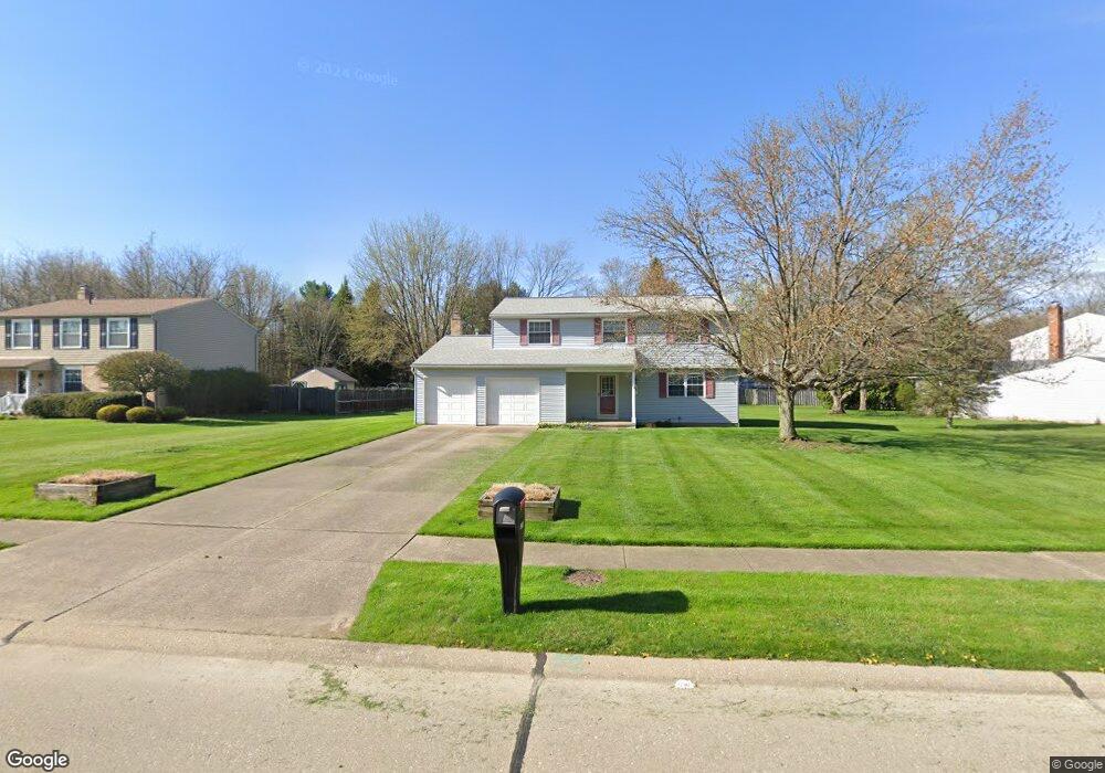
196 Forest Brook Blvd Munroe Falls, OH 44262
Estimated Value: $312,879 - $336,000
4
Beds
3
Baths
1,800
Sq Ft
$178/Sq Ft
Est. Value
About This Home
This home is located at 196 Forest Brook Blvd, Munroe Falls, OH 44262 and is currently estimated at $320,970, approximately $178 per square foot. 196 Forest Brook Blvd is a home located in Summit County with nearby schools including Stow-Munroe Falls High School, Chapel Hill Christian School, and Cornerstone Community School.
Ownership History
Date
Name
Owned For
Owner Type
Purchase Details
Closed on
Oct 11, 2001
Sold by
Benfield Ronald L and Benfield Norma
Bought by
Anderson Richard W and Anderson Cindie K
Current Estimated Value
Home Financials for this Owner
Home Financials are based on the most recent Mortgage that was taken out on this home.
Original Mortgage
$158,650
Outstanding Balance
$62,237
Interest Rate
6.92%
Mortgage Type
Purchase Money Mortgage
Estimated Equity
$258,733
Create a Home Valuation Report for This Property
The Home Valuation Report is an in-depth analysis detailing your home's value as well as a comparison with similar homes in the area
Home Values in the Area
Average Home Value in this Area
Purchase History
| Date | Buyer | Sale Price | Title Company |
|---|---|---|---|
| Anderson Richard W | $167,000 | -- |
Source: Public Records
Mortgage History
| Date | Status | Borrower | Loan Amount |
|---|---|---|---|
| Open | Anderson Richard W | $158,650 |
Source: Public Records
Tax History
| Year | Tax Paid | Tax Assessment Tax Assessment Total Assessment is a certain percentage of the fair market value that is determined by local assessors to be the total taxable value of land and additions on the property. | Land | Improvement |
|---|---|---|---|---|
| 2024 | $5,163 | $93,129 | $15,222 | $77,907 |
| 2023 | $5,163 | $93,129 | $15,222 | $77,907 |
| 2022 | $4,639 | $72,342 | $11,799 | $60,543 |
| 2021 | $4,025 | $72,342 | $11,799 | $60,543 |
| 2020 | $3,954 | $72,340 | $11,800 | $60,540 |
| 2019 | $3,364 | $56,600 | $9,230 | $47,370 |
| 2018 | $3,309 | $56,600 | $9,230 | $47,370 |
| 2017 | $2,898 | $56,600 | $9,230 | $47,370 |
| 2016 | $3,095 | $51,920 | $9,230 | $42,690 |
| 2015 | $2,898 | $51,920 | $9,230 | $42,690 |
| 2014 | $2,901 | $51,920 | $9,230 | $42,690 |
| 2013 | $3,085 | $52,110 | $9,230 | $42,880 |
Source: Public Records
Map
Nearby Homes
- 132 S Main St Unit B10
- 1845 Seattle St
- 1468 Curtis Ave
- 1473 Munroe Falls Ave Unit 5
- 1120 Broadway St E Unit 1124
- 1917 Lancaster St Unit 1921
- 1111 Center Ave
- 1912 Hanover St
- 2155 Bailey Rd
- 2289 Bailey Rd
- 1452 Buckingham Gate Blvd
- 2435 Willis St
- 1971 Tudor St
- 2665 Oak Park Blvd
- 211 Cherry Ridge Unit 33
- 455 Classic Dr
- 370 Cherry Ridge Unit 60
- 1251 Bailey Rd
- 331 Cherry Ridge Unit 45
- 341 Cherry Ridge
- 204 Forest Brook Blvd
- 188 Forest Brook Blvd
- 197 Fox Run Dr
- 187 Fox Run Dr
- 232 Forest Brook Blvd
- 180 Forest Brook Blvd
- 185 Forest Brook Blvd
- 191 Prentiss St
- 175 Fox Run Dr
- 177 Forest Brook Blvd
- 167 Forest Brook Blvd
- 181 Prentiss St
- 178 Prentiss St
- 254 Forest Brook Blvd
- 251 Forest Brook Blvd
- 157 Fox Run Dr
- 165 Merle Blvd
- 173 Prentiss St
- 170 Fox Run Dr
- 180 Laurel Blvd
Your Personal Tour Guide
Ask me questions while you tour the home.