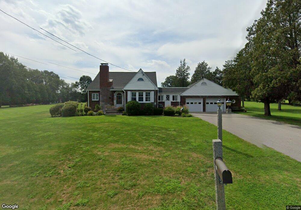
196 Hampstead St Methuen, MA 01844
The North End NeighborhoodEstimated Value: $750,594 - $908,000
3
Beds
1
Bath
4,057
Sq Ft
$204/Sq Ft
Est. Value
About This Home
This home is located at 196 Hampstead St, Methuen, MA 01844 and is currently estimated at $827,399, approximately $203 per square foot. 196 Hampstead St is a home located in Essex County with nearby schools including South Point Elementary School, Methuen High School, and The Birches Academy of Academics and Art.
Create a Home Valuation Report for This Property
The Home Valuation Report is an in-depth analysis detailing your home's value as well as a comparison with similar homes in the area
Home Values in the Area
Average Home Value in this Area
Tax History Compared to Growth
Tax History
| Year | Tax Paid | Tax Assessment Tax Assessment Total Assessment is a certain percentage of the fair market value that is determined by local assessors to be the total taxable value of land and additions on the property. | Land | Improvement |
|---|---|---|---|---|
| 2025 | $7,225 | $682,900 | $298,200 | $384,700 |
| 2024 | $7,011 | $645,600 | $260,900 | $384,700 |
| 2023 | $6,531 | $558,200 | $229,700 | $328,500 |
| 2022 | $6,089 | $466,600 | $188,300 | $278,300 |
| 2021 | $5,753 | $436,200 | $178,000 | $258,200 |
| 2020 | $5,755 | $428,200 | $178,000 | $250,200 |
| 2019 | $5,621 | $396,100 | $167,600 | $228,500 |
| 2018 | $5,328 | $373,400 | $157,200 | $216,200 |
| 2017 | $5,117 | $349,300 | $157,200 | $192,100 |
| 2016 | $4,723 | $318,900 | $146,900 | $172,000 |
| 2015 | $4,510 | $308,900 | $146,900 | $162,000 |
Source: Public Records
Map
Nearby Homes
- 139 North St
- 74 Ayers Village Rd
- 40 Stanwood Rd Unit 9
- 1513 Broadway
- 20 Stanwood Rd
- 20 Ashwood Ave
- 47 Bailey Ct
- 1 Ballard Ln
- 6 Douglas Dr
- 35 Fraser Dr
- 17 Sawmill Ridge Rd
- 10 Sally Sweets Way Unit V104
- 1 Kimball Ave
- 28 Emma Rose Cir Unit Lot 2
- 25 Thayer St
- 10 Evelyn Rd
- 27 General Pulaski Dr
- 257 Howe St
- 15 Linwood Ave
- 33 Lake St