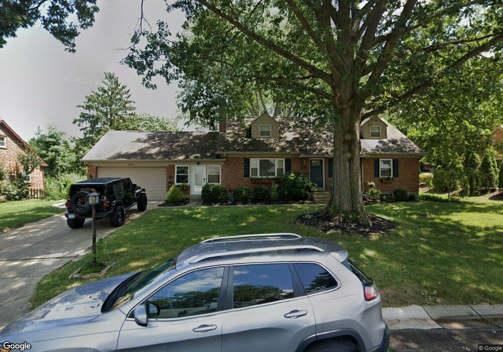
196 Maple Ave Dayton, OH 45459
Estimated Value: $321,196 - $368,000
5
Beds
2
Baths
1,711
Sq Ft
$202/Sq Ft
Est. Value
About This Home
This home is located at 196 Maple Ave, Dayton, OH 45459 and is currently estimated at $346,049, approximately $202 per square foot. 196 Maple Ave is a home located in Montgomery County with nearby schools including Primary Village North, Stingley Elementary School, and Tower Heights Middle School.
Ownership History
Date
Name
Owned For
Owner Type
Purchase Details
Closed on
Apr 2, 2010
Sold by
Meckstroth Harry W
Bought by
Adkins Kelly E and Adkins Kristian R
Current Estimated Value
Home Financials for this Owner
Home Financials are based on the most recent Mortgage that was taken out on this home.
Original Mortgage
$127,000
Outstanding Balance
$83,721
Interest Rate
5.03%
Mortgage Type
Purchase Money Mortgage
Estimated Equity
$262,328
Purchase Details
Closed on
Jan 23, 2008
Sold by
Meckstroth Harry W
Bought by
Meckstroth Harry W and Meckstroth Margaret L
Purchase Details
Closed on
Nov 6, 2006
Sold by
Meckstroth Harry W and Meckstroth Margaret L
Bought by
Meckstroth Harry W and Meckstroth Margaret L
Purchase Details
Closed on
Oct 1, 1997
Sold by
Meckstroth Margaret L
Bought by
Meckstroth Harry W and Meckstroth Margaret L
Create a Home Valuation Report for This Property
The Home Valuation Report is an in-depth analysis detailing your home's value as well as a comparison with similar homes in the area
Purchase History
| Date | Buyer | Sale Price | Title Company |
|---|---|---|---|
| Adkins Kelly E | $158,800 | Attorney | |
| Meckstroth Harry W | -- | Attorney | |
| Meckstroth Harry W | -- | None Available | |
| Meckstroth Harry W | -- | -- |
Source: Public Records
Mortgage History
| Date | Status | Borrower | Loan Amount |
|---|---|---|---|
| Open | Adkins Kelly E | $127,000 |
Source: Public Records
Tax History
| Year | Tax Paid | Tax Assessment Tax Assessment Total Assessment is a certain percentage of the fair market value that is determined by local assessors to be the total taxable value of land and additions on the property. | Land | Improvement |
|---|---|---|---|---|
| 2025 | $6,108 | $96,190 | $17,260 | $78,930 |
| 2024 | $5,585 | $96,190 | $17,260 | $78,930 |
| 2023 | $5,585 | $96,190 | $17,260 | $78,930 |
| 2022 | $5,119 | $69,910 | $12,510 | $57,400 |
| 2021 | $5,133 | $69,910 | $12,510 | $57,400 |
| 2020 | $5,126 | $69,910 | $12,510 | $57,400 |
| 2019 | $4,939 | $60,110 | $12,510 | $47,600 |
| 2018 | $4,378 | $60,110 | $12,510 | $47,600 |
| 2017 | $4,327 | $60,110 | $12,510 | $47,600 |
| 2016 | $4,425 | $58,020 | $12,510 | $45,510 |
| 2015 | $4,379 | $58,020 | $12,510 | $45,510 |
| 2014 | $4,379 | $58,020 | $12,510 | $45,510 |
| 2012 | -- | $53,140 | $12,500 | $40,640 |
Source: Public Records
Map
Nearby Homes
- 30 Poinciana Dr
- 121 Woodfield Place
- 7576 Normandy Ln
- 61 Martha Ave
- 41 Winchester Place Unit J
- 51 Winchester Place
- 426 Willowhurst Dr
- 7926 Normandy Ln
- 435 Blackstone Dr
- 7637 Essington Cir
- 7627 Essington Cir
- 7215 Whitetail Trail Unit 108108
- 7035 Bluffs Dr Unit 27035
- 7810 Port Cir Unit 7810
- 6935 Paragon Rd
- 590 Versailles Dr
- 7044 Fallen Oak Trace Unit 1467
- 7851 Millerton Dr
- 365 Pond Meadows Ct
- 125 Gulfwood Ct
Your Personal Tour Guide
Ask me questions while you tour the home.