Estimated Value: $289,000 - $305,000
2
Beds
1
Bath
934
Sq Ft
$320/Sq Ft
Est. Value
About This Home
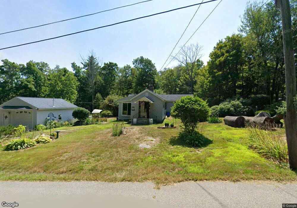
This home is located at 196 Moore Hill Rd, Athol, MA 01331 and is currently estimated at $298,592, approximately $319 per square foot. 196 Moore Hill Rd is a home located in Worcester County with nearby schools including Athol High School.
Ownership History
Date
Name
Owned For
Owner Type
Purchase Details
Closed on
Dec 30, 1994
Sold by
Carrier Judith
Bought by
Blackbird Kirk and Blackbird Catherine
Current Estimated Value
Home Financials for this Owner
Home Financials are based on the most recent Mortgage that was taken out on this home.
Original Mortgage
$64,100
Interest Rate
9.2%
Mortgage Type
Purchase Money Mortgage
Create a Home Valuation Report for This Property
The Home Valuation Report is an in-depth analysis detailing your home's value as well as a comparison with similar homes in the area
Home Values in the Area
Average Home Value in this Area
Purchase History
| Date | Buyer | Sale Price | Title Company |
|---|---|---|---|
| Blackbird Kirk | $67,500 | -- |
Source: Public Records
Mortgage History
| Date | Status | Borrower | Loan Amount |
|---|---|---|---|
| Open | Blackbird Kirk | $62,800 | |
| Closed | Blackbird Kirk | $64,100 |
Source: Public Records
Tax History Compared to Growth
Tax History
| Year | Tax Paid | Tax Assessment Tax Assessment Total Assessment is a certain percentage of the fair market value that is determined by local assessors to be the total taxable value of land and additions on the property. | Land | Improvement |
|---|---|---|---|---|
| 2025 | $2,951 | $232,200 | $63,000 | $169,200 |
| 2024 | $2,952 | $230,100 | $63,000 | $167,100 |
| 2023 | $2,767 | $197,100 | $45,600 | $151,500 |
| 2022 | $2,616 | $163,000 | $43,400 | $119,600 |
| 2021 | $2,591 | $146,700 | $39,500 | $107,200 |
| 2020 | $3,251 | $140,800 | $36,000 | $104,800 |
| 2019 | $2,300 | $131,800 | $33,800 | $98,000 |
| 2018 | $2,331 | $119,100 | $30,700 | $88,400 |
| 2017 | $2,203 | $108,000 | $30,700 | $77,300 |
| 2016 | $2,062 | $104,000 | $30,700 | $73,300 |
| 2015 | $1,979 | $104,000 | $30,700 | $73,300 |
| 2014 | $1,917 | $104,000 | $30,700 | $73,300 |
Source: Public Records
Map
Nearby Homes
- 0 Moore Hill Rd
- 143 Moore Hill Rd
- 94 Moore Hill Rd
- 280 Moore Hill Rd
- 297 Moore Hill Rd
- 35 Moore Hill Rd
- 317 Brooks Rd
- Lot 29 Moore Hill Rd
- 357 Brooks Rd
- 12 Moore Hill Rd
- 245 Brooks Rd
- 421 Brooks Rd
- 481 Brooks Rd
- Lot 3 Brooks Rd
- Lot 0 Brooks Rd
- Lots 1,2,4 Brooks Rd
- Lot 4 Brooks Rd
- 511 Brooks Rd
- 149 Brooks Rd
- 715 Moore Hill Rd