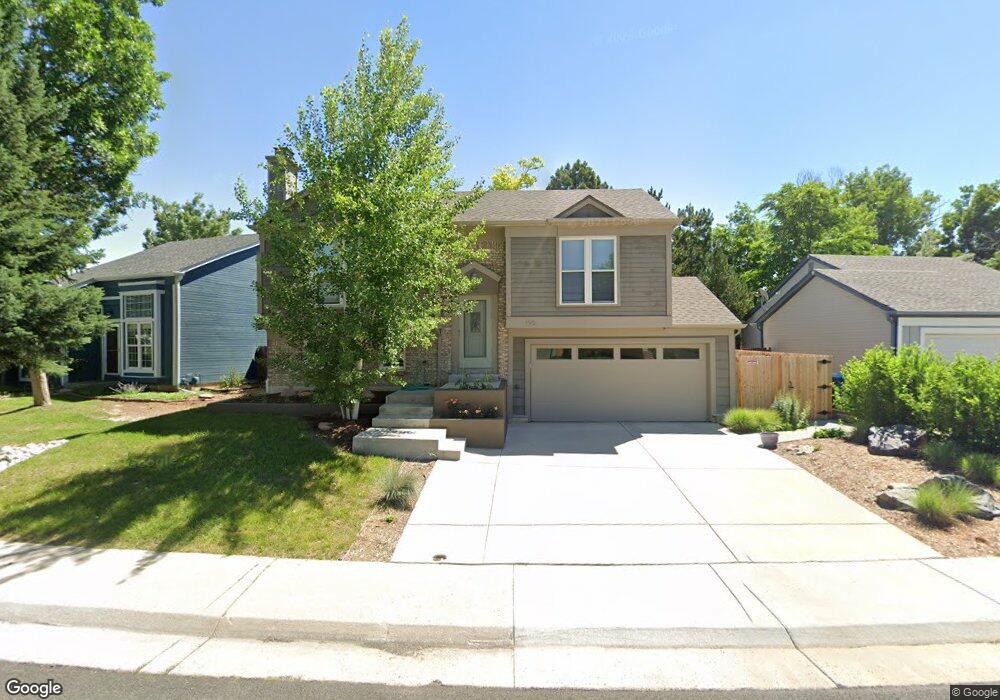
196 S Tyler Ave Louisville, CO 80027
Estimated Value: $648,195 - $782,000
2
Beds
1
Bath
924
Sq Ft
$783/Sq Ft
Est. Value
About This Home
This home is located at 196 S Tyler Ave, Louisville, CO 80027 and is currently estimated at $723,049, approximately $782 per square foot. 196 S Tyler Ave is a home located in Boulder County with nearby schools including Fireside Elementary School, Monarch K-8 School, and Monarch High School.
Ownership History
Date
Name
Owned For
Owner Type
Purchase Details
Closed on
Jul 29, 1997
Sold by
Astorino Paul and Astorino Alice
Bought by
Lang Nancy E
Current Estimated Value
Home Financials for this Owner
Home Financials are based on the most recent Mortgage that was taken out on this home.
Original Mortgage
$148,200
Outstanding Balance
$22,331
Interest Rate
7.6%
Estimated Equity
$700,718
Purchase Details
Closed on
May 9, 1996
Sold by
Poe Michael R and Poe Paula J
Bought by
Astorino Paul
Home Financials for this Owner
Home Financials are based on the most recent Mortgage that was taken out on this home.
Original Mortgage
$146,933
Interest Rate
7.67%
Mortgage Type
FHA
Purchase Details
Closed on
Jun 1, 1987
Bought by
Lang Nancy E
Purchase Details
Closed on
Nov 10, 1983
Bought by
Lang Nancy E
Create a Home Valuation Report for This Property
The Home Valuation Report is an in-depth analysis detailing your home's value as well as a comparison with similar homes in the area
Home Values in the Area
Average Home Value in this Area
Purchase History
| Date | Buyer | Sale Price | Title Company |
|---|---|---|---|
| Lang Nancy E | $156,000 | -- | |
| Astorino Paul | $150,000 | Land Title | |
| Lang Nancy E | $83,900 | -- | |
| Lang Nancy E | $77,600 | -- |
Source: Public Records
Mortgage History
| Date | Status | Borrower | Loan Amount |
|---|---|---|---|
| Open | Lang Nancy E | $148,200 | |
| Previous Owner | Astorino Paul | $146,933 |
Source: Public Records
Tax History Compared to Growth
Tax History
| Year | Tax Paid | Tax Assessment Tax Assessment Total Assessment is a certain percentage of the fair market value that is determined by local assessors to be the total taxable value of land and additions on the property. | Land | Improvement |
|---|---|---|---|---|
| 2025 | $2,951 | $40,500 | $16,981 | $23,519 |
| 2024 | $2,951 | $40,500 | $16,981 | $23,519 |
| 2023 | $2,901 | $39,537 | $17,976 | $25,246 |
| 2022 | $2,404 | $31,928 | $13,497 | $18,431 |
| 2021 | $2,540 | $34,578 | $14,615 | $19,963 |
| 2020 | $2,990 | $31,954 | $11,798 | $20,156 |
| 2019 | $2,948 | $31,954 | $11,798 | $20,156 |
| 2018 | $2,324 | $26,014 | $7,920 | $18,094 |
| 2017 | $2,278 | $28,759 | $8,756 | $20,003 |
| 2016 | $2,340 | $26,602 | $9,552 | $17,050 |
| 2015 | $2,218 | $23,132 | $12,736 | $10,396 |
| 2014 | $1,978 | $23,132 | $12,736 | $10,396 |
Source: Public Records
Map
Nearby Homes
- 159 S Polk Ave
- 641 W Dahlia St
- 408 Fillmore Ct
- 291 W Sycamore Ln
- 284 S Taft Ct Unit 76
- 118 S Tanager Ct
- 279 S Taft Ct Unit 53
- 362 S Taft Ct Unit 108
- 539 Coal Creek Ln
- 323 S Taft Ct Unit 26
- 592 Spruce Cir
- 305 S Taft Ct Unit 33
- 203 Springs Dr
- 494 Owl Dr Unit 4
- 567 Manorwood Ln
- 812 W Mulberry St
- 749 Apple Ct
- 426 W Spruce Ln
- 474 W Spruce St
- 298 S Hoover Ave
- 202 S Tyler Ave
- 192 S Tyler Ave
- 536 W Fir Way
- 214 S Tyler Ave
- 528 W Fir Way
- 201 S Tyler Ave
- 199 S Tyler Ave
- 219 S Cleveland Ave
- 217 S Cleveland Ave
- 215 S Tyler Ave
- 207 S Tyler Ave
- 549 W Fir Way
- 545 W Fir Way
- 189 S Tyler Ave
- 213 S Cleveland Ave
- 520 W Fir Way
- 207 S Cleveland Ave
- 221 S Tyler Ave
- 211 S Tyler Ave
- 537 W Fir Way