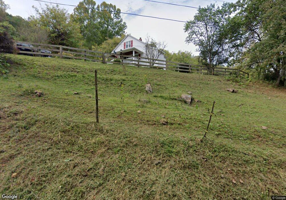
196 Stinnett Rd Amherst, VA 24521
Estimated Value: $155,000 - $187,000
2
Beds
1
Bath
1,147
Sq Ft
$150/Sq Ft
Est. Value
About This Home
This home is located at 196 Stinnett Rd, Amherst, VA 24521 and is currently estimated at $172,576, approximately $150 per square foot. 196 Stinnett Rd is a home located in Amherst County with nearby schools including Pleasant View Elementary School, Amherst Middle School, and Amherst County High School.
Ownership History
Date
Name
Owned For
Owner Type
Purchase Details
Closed on
Dec 30, 2015
Sold by
Stinnett Harry B and Stinnett Michael Edward
Bought by
Condrey Keith W and Condrey Sally A
Current Estimated Value
Home Financials for this Owner
Home Financials are based on the most recent Mortgage that was taken out on this home.
Original Mortgage
$68,019
Outstanding Balance
$53,722
Interest Rate
3.75%
Mortgage Type
FHA
Estimated Equity
$118,854
Purchase Details
Closed on
Feb 10, 2011
Sold by
Mays David E and Clayton Mays H
Bought by
Mays David E and Mays Mary C
Create a Home Valuation Report for This Property
The Home Valuation Report is an in-depth analysis detailing your home's value as well as a comparison with similar homes in the area
Home Values in the Area
Average Home Value in this Area
Purchase History
| Date | Buyer | Sale Price | Title Company |
|---|---|---|---|
| Condrey Keith W | $78,650 | Attorney | |
| Mays David E | -- | None Available |
Source: Public Records
Mortgage History
| Date | Status | Borrower | Loan Amount |
|---|---|---|---|
| Open | Condrey Keith W | $68,019 |
Source: Public Records
Tax History Compared to Growth
Tax History
| Year | Tax Paid | Tax Assessment Tax Assessment Total Assessment is a certain percentage of the fair market value that is determined by local assessors to be the total taxable value of land and additions on the property. | Land | Improvement |
|---|---|---|---|---|
| 2025 | $651 | $106,700 | $25,000 | $81,700 |
| 2024 | $651 | $106,700 | $25,000 | $81,700 |
| 2023 | $485 | $79,500 | $25,000 | $54,500 |
| 2022 | $485 | $79,500 | $25,000 | $54,500 |
| 2021 | $485 | $79,500 | $25,000 | $54,500 |
| 2020 | $485 | $79,500 | $25,000 | $54,500 |
| 2019 | $500 | $81,900 | $29,000 | $52,900 |
| 2018 | $500 | $81,900 | $29,000 | $52,900 |
| 2017 | $500 | $81,900 | $29,000 | $52,900 |
| 2016 | $500 | $81,900 | $29,000 | $52,900 |
Source: Public Records
Map
Nearby Homes
- 355 Dyson Rd
- 7795 Lexington Turnpike
- 3523 Beverly Town Rd
- 0 Kersey Rd Unit 11504309
- 00 Kersey Rd
- 303 Harrison Creek Rd
- 0 W Perch Unit 362248
- 0 Love Lady Creek Rd
- 0 Puppy Creek Rd
- 549 Thrashers Creek Rd
- 0 Pedlar River Rd
- 2444 Laurel Ave
- 2346 Holly Ave
- 0 19th Unit 362428
- 1635 Pine Ave
- 1735 Pine Ave
- 2474 Spruce Ave
- 2260 Pine Ave
- 225 Opus Ln Unit 1 of 5 See Map
- 2224 Hawthorne Ave
- 138 Stinnett Rd
- 5675 Lexington Turnpike
- 5595 Lexington Turnpike
- 117 Mount Horeb Rd
- 5794 Lexington Turnpike
- 311 Stinnett Rd
- 5807 Lexington Turnpike
- 172 Mount Horeb Rd
- 5837 Lexington Turnpike
- 190 Buck Hollow Rd
- 139 Sweet Herb Farm Rd
- 128 Buck Hollow Rd
- 479 Stinnett Rd
- 167 Sweet Herb Farm Rd
- 194 Buck Hollow Rd
- 199 Buck Hollow Rd
- 162 Sweet Herb Farm Rd
- 200 Buck Hollow Rd
- 161 Buck Hollow Rd
- 139 Buck Hollow Rd