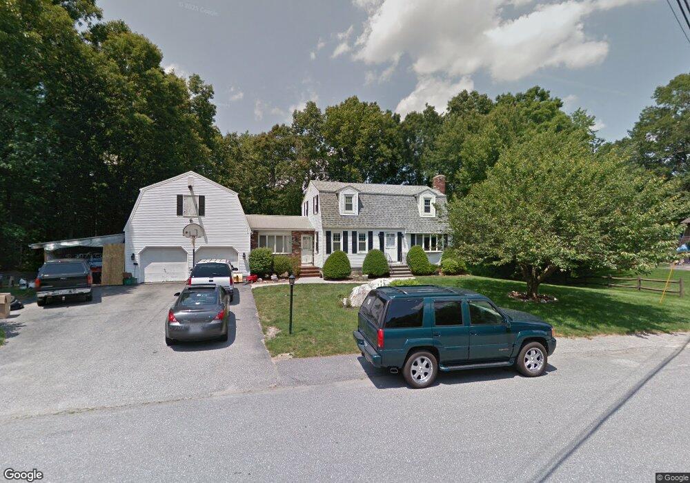
196 Trout Brook Rd Dracut, MA 01826
Estimated Value: $684,253 - $790,000
3
Beds
3
Baths
1,888
Sq Ft
$392/Sq Ft
Est. Value
About This Home
This home is located at 196 Trout Brook Rd, Dracut, MA 01826 and is currently estimated at $740,063, approximately $391 per square foot. 196 Trout Brook Rd is a home located in Middlesex County with nearby schools including Joseph A. Campbell Elementary School, Richardson Middle School, and Dracut Senior High School.
Ownership History
Date
Name
Owned For
Owner Type
Purchase Details
Closed on
Aug 4, 1995
Sold by
Mcmanus Thomas and Mcmanus Rita
Bought by
Bickerstaffe Thomas and Bickerstaffe Mary
Current Estimated Value
Create a Home Valuation Report for This Property
The Home Valuation Report is an in-depth analysis detailing your home's value as well as a comparison with similar homes in the area
Home Values in the Area
Average Home Value in this Area
Purchase History
| Date | Buyer | Sale Price | Title Company |
|---|---|---|---|
| Bickerstaffe Thomas | $175,000 | -- |
Source: Public Records
Mortgage History
| Date | Status | Borrower | Loan Amount |
|---|---|---|---|
| Open | Bickerstaffe Thomas | $247,000 | |
| Closed | Bickerstaffe Thomas | $105,000 | |
| Closed | Bickerstaffe Thomas | $35,000 | |
| Closed | Bickerstaffe Thomas | $46,000 |
Source: Public Records
Tax History
| Year | Tax Paid | Tax Assessment Tax Assessment Total Assessment is a certain percentage of the fair market value that is determined by local assessors to be the total taxable value of land and additions on the property. | Land | Improvement |
|---|---|---|---|---|
| 2025 | $6,851 | $677,000 | $230,100 | $446,900 |
| 2024 | $6,663 | $637,600 | $219,300 | $418,300 |
| 2023 | $6,458 | $557,700 | $190,700 | $367,000 |
| 2022 | $6,242 | $507,900 | $173,500 | $334,400 |
| 2021 | $9,093 | $474,000 | $157,500 | $316,500 |
| 2020 | $5,955 | $446,100 | $152,800 | $293,300 |
| 2019 | $5,682 | $413,200 | $145,400 | $267,800 |
| 2018 | $5,680 | $401,700 | $145,400 | $256,300 |
| 2017 | $5,623 | $401,700 | $145,400 | $256,300 |
| 2016 | $5,623 | $378,900 | $146,200 | $232,700 |
| 2015 | $5,409 | $362,300 | $146,200 | $216,100 |
| 2014 | $5,044 | $348,100 | $146,200 | $201,900 |
Source: Public Records
Map
Nearby Homes
- 277 Loon Hill Rd
- 315 Broadway Rd Unit 1
- 315 Broadway Rd Unit 7
- 785 Broadway Rd
- 287 Fox Ave
- 10 Lanseigne St
- 170 E Richardson Rd
- 84 Tellier Way
- 144 Thissell Ave Unit 11
- 54 Montaup Ave
- 69 Arlington St
- 4 Hazelwood Ave Unit 12
- 30 Parker Rd
- 700 Robbins Ave Unit 6
- 40 Arlington Ave
- 668 Robbins Ave Unit 1
- 935 Methuen St Unit 13
- 175 Willard St Unit 9
- 1391 Bridge St
- 1563 Bridge St
- 186 Trout Brook Rd
- 197 Trout Brook Rd
- 206 Trout Brook Rd
- 207 Trout Brook Rd
- 216 Trout Brook Rd
- 187 Trout Brook Rd
- 176 Trout Brook Rd
- 7 Blueberry Hill Rd
- 13 Blueberry Hill Rd
- 177 Trout Brook Rd
- 217 Trout Brook Rd
- 30 Blueberry Hill Rd
- 226 Trout Brook Rd
- 54 Colonial Dr
- 62 Colonial Dr
- 167 Trout Brook Rd
- 36 Colonial Dr
- 134 Heather Rd
- 144 Heather Rd
- 14 Blueberry Hill Rd
Your Personal Tour Guide
Ask me questions while you tour the home.