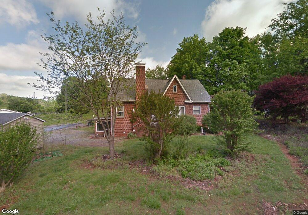
196 W Parker Rd Morganton, NC 28655
Estimated Value: $196,000 - $275,000
3
Beds
1
Bath
1,828
Sq Ft
$132/Sq Ft
Est. Value
About This Home
This home is located at 196 W Parker Rd, Morganton, NC 28655 and is currently estimated at $241,449, approximately $132 per square foot. 196 W Parker Rd is a home located in Burke County with nearby schools including Mull Elementary School, Liberty Middle School, and Robert L. Patton High School.
Ownership History
Date
Name
Owned For
Owner Type
Purchase Details
Closed on
Feb 7, 2025
Sold by
Lail Jean B
Bought by
Lail Jean B and Tilley Christopher M
Current Estimated Value
Purchase Details
Closed on
Mar 13, 2023
Sold by
Tiley Christopher M
Bought by
Lail Jean B
Purchase Details
Closed on
Feb 7, 2023
Sold by
Lail Jean B
Bought by
Lail Jean B and Tiley Christopher M
Create a Home Valuation Report for This Property
The Home Valuation Report is an in-depth analysis detailing your home's value as well as a comparison with similar homes in the area
Home Values in the Area
Average Home Value in this Area
Purchase History
| Date | Buyer | Sale Price | Title Company |
|---|---|---|---|
| Lail Jean B | -- | None Listed On Document | |
| Lail Jean B | -- | None Listed On Document | |
| Lail Jean B | -- | -- | |
| Lail Jean B | -- | None Listed On Document | |
| Lail Jean B | -- | -- | |
| Lail Jean B | -- | None Listed On Document |
Source: Public Records
Tax History Compared to Growth
Tax History
| Year | Tax Paid | Tax Assessment Tax Assessment Total Assessment is a certain percentage of the fair market value that is determined by local assessors to be the total taxable value of land and additions on the property. | Land | Improvement |
|---|---|---|---|---|
| 2025 | $766 | $120,552 | $18,292 | $102,260 |
| 2024 | $768 | $120,552 | $18,292 | $102,260 |
| 2023 | $763 | $120,552 | $18,292 | $102,260 |
| 2022 | $781 | $100,543 | $18,292 | $82,251 |
| 2021 | $775 | $100,543 | $18,292 | $82,251 |
| 2020 | $771 | $100,543 | $18,292 | $82,251 |
| 2019 | $771 | $100,543 | $18,292 | $82,251 |
| 2018 | $393 | $100,065 | $18,292 | $81,773 |
| 2017 | $745 | $97,129 | $18,292 | $78,837 |
| 2016 | $725 | $97,129 | $18,292 | $78,837 |
| 2015 | $722 | $97,129 | $18,292 | $78,837 |
| 2014 | $721 | $97,129 | $18,292 | $78,837 |
| 2013 | $721 | $97,129 | $18,292 | $78,837 |
Source: Public Records
Map
Nearby Homes
- VL Blvd
- 107 Dale Cir
- 805 Old Nc 18 Hwy
- 108 Logan St Unit 110
- 107 N Matthews St
- 602 Enola Rd
- 207 Stacy St
- 107 Oakwood St
- 106 Rebel Run
- 204 Old Mill Dr
- 0 Coal Shute Rd Unit CAR3935533
- 421 Bethel Rd
- 0 Coffey St
- 1438 Bethel Rd
- Lot 2 Lane St Unit 2
- Lot 5 Lane St Unit 5
- Lot 6 Lane St Unit 6
- Lot 4 Lane St Unit 4
- Lot 3 Lane St Unit 3
- 1376 Old Nc 18 Unit 1380
- 102 Sageview Ln
- 445 Old Nc 18
- 103 Sageview Ln
- 443 Old Nc 18
- 443 Old Nc 18
- 441 Old Nc 18
- 441 Old Nc 18
- 105 Mica Ave
- 105 Mica Ave Unit D
- 105 Mica Ave Unit C
- 111 Mica Ave
- 601 Old Nc 18
- 109 Mica Ave Unit 113
- 170 W Parker Rd
- 102 Brookwood Rd
- 603 Old Nc 18
- 603 Old Nc Hwy 18 Hwy
- 168 W Parker Rd
- 104 Brookwood Rd
- 605 Old Nc 18