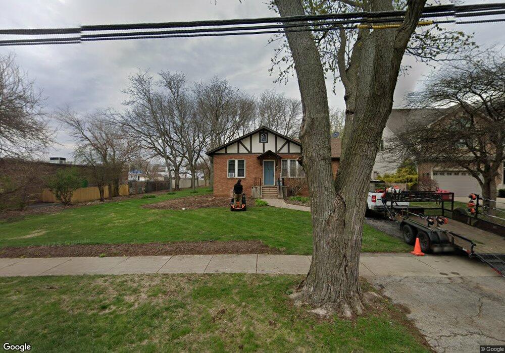
1960 Curtiss St Downers Grove, IL 60515
Estimated Value: $373,800 - $501,000
--
Bed
--
Bath
1,276
Sq Ft
$335/Sq Ft
Est. Value
About This Home
This home is located at 1960 Curtiss St, Downers Grove, IL 60515 and is currently estimated at $427,950, approximately $335 per square foot. 1960 Curtiss St is a home located in DuPage County with nearby schools including Henry Puffer School, Herrick Middle School, and Downer Grove North High School.
Ownership History
Date
Name
Owned For
Owner Type
Purchase Details
Closed on
Jun 18, 2004
Sold by
Gloss Helen B
Bought by
Klemp Alan and Klemp Tracy
Current Estimated Value
Home Financials for this Owner
Home Financials are based on the most recent Mortgage that was taken out on this home.
Original Mortgage
$185,000
Outstanding Balance
$93,212
Interest Rate
6.46%
Mortgage Type
Purchase Money Mortgage
Estimated Equity
$334,738
Create a Home Valuation Report for This Property
The Home Valuation Report is an in-depth analysis detailing your home's value as well as a comparison with similar homes in the area
Home Values in the Area
Average Home Value in this Area
Purchase History
| Date | Buyer | Sale Price | Title Company |
|---|---|---|---|
| Klemp Alan | $240,000 | Ctic |
Source: Public Records
Mortgage History
| Date | Status | Borrower | Loan Amount |
|---|---|---|---|
| Open | Klemp Alan | $185,000 |
Source: Public Records
Tax History Compared to Growth
Tax History
| Year | Tax Paid | Tax Assessment Tax Assessment Total Assessment is a certain percentage of the fair market value that is determined by local assessors to be the total taxable value of land and additions on the property. | Land | Improvement |
|---|---|---|---|---|
| 2024 | $6,714 | $117,393 | $64,712 | $52,681 |
| 2023 | $6,381 | $107,140 | $59,060 | $48,080 |
| 2022 | $6,006 | $102,040 | $56,250 | $45,790 |
| 2021 | $5,483 | $98,180 | $54,120 | $44,060 |
| 2020 | $5,399 | $96,420 | $53,150 | $43,270 |
| 2019 | $5,227 | $92,250 | $50,850 | $41,400 |
| 2018 | $4,962 | $86,340 | $47,590 | $38,750 |
| 2017 | $4,834 | $83,420 | $45,980 | $37,440 |
| 2016 | $4,795 | $80,410 | $44,320 | $36,090 |
| 2015 | $4,762 | $75,730 | $41,740 | $33,990 |
| 2014 | $4,730 | $72,990 | $40,230 | $32,760 |
| 2013 | $4,668 | $73,170 | $40,330 | $32,840 |
Source: Public Records
Map
Nearby Homes
- 4947 Stonewall Ave
- 2160 Howard Ave
- 5431 Ashbrook Place Unit 8
- 4940 Cornell Ave
- 5509 Aspen Ave Unit 6
- 5434 Ashbrook Place
- 5454 Lee Ave
- 4939 Lee Ave
- 2335 Old George Way Unit 2335
- 4848 Francisco Ave
- 5538 Durand Dr
- 1903 Maple Ave
- 4601 Wilson Ave
- 5622 Belmont Rd
- 5616 Durand Dr Unit 6D
- 5617 Durand Dr Unit 9A
- 4512 Wilson Ave
- 5727 Woodward Ave
- 4508 Stonewall Ave
- 5760 Woodward Ave
- 1958 Curtiss St
- 1954 Curtiss St
- 5129 Belmont Rd
- 5133 Belmont Rd
- 5137 Belmont Rd
- 1952 Curtiss St
- 1961 Curtiss St
- 1957 Curtiss St
- 1959 Curtiss St
- 1950 Curtiss St
- 1967 Hitchcock Ave
- 1955 Curtiss St
- 1963 Hitchcock Ave
- 1953 Curtiss St
- 1948 Curtiss St
- 1951 Curtiss St
- 1965 Hitchcock Ave
- 1946 Curtiss St
- 1961 Hitchcock Ave
- 1949 Curtiss St
