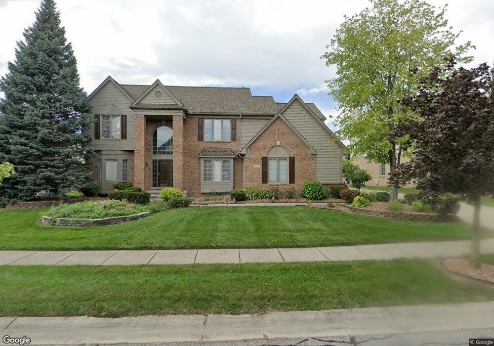
1960 Stonebridge Way Unit Bldg-Unit Canton, MI 48188
Estimated Value: $613,000 - $658,000
--
Bed
3
Baths
3,093
Sq Ft
$206/Sq Ft
Est. Value
About This Home
This home is located at 1960 Stonebridge Way Unit Bldg-Unit, Canton, MI 48188 and is currently estimated at $635,842, approximately $205 per square foot. 1960 Stonebridge Way Unit Bldg-Unit is a home located in Wayne County with nearby schools including Canton High School, Plymouth High School, and Salem High School.
Ownership History
Date
Name
Owned For
Owner Type
Purchase Details
Closed on
Mar 11, 2022
Sold by
Singhal and Ruchi
Bought by
Shannon Anthony D and Shannon Glynis D
Current Estimated Value
Purchase Details
Closed on
Jul 20, 2009
Sold by
Porter Paul D and Porter Susan M
Bought by
Singhal Sharad
Purchase Details
Closed on
Jul 15, 2005
Sold by
Sun Lee James Y and Sun Lee Jae
Bought by
Porter Paul D
Create a Home Valuation Report for This Property
The Home Valuation Report is an in-depth analysis detailing your home's value as well as a comparison with similar homes in the area
Home Values in the Area
Average Home Value in this Area
Purchase History
| Date | Buyer | Sale Price | Title Company |
|---|---|---|---|
| Shannon Anthony D | $505,000 | Reputation First Title | |
| Singhal Sharad | $310,000 | None Available | |
| Porter Paul D | $409,900 | Multiple |
Source: Public Records
Tax History Compared to Growth
Tax History
| Year | Tax Paid | Tax Assessment Tax Assessment Total Assessment is a certain percentage of the fair market value that is determined by local assessors to be the total taxable value of land and additions on the property. | Land | Improvement |
|---|---|---|---|---|
| 2025 | $4,449 | $289,100 | $0 | $0 |
| 2024 | $4,449 | $260,000 | $0 | $0 |
| 2023 | $4,242 | $234,900 | $0 | $0 |
| 2022 | $6,776 | $215,800 | $0 | $0 |
| 2021 | $9,483 | $207,700 | $0 | $0 |
| 2020 | $9,365 | $208,500 | $0 | $0 |
| 2019 | $9,192 | $177,110 | $0 | $0 |
| 2018 | $5,191 | $169,740 | $0 | $0 |
| 2017 | $6,177 | $161,100 | $0 | $0 |
| 2016 | $5,561 | $159,200 | $0 | $0 |
| 2015 | $14,035 | $148,230 | $0 | $0 |
| 2013 | $13,597 | $142,570 | $0 | $0 |
| 2010 | -- | $127,500 | $71,546 | $55,954 |
Source: Public Records
Map
Nearby Homes
- 1861 Stonebridge Way
- 2498 Cleveland Way
- 2304 Cleveland Way
- 1564 Crowndale Ln
- 46948 Southgate Dr
- 1938 Scenic Dr
- 47631 Scenic Circle Dr N
- 1849 Wentworth Ct
- 1752 Thistle Dr
- 51026 Meadowlands
- 1709 Thistle Dr Unit 51
- 2381 Lexington Cir S
- 47671 Vistas Circle Dr N
- 47815 Vistas Circle Dr S
- 3406 Riverside Ct
- 46502 Killarney Cir Unit 191
- 46000 Geddes Rd Unit 156
- 46000 Geddes Rd Unit 404
- 46000 Geddes Rd Unit 132
- 46000 Geddes Rd Unit 300
- 1960 Stonebridge Way
- 1988 Stonebridge Way
- 1942 Stonebridge Way
- 2013 Crowndale Ln
- 1987 Crowndale Ln
- 1934 Stonebridge Way
- 1957 Stonebridge Way
- 1969 Stonebridge Way
- 2024 Stonebridge Way
- 1945 Stonebridge Way
- 1981 Stonebridge Way
- 1971 Crowndale Ln
- 1926 Stonebridge Way
- 1933 Stonebridge Way
- 2012 Crowndale Ln
- 2040 Crowndale Ln
- 1984 Crowndale Ln
- 2170 N Woods Ct
- 1955 Crowndale Ln
- 2170 N North Woods Ct Ct