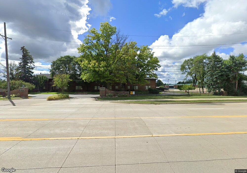
19601 W 12 Mile Rd Unit 102 Southfield, MI 48076
Estimated Value: $106,515 - $123,000
2
Beds
2
Baths
1,008
Sq Ft
$115/Sq Ft
Est. Value
About This Home
This home is located at 19601 W 12 Mile Rd Unit 102, Southfield, MI 48076 and is currently estimated at $115,629, approximately $114 per square foot. 19601 W 12 Mile Rd Unit 102 is a home located in Oakland County with nearby schools including Alice M. Birney K-8 School, Mcintyre Elementary School, and Crescent Academy Pk-1.
Ownership History
Date
Name
Owned For
Owner Type
Purchase Details
Closed on
Dec 1, 2020
Sold by
19601 W Twelve Mile Property Llc
Bought by
Body Francina
Current Estimated Value
Home Financials for this Owner
Home Financials are based on the most recent Mortgage that was taken out on this home.
Original Mortgage
$87,300
Outstanding Balance
$77,862
Interest Rate
2.8%
Mortgage Type
New Conventional
Estimated Equity
$37,767
Purchase Details
Closed on
Aug 17, 2020
Sold by
Strategic Holdings And Real Estate Inc
Bought by
19601 W Twelve Mile Property Llc
Purchase Details
Closed on
Aug 22, 2017
Sold by
Young Allison
Bought by
Strategic Holdings And Real Estate Inc
Purchase Details
Closed on
Mar 23, 2004
Sold by
Sheloski John M
Bought by
Young Allison
Home Financials for this Owner
Home Financials are based on the most recent Mortgage that was taken out on this home.
Original Mortgage
$68,870
Interest Rate
5.66%
Mortgage Type
FHA
Purchase Details
Closed on
Feb 1, 1996
Sold by
Sheloski Anne E
Bought by
Sheloski Anne E
Create a Home Valuation Report for This Property
The Home Valuation Report is an in-depth analysis detailing your home's value as well as a comparison with similar homes in the area
Home Values in the Area
Average Home Value in this Area
Purchase History
| Date | Buyer | Sale Price | Title Company |
|---|---|---|---|
| Body Francina | $92,000 | Liberty Title | |
| 19601 W Twelve Mile Property Llc | -- | None Available | |
| Strategic Holdings And Real Estate Inc | -- | None Available | |
| Young Allison | $71,000 | -- | |
| Sheloski Anne E | -- | -- |
Source: Public Records
Mortgage History
| Date | Status | Borrower | Loan Amount |
|---|---|---|---|
| Open | Body Francina | $87,300 | |
| Previous Owner | Young Allison | $68,870 |
Source: Public Records
Tax History Compared to Growth
Tax History
| Year | Tax Paid | Tax Assessment Tax Assessment Total Assessment is a certain percentage of the fair market value that is determined by local assessors to be the total taxable value of land and additions on the property. | Land | Improvement |
|---|---|---|---|---|
| 2022 | $2,211 | $43,770 | $8,750 | $35,020 |
| 2021 | $2,348 | $39,660 | $6,000 | $33,660 |
| 2020 | $1,042 | $27,860 | $3,100 | $24,760 |
| 2018 | $976 | $18,730 | $3,100 | $15,630 |
| 2015 | -- | $14,500 | $0 | $0 |
| 2014 | -- | $14,360 | $0 | $0 |
| 2011 | -- | $19,650 | $0 | $0 |
Source: Public Records
Map
Nearby Homes
- 19601 W 12 Mile Rd Unit 102
- 20141 Lacrosse Ave
- 21650 W 11 Mile Rd
- 28450 Tapert Dr
- 29140 Candlewood Ln
- 20120 Covington Pkwy
- 20351 Lacrosse Ave
- 18797 Wiltshire Blvd
- 29662 Westbrook Pkwy
- 29214 Candlewood Ln
- 29743 Chelmsford Rd
- 29484 Spring Hill Dr
- 29239 Somerset Dr
- 29807 Spring Hill Dr
- 18830 San Quentin Dr
- 30130 Woodgate Dr
- 27925 Arlington Dr
- 20345 Harbor Ln
- 29848 Rambling Rd
- 27430 Evergreen Rd Unit 36
- 19603 W 12 Mile Rd Unit 204
- 19601 W 12 Mile Rd Unit 1
- 19639 W 12 Mile Rd Unit 282 201
- 19603 W 12 Mile Rd
- 19603 W 12 Mile Rd
- 19603 W 12 Mile Rd
- 19603 W 12 Mile Rd
- 19603 W 12 Mile Rd
- 19603 W 12 Mile Rd
- 19603 W 12 Mile Rd
- 19603 W 12 Mile Rd
- 19601 W 12 Mile Rd
- 19601 W 12 Mile Rd
- 19601 W 12 Mile Rd
- 19601 W 12 Mile Rd
- 19601 W 12 Mile Rd
- 19601 W 12 Mile Rd
- 19601 W 12 Mile Rd
- 19601 W 12 Mile Rd
- 19635 W 12 Mile Rd