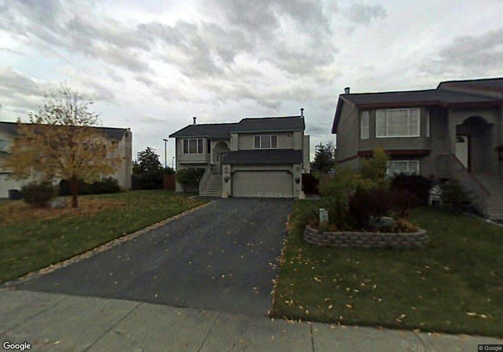
1961 Courage Dr Anchorage, AK 99507
Abbott Loop NeighborhoodEstimated Value: $473,880 - $623,000
4
Beds
3
Baths
2,036
Sq Ft
$257/Sq Ft
Est. Value
About This Home
This home is located at 1961 Courage Dr, Anchorage, AK 99507 and is currently estimated at $523,470, approximately $257 per square foot. 1961 Courage Dr is a home located in Anchorage Municipality with nearby schools including Spring Hill Elementary School, Hanshew Middle School, and Service High School.
Ownership History
Date
Name
Owned For
Owner Type
Purchase Details
Closed on
Apr 13, 2011
Sold by
Loper Willie D and Loper Deborah J
Bought by
Wilson Christopher N and Wilson Christina M
Current Estimated Value
Home Financials for this Owner
Home Financials are based on the most recent Mortgage that was taken out on this home.
Original Mortgage
$331,987
Outstanding Balance
$226,044
Interest Rate
4.83%
Mortgage Type
VA
Estimated Equity
$297,426
Purchase Details
Closed on
Feb 3, 2005
Sold by
Watson Richard D and Watson Deana L
Bought by
Loper Willie D and Loper Deborah J
Home Financials for this Owner
Home Financials are based on the most recent Mortgage that was taken out on this home.
Original Mortgage
$278,256
Interest Rate
5.74%
Mortgage Type
VA
Purchase Details
Closed on
Oct 8, 2002
Sold by
Watson Richard D and Watson Deana
Bought by
Watson Richard D and Watson Deana L
Home Financials for this Owner
Home Financials are based on the most recent Mortgage that was taken out on this home.
Original Mortgage
$153,915
Interest Rate
5.12%
Mortgage Type
Purchase Money Mortgage
Purchase Details
Closed on
Oct 4, 2002
Sold by
Watson Richard D and Watson Deana
Bought by
Watson Richard D and Watson Deana L
Home Financials for this Owner
Home Financials are based on the most recent Mortgage that was taken out on this home.
Original Mortgage
$153,915
Interest Rate
5.12%
Mortgage Type
Purchase Money Mortgage
Purchase Details
Closed on
Oct 11, 2000
Sold by
Norman Carlton T and Norman Rachel H
Bought by
Watson Richard D and Watson Deana
Home Financials for this Owner
Home Financials are based on the most recent Mortgage that was taken out on this home.
Original Mortgage
$179,550
Interest Rate
7.96%
Mortgage Type
New Conventional
Purchase Details
Closed on
Jun 29, 1995
Sold by
Spinell Homes Inc
Bought by
Norman Carlton T and Norman Rachel H
Home Financials for this Owner
Home Financials are based on the most recent Mortgage that was taken out on this home.
Original Mortgage
$161,333
Interest Rate
7.88%
Mortgage Type
FHA
Create a Home Valuation Report for This Property
The Home Valuation Report is an in-depth analysis detailing your home's value as well as a comparison with similar homes in the area
Home Values in the Area
Average Home Value in this Area
Purchase History
| Date | Buyer | Sale Price | Title Company |
|---|---|---|---|
| Wilson Christopher N | -- | Stewart Title Company | |
| Loper Willie D | -- | Stewart Title Of Alaska | |
| Watson Richard D | -- | -- | |
| Watson Richard D | -- | -- | |
| Watson Richard D | -- | Pacific Northwest Title | |
| Watson Richard D | -- | -- | |
| Norman Carlton T | -- | -- | |
| Norman Carlton T | -- | -- |
Source: Public Records
Mortgage History
| Date | Status | Borrower | Loan Amount |
|---|---|---|---|
| Open | Wilson Christopher N | $331,987 | |
| Previous Owner | Loper Willie D | $278,256 | |
| Previous Owner | Watson Richard D | $153,915 | |
| Previous Owner | Watson Richard D | $153,915 | |
| Previous Owner | Watson Richard D | $179,550 | |
| Previous Owner | Norman Carlton T | $161,333 |
Source: Public Records
Tax History
| Year | Tax Paid | Tax Assessment Tax Assessment Total Assessment is a certain percentage of the fair market value that is determined by local assessors to be the total taxable value of land and additions on the property. | Land | Improvement |
|---|---|---|---|---|
| 2025 | $3,056 | $422,900 | $89,100 | $333,800 |
| 2024 | $3,056 | $414,300 | $89,100 | $325,200 |
| 2023 | $6,473 | $380,100 | $89,100 | $291,000 |
| 2022 | $3,184 | $389,100 | $89,100 | $300,000 |
| 2021 | $6,201 | $344,100 | $89,100 | $255,000 |
| 2020 | $2,316 | $337,400 | $89,100 | $248,300 |
| 2019 | $2,173 | $332,800 | $89,100 | $243,700 |
| 2018 | $2,027 | $323,600 | $79,200 | $244,400 |
| 2017 | $2,521 | $331,000 | $79,200 | $251,800 |
| 2016 | $4,444 | $335,900 | $74,900 | $261,000 |
| 2015 | $4,444 | $328,200 | $74,900 | $253,300 |
| 2014 | $4,444 | $323,500 | $74,900 | $248,600 |
Source: Public Records
Map
Nearby Homes
- 9130 Golovin St
- 2211 Sentry Dr Unit B6
- 2300 Sentry Dr Unit E102
- 2300 Sentry Dr Unit E106
- 9710 Vanguard Dr Unit 80
- 9715 Independence Dr Unit B306
- 9499 Brayton Dr Unit 39
- 9499 Brayton Dr Unit 152
- 9499 Brayton Dr Unit 245
- 2430 Sentry Dr Unit B306
- 9750 Vanguard Dr Unit 54
- 9751 Newhaven Loop
- 9387 Morningside Loop
- 9599 Brayton Dr Unit 422
- 10282 Jamestown Dr Unit 5A
- 9610 Morningside Loop Unit B1
- 10229 Jamestown Dr Unit 605
- 1900-1941 Marthas Vineyard Cir
- 8000 Independence Park Dr
- 1962 Commodore Dr
- 1971 Courage Dr
- 1951 Courage Dr
- 1981 Courage Dr
- 1941 Courage Dr
- L11B19 Courage Dr
- L7 B19 Courage Dr
- 2001 Courage Dr
- 1970 Courage Dr
- 9201 Flintlock St
- 1931 Courage Dr
- 2021 Courage Dr
- 2000 Abbott Rd
- 2000 Abbott Rd
- 2000 Abbott Rd
- 2000 Abbott Rd
- 2000 Abbott Rd Unit A2
- 2000 Abbott Rd Unit B2
- 2000 Abbott Rd Unit A3
- 9211 Flintlock St
- 2011 Courage Cir
Your Personal Tour Guide
Ask me questions while you tour the home.