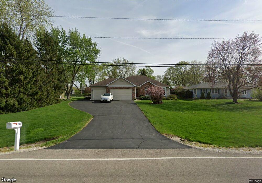
1961 Sheffer Rd Aurora, IL 60502
Indian Creek NeighborhoodEstimated Value: $392,000 - $471,000
Studio
--
Bath
1,637
Sq Ft
$268/Sq Ft
Est. Value
About This Home
This home is located at 1961 Sheffer Rd, Aurora, IL 60502 and is currently estimated at $438,725, approximately $268 per square foot. 1961 Sheffer Rd is a home located in Kane County with nearby schools including Mabel O Donnell Elementary School, Simmons Middle School, and East Aurora High School.
Ownership History
Date
Name
Owned For
Owner Type
Purchase Details
Closed on
Apr 7, 2003
Sold by
Bohr Lawrence and Bohr Cynthia
Bought by
Gonnerman Steve A and Gonnerman Marie E
Current Estimated Value
Home Financials for this Owner
Home Financials are based on the most recent Mortgage that was taken out on this home.
Original Mortgage
$156,700
Interest Rate
5.95%
Mortgage Type
Construction
Create a Home Valuation Report for This Property
The Home Valuation Report is an in-depth analysis detailing your home's value as well as a comparison with similar homes in the area
Home Values in the Area
Average Home Value in this Area
Purchase History
| Date | Buyer | Sale Price | Title Company |
|---|---|---|---|
| Gonnerman Steve A | $45,000 | Law Title Insurance Co Inc |
Source: Public Records
Mortgage History
| Date | Status | Borrower | Loan Amount |
|---|---|---|---|
| Closed | Gonnerman Steve A | $156,700 |
Source: Public Records
Tax History
| Year | Tax Paid | Tax Assessment Tax Assessment Total Assessment is a certain percentage of the fair market value that is determined by local assessors to be the total taxable value of land and additions on the property. | Land | Improvement |
|---|---|---|---|---|
| 2024 | $6,653 | $147,656 | $18,563 | $129,093 |
| 2023 | $6,414 | $131,930 | $16,586 | $115,344 |
| 2022 | $2,519 | $120,374 | $15,133 | $105,241 |
| 2021 | $5,937 | $112,070 | $14,089 | $97,981 |
| 2020 | $2,785 | $104,097 | $13,087 | $91,010 |
| 2019 | $5,532 | $96,448 | $12,125 | $84,323 |
| 2018 | $3,137 | $84,636 | $11,215 | $73,421 |
| 2017 | $3,421 | $79,390 | $10,334 | $69,056 |
| 2016 | $3,732 | $75,728 | $8,858 | $66,870 |
| 2015 | -- | $66,505 | $7,617 | $58,888 |
| 2014 | -- | $58,073 | $7,326 | $50,747 |
| 2013 | -- | $59,650 | $7,221 | $52,429 |
Source: Public Records
Map
Nearby Homes
- 1771 Briarheath Dr
- 1176 Heathrow Ln
- 1671 Sheffer Rd
- 2752 Preserve Cir Unit 13006
- 2748 Preserve Cir Unit 13005
- 2732 Preserve Cir Unit 13001
- 2892 Preserve Cir Unit 5003
- 2888 Preserve Cir Unit 5002
- 970 Waterside Ct
- 0000 N Farnsworth Ave
- Lot 1 Reckinger Rd
- 2314 Reflections Dr Unit C0602
- 907 Harley Ct
- 1037 Parkhill Cir
- 2428 Ridgewood Ct
- 1015 Woodview Ct
- 1050 N Farnsworth Ave Unit 111
- 1110 Oakhill Dr
- 1751 Gary Ave
- 1900 E New York St
- 1981 Sheffer Rd
- 1941 Sheffer Rd
- 1960 Stephen St
- 1931 Sheffer Rd
- 1980 Stephen St
- 1940 Stephen St
- 1849 Foxridge Ct Unit 56
- 1849 Foxridge Ct Unit 1
- 1990 Stephen St
- 1930 Stephen St
- 1911 Sheffer Rd
- 1825 Foxridge Ct Unit 46
- 1845 Foxridge Ct
- 1910 Stephen St
- 1841 Foxridge Ct
- 1837 Foxridge Ct Unit 43
- 1873 Foxridge Ct Unit 66
- 1873 Foxridge Ct Unit 1873
- 1833 Foxridge Ct Unit 44
- 1833 Foxridge Ct Unit 1833
Your Personal Tour Guide
Ask me questions while you tour the home.