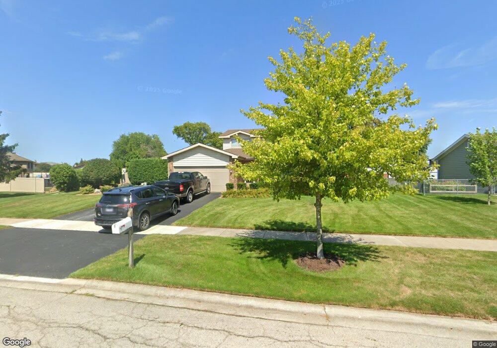
19611 S Arran Dr Frankfort, IL 60423
Frankfort Square NeighborhoodEstimated Value: $377,000 - $425,000
3
Beds
3
Baths
1,854
Sq Ft
$216/Sq Ft
Est. Value
About This Home
This home is located at 19611 S Arran Dr, Frankfort, IL 60423 and is currently estimated at $401,251, approximately $216 per square foot. 19611 S Arran Dr is a home located in Will County with nearby schools including Frankfort Square Elementary School, Summit Hill Junior High School, and Lincoln-Way East High School.
Ownership History
Date
Name
Owned For
Owner Type
Purchase Details
Closed on
Sep 17, 2024
Sold by
Trust Number 15357 and Chicago Title Land Trust Company
Bought by
Kenneth Anthony Kloska And Michele Therese Kl and Kloska
Current Estimated Value
Purchase Details
Closed on
Mar 25, 1997
Sold by
Kloska Kenneth A and Kloska Kathryn E
Bought by
First National Bank Of Evergreen Park and Trust #15357
Create a Home Valuation Report for This Property
The Home Valuation Report is an in-depth analysis detailing your home's value as well as a comparison with similar homes in the area
Home Values in the Area
Average Home Value in this Area
Purchase History
| Date | Buyer | Sale Price | Title Company |
|---|---|---|---|
| Kenneth Anthony Kloska And Michele Therese Kl | -- | Chicago Title | |
| First National Bank Of Evergreen Park | -- | -- |
Source: Public Records
Tax History Compared to Growth
Tax History
| Year | Tax Paid | Tax Assessment Tax Assessment Total Assessment is a certain percentage of the fair market value that is determined by local assessors to be the total taxable value of land and additions on the property. | Land | Improvement |
|---|---|---|---|---|
| 2024 | $10,491 | $132,380 | $19,421 | $112,959 |
| 2023 | $10,491 | $118,228 | $17,345 | $100,883 |
| 2022 | $9,284 | $107,685 | $15,798 | $91,887 |
| 2021 | $8,704 | $100,744 | $14,780 | $85,964 |
| 2020 | $8,569 | $97,904 | $14,363 | $83,541 |
| 2019 | $8,283 | $95,284 | $13,979 | $81,305 |
| 2018 | $7,979 | $92,545 | $13,577 | $78,968 |
| 2017 | $7,811 | $90,385 | $13,260 | $77,125 |
| 2016 | $7,569 | $87,286 | $12,805 | $74,481 |
| 2015 | $7,296 | $84,212 | $12,354 | $71,858 |
| 2014 | $7,296 | $83,626 | $12,268 | $71,358 |
| 2013 | $7,296 | $84,710 | $12,427 | $72,283 |
Source: Public Records
Map
Nearby Homes
- 19708 S Skye Dr
- 19642 S Edinburgh Ln
- 7407 Ridgefield Ln
- 19558 S Harlem Ave
- 7758 W Kingston Dr
- 7800 W Kingston Dr
- 7905 Richardson Ln
- 20137 S Hampton Ct Unit A
- 7722 Greenway Blvd Unit 4SE
- 7959 Brookside Glen Dr Unit VI
- 7716 Greenway Blvd Unit 1SW
- 8025 Stonegate Dr
- 20027 S Jessica Ln
- 20206 S Frankfort Square Rd Unit A
- 7928 Trinity Cir Unit 2SW
- 7928 Trinity Cir Unit 3NW
- 8036 Highfield Ct
- 7752 W Almond Ct Unit 135
- 20216 S Greenfield Ln
- 8131 W Evergreen Dr
- 19623 S Arran Dr
- 7447 W Arran Dr
- 19608 S Skye Dr
- 19618 S Skye Dr
- 19631 S Arran Dr
- 19600 S Skye Dr
- 19626 S Skye Dr
- 7445 W Arran Dr
- 19641 S Arran Dr
- 19558 S Skye Dr
- 7441 W Arran Dr
- 19636 S Skye Dr
- 19649 S Arran Dr
- 7433 W Arran Dr
- 19607 S Skye Dr
- 19644 S Skye Dr
- 19621 S Skye Dr
- 7425 W Arran Dr
- 19546 S Skye Dr
- 19657 S Arran Dr