Estimated Value: $341,000 - $776,804
3
Beds
4
Baths
3,504
Sq Ft
$148/Sq Ft
Est. Value
About This Home
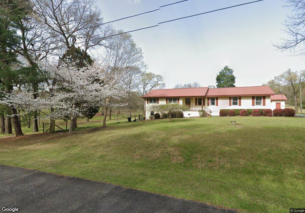
This home is located at 1962 Powersville Rd, Byron, GA 31008 and is currently estimated at $517,268, approximately $147 per square foot. 1962 Powersville Rd is a home with nearby schools including Kay Road Elementary School, Fort Valley Middle School, and Peach County High School.
Ownership History
Date
Name
Owned For
Owner Type
Purchase Details
Closed on
Nov 17, 2016
Sold by
Dena M
Bought by
Wells Philip Kevin
Current Estimated Value
Purchase Details
Closed on
Jan 1, 2009
Sold by
Jeffers John D
Bought by
Jeffers John D and Jeffers Dena M
Purchase Details
Closed on
May 9, 2005
Sold by
Jeffers John D
Bought by
Jeffers John D
Purchase Details
Closed on
May 30, 2000
Sold by
Avera Lucille H
Bought by
Jeffers John Sr D and Jeffers Marie M
Create a Home Valuation Report for This Property
The Home Valuation Report is an in-depth analysis detailing your home's value as well as a comparison with similar homes in the area
Home Values in the Area
Average Home Value in this Area
Purchase History
| Date | Buyer | Sale Price | Title Company |
|---|---|---|---|
| Wells Philip Kevin | $45,000 | -- | |
| Jeffers John D | -- | -- | |
| Jeffers John D | $61,696 | -- | |
| Jeffers John Sr D | -- | -- |
Source: Public Records
Tax History Compared to Growth
Tax History
| Year | Tax Paid | Tax Assessment Tax Assessment Total Assessment is a certain percentage of the fair market value that is determined by local assessors to be the total taxable value of land and additions on the property. | Land | Improvement |
|---|---|---|---|---|
| 2024 | $5,661 | $256,840 | $60,960 | $195,880 |
| 2023 | $5,511 | $232,360 | $42,040 | $190,320 |
| 2022 | $4,851 | $208,000 | $42,040 | $165,960 |
| 2021 | $4,832 | $183,760 | $42,040 | $141,720 |
| 2020 | $4,584 | $175,960 | $42,040 | $133,920 |
| 2019 | $842 | $26,840 | $26,840 | $0 |
| 2018 | $58 | $26,840 | $26,840 | $0 |
| 2017 | $56 | $26,840 | $26,840 | $0 |
| 2016 | $54 | $26,840 | $26,840 | $0 |
| 2015 | $53 | $21,960 | $21,960 | $0 |
| 2014 | $51 | $21,960 | $21,960 | $0 |
| 2013 | -- | $21,960 | $21,960 | $0 |
Source: Public Records
Map
Nearby Homes
- 81 Idell Ct
- 510 Southland Trail
- 408 Dixieland Dr
- 302 Southland Trail
- 0 Barker Rd Unit 243030
- 0 Barker Rd Unit 14258525
- 0 Barker Rd Unit 175053
- 51 Allred Rd
- 1046 Walker Rd
- 152 Hawks Ridge Trace
- 127 Hawks Ridge Trace
- 120 Hawks Ridge Trace
- 117 Hawks Ridge Trace
- 109 Red Tail Cir
- 107 Red Tail Cir
- 113 Sweetspire Ln
- 120 Hawks Place
- 135 Abelia Ln
- Parcel 2 Powersville Rd
- 2078 Powersville Rd
- Parcel 1 Powersville Rd
- 387 Sullivan Dr
- 2104 Powersville Rd
- 1938 Powersville Rd
- 2206 Powersville Rd
- 425 Sullivan Dr
- 365 Sullivan Dr
- 171 Avera Ln
- 2390 Powersville Rd
- 2388 Powersville Rd
- 374 Sullivan Dr
- 2233 Powersville Rd
- 205 Sullivan Dr
- 311 Avera Ln
- 324 Sullivan Dr
- 249 Avera Ln
- 2316 Powersville Rd
- 165 Sullivan Dr