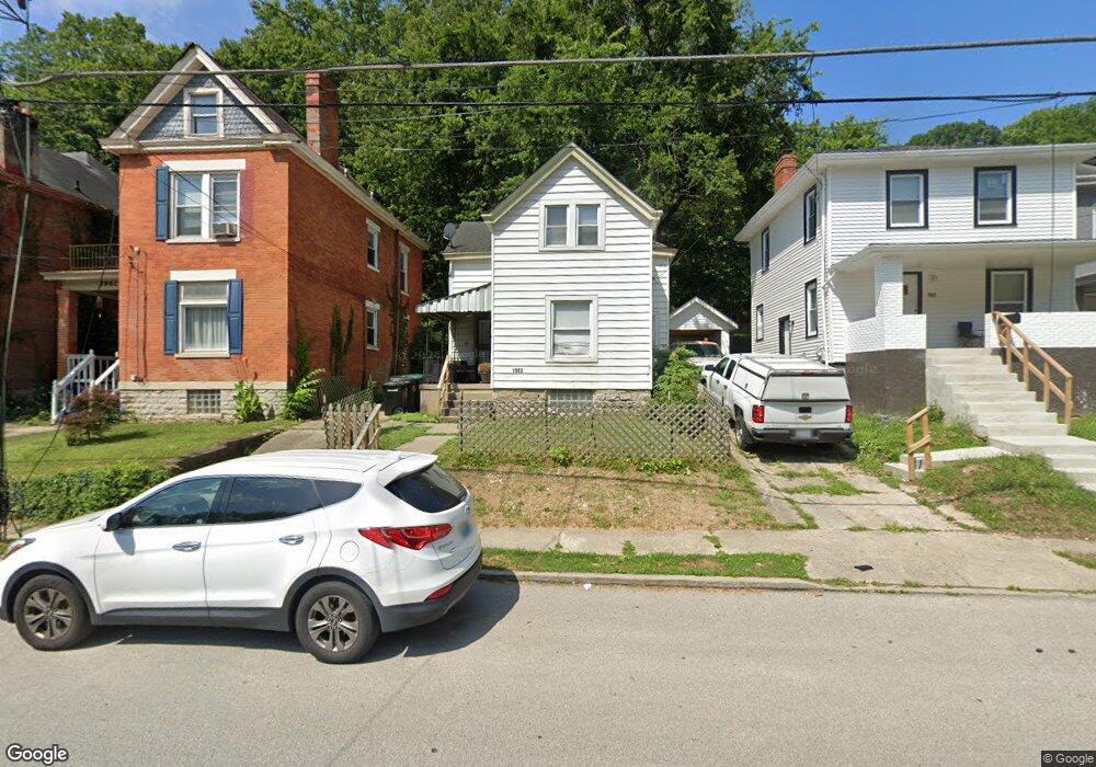
1963 Baltimore Ave Cincinnati, OH 45225
North Fairmount NeighborhoodEstimated Value: $65,000 - $126,000
2
Beds
1
Bath
1,037
Sq Ft
$82/Sq Ft
Est. Value
About This Home
This home is located at 1963 Baltimore Ave, Cincinnati, OH 45225 and is currently estimated at $84,733, approximately $81 per square foot. 1963 Baltimore Ave is a home located in Hamilton County with nearby schools including Robert A. Taft Information Technology High School, Western Hills High School, and Gilbert A. Dater High School.
Ownership History
Date
Name
Owned For
Owner Type
Purchase Details
Closed on
Jan 18, 2024
Sold by
Hauck Investments Llc
Bought by
Hauck Drew W
Current Estimated Value
Purchase Details
Closed on
Mar 16, 2022
Sold by
Hauck Drew W and Hauck Valerie M
Bought by
Hauck Investments Llc
Home Financials for this Owner
Home Financials are based on the most recent Mortgage that was taken out on this home.
Original Mortgage
$225,145
Interest Rate
2.93%
Mortgage Type
New Conventional
Purchase Details
Closed on
Mar 16, 2006
Sold by
Xlt Lp
Bought by
Hauck Drew W and Hauck Valerie M
Home Financials for this Owner
Home Financials are based on the most recent Mortgage that was taken out on this home.
Original Mortgage
$47,203
Interest Rate
6.38%
Mortgage Type
Unknown
Purchase Details
Closed on
Feb 14, 2006
Sold by
Willis Jason Anthony and Hollander William
Bought by
Aurora Loan Services Llc
Home Financials for this Owner
Home Financials are based on the most recent Mortgage that was taken out on this home.
Original Mortgage
$47,203
Interest Rate
6.38%
Mortgage Type
Unknown
Purchase Details
Closed on
Apr 18, 2005
Sold by
Hollander William M
Bought by
Willis Jason Anthony
Home Financials for this Owner
Home Financials are based on the most recent Mortgage that was taken out on this home.
Original Mortgage
$63,000
Interest Rate
10.2%
Mortgage Type
Fannie Mae Freddie Mac
Purchase Details
Closed on
Mar 14, 2005
Sold by
Aurora Loan Services Llc
Bought by
Xlt Lp
Home Financials for this Owner
Home Financials are based on the most recent Mortgage that was taken out on this home.
Original Mortgage
$63,000
Interest Rate
10.2%
Mortgage Type
Fannie Mae Freddie Mac
Purchase Details
Closed on
Feb 7, 2005
Sold by
Wells Fargo Bank Na
Bought by
Hollander William M
Purchase Details
Closed on
Feb 5, 2004
Sold by
Wilson Carolyn M and Goering Robert
Bought by
Wells Fargo Bank Minnesota Na
Create a Home Valuation Report for This Property
The Home Valuation Report is an in-depth analysis detailing your home's value as well as a comparison with similar homes in the area
Home Values in the Area
Average Home Value in this Area
Purchase History
We collect this data history from publicly available records. To have your information removed, we recommend requesting removal directly through your county’s website.
| Date | Buyer | Sale Price | Title Company |
|---|---|---|---|
| Hauck Drew W | -- | None Listed On Document | |
| Hauck Drew W | -- | None Listed On Document | |
| Hauck Investments Llc | -- | Northwest Title | |
| Hauck Drew W | $7,000 | None Available | |
| Aurora Loan Services Llc | $26,000 | Chicago Title Insurance Co | |
| Willis Jason Anthony | $70,000 | Precision Land Title | |
| Xlt Lp | $26,000 | Chicago Title Insurance Co | |
| Hollander William M | -- | None Available | |
| Wells Fargo Bank Minnesota Na | $50,000 | -- |
Source: Public Records
Mortgage History
We collect this data history from publicly available records. To have your information removed, we recommend requesting removal directly through your county’s website.
| Date | Status | Borrower | Loan Amount |
|---|---|---|---|
| Previous Owner | Hauck Investments Llc | $225,145 | |
| Previous Owner | Hauck Drew W | $47,203 | |
| Previous Owner | Willis Jason Anthony | $63,000 |
Source: Public Records
Tax History
| Year | Tax Paid | Tax Assessment Tax Assessment Total Assessment is a certain percentage of the fair market value that is determined by local assessors to be the total taxable value of land and additions on the property. | Land | Improvement |
|---|---|---|---|---|
| 2025 | $976 | $15,243 | $3,917 | $11,326 |
| 2024 | $975 | $15,243 | $3,917 | $11,326 |
| 2023 | $977 | $15,243 | $3,917 | $11,326 |
| 2022 | $576 | $8,016 | $3,420 | $4,596 |
| 2021 | $563 | $8,016 | $3,420 | $4,596 |
| 2020 | $564 | $8,016 | $3,420 | $4,596 |
| 2019 | $563 | $7,287 | $3,108 | $4,179 |
| 2018 | $564 | $7,287 | $3,108 | $4,179 |
| 2017 | $543 | $7,287 | $3,108 | $4,179 |
| 2016 | $650 | $8,534 | $3,973 | $4,561 |
| 2015 | $581 | $8,534 | $3,973 | $4,561 |
| 2014 | $584 | $8,534 | $3,973 | $4,561 |
| 2013 | $645 | $9,275 | $4,319 | $4,956 |
Source: Public Records
Map
Nearby Homes
- 1959 Baltimore Ave
- 1883 Baltimore Ave
- 2041 Baltimore Ave
- 1767 Sutter Ave
- 2043 E Teralta Cir
- 2088 N Teralta Cir
- 2114 Saint Leo Place
- 1797 Denham St
- 2065 Harrison Ave
- 2082 Harrison Ave
- 1793 Baltimore Ave
- 1765 Denham St
- 1970 Westwood Northern Blvd
- 2594 Seegar Ave
- 2167 Westwood Northern Blvd
- 1743 Baltimore Ave
- 3384 Ninann Ct
- 2183 Westwood Northern Blvd
- 2568 Trevor Place
- 2465 Saturn St
- 1915 Brinkmeier Ave
- 1921 Brinkmeier Ave
- 1961 Baltimore Ave
- 1965 Baltimore Ave
- 1916 Brinkmeier Ave
- 1967 Baltimore Ave
- 1912 Brinkmeier Ave
- 1924 Brinkmeier Ave
- 1957 Baltimore Ave
- 1928 Brinkmeier Ave
- 1969 Baltimore Ave
- 1970 Baltimore Ave
- 1962 Baltimore Ave
- 1972 Baltimore Ave
- 1942 Baltimore Ave
- 1958 Baltimore Ave
- 1978 Baltimore Ave
- 1946 Baltimore Ave
- 1980 Baltimore Ave
- 1982 Baltimore Ave
Your Personal Tour Guide
Ask me questions while you tour the home.