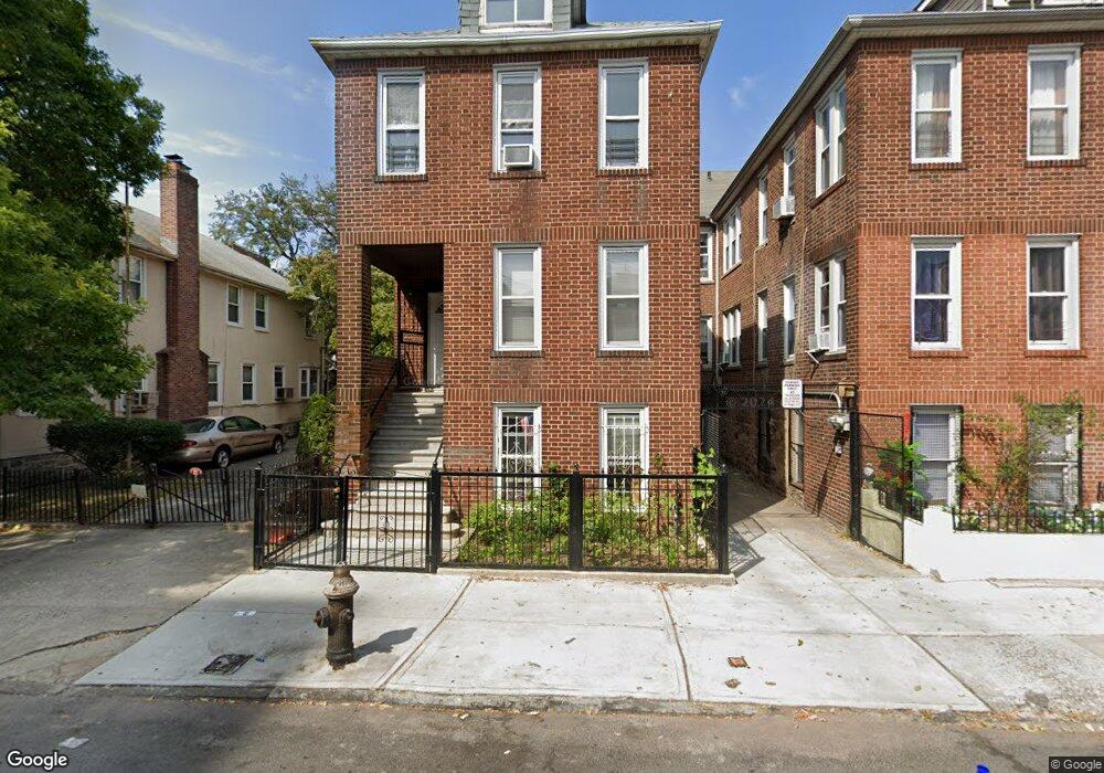
1963 Benedict Ave Bronx, NY 10462
Parkchester NeighborhoodEstimated Value: $1,003,000 - $1,262,000
Studio
--
Bath
3,330
Sq Ft
$334/Sq Ft
Est. Value
About This Home
This home is located at 1963 Benedict Ave, Bronx, NY 10462 and is currently estimated at $1,111,875, approximately $333 per square foot. 1963 Benedict Ave is a home located in Bronx County with nearby schools including P.S. 106 - Parkchester, M.S. 127 - The Castle Hill Middle School, and St Helena School.
Ownership History
Date
Name
Owned For
Owner Type
Purchase Details
Closed on
Dec 12, 2023
Sold by
Hawthorne Lambert
Bought by
Hawthorne Lambert and Robinson Nadine
Current Estimated Value
Purchase Details
Closed on
Sep 7, 2001
Sold by
Cassidy James and Cassidy Mary Donohoe
Bought by
Hawthorne Lambert and Hawthorne Pauline
Home Financials for this Owner
Home Financials are based on the most recent Mortgage that was taken out on this home.
Original Mortgage
$274,811
Interest Rate
6.86%
Mortgage Type
Purchase Money Mortgage
Purchase Details
Closed on
Nov 20, 1998
Sold by
Estate Of Maddalena Laudani
Bought by
Cassidy James and Cassidy Mary Donohoe
Home Financials for this Owner
Home Financials are based on the most recent Mortgage that was taken out on this home.
Original Mortgage
$193,500
Interest Rate
6.8%
Mortgage Type
Purchase Money Mortgage
Create a Home Valuation Report for This Property
The Home Valuation Report is an in-depth analysis detailing your home's value as well as a comparison with similar homes in the area
Home Values in the Area
Average Home Value in this Area
Purchase History
| Date | Buyer | Sale Price | Title Company |
|---|---|---|---|
| Hawthorne Lambert | -- | -- | |
| Hawthorne Lambert | -- | -- | |
| Cassidy James | $215,000 | -- |
Source: Public Records
Mortgage History
| Date | Status | Borrower | Loan Amount |
|---|---|---|---|
| Previous Owner | Hawthorne Lambert | $274,811 | |
| Previous Owner | Cassidy James | $193,500 |
Source: Public Records
Tax History
| Year | Tax Paid | Tax Assessment Tax Assessment Total Assessment is a certain percentage of the fair market value that is determined by local assessors to be the total taxable value of land and additions on the property. | Land | Improvement |
|---|---|---|---|---|
| 2025 | $7,288 | $38,465 | $5,672 | $32,793 |
| 2024 | $7,288 | $36,288 | $6,376 | $29,912 |
| 2023 | $7,370 | $36,288 | $6,690 | $29,598 |
| 2022 | $7,113 | $54,360 | $9,900 | $44,460 |
| 2021 | $7,150 | $44,760 | $9,900 | $34,860 |
| 2020 | $6,785 | $46,560 | $9,900 | $36,660 |
| 2019 | $6,326 | $40,020 | $9,900 | $30,120 |
| 2018 | $6,164 | $30,240 | $7,676 | $22,564 |
| 2017 | $6,053 | $29,692 | $7,789 | $21,903 |
| 2016 | $5,660 | $28,314 | $9,632 | $18,682 |
| 2015 | $3,378 | $26,712 | $7,771 | $18,941 |
| 2014 | $3,378 | $25,200 | $8,640 | $16,560 |
Source: Public Records
Map
Nearby Homes
- 1926 Mcgraw Ave
- 1332 Metropolitan Ave Unit 2A
- 1332 Metropolitan Ave Unit 3H
- 1332 Metropolitan Ave Unit 4K
- 1332 Metropolitan Ave Unit 5G
- 1922 Mcgraw Ave Unit 6I
- 2012 Benedict Ave
- 1521 Unionport Rd Unit 11G
- 1521 Unionport Rd Unit 11A
- 2049 Mcgraw Ave Unit 2C
- 2053 Mcgraw Ave Unit 4E
- 1470 East Ave Unit 5G
- 1480 Parkchester Rd
- 1966 Newbold Ave Unit 108
- 1966 Newbold Ave Unit 1510
- 1966 Newbold Ave Unit 1502
- 1966 Newbold Ave Unit 505
- 1966 Newbold Ave Unit 408
- 1966 Newbold Ave Unit 904
- 1966 Newbold Ave Unit 1109
- 1965 Benedict Ave
- 1957 Benedict Ave
- 1955 Benedict Ave
- 1967 Benedict Ave
- 1969 Benedict Ave
- 1951 Benedict Ave
- 1339 Pugsley Ave
- 1956 Mcgraw Ave
- 1958 Mcgraw Ave Unit 1C
- 1958 Mcgraw Ave
- 1341 Pugsley Ave
- 1978 Mcgraw Ave
- 1976 Mcgraw Ave
- 1971 Benedict Ave
- 1343 Pugsley Ave
- 1949 Benedict Ave
- 1990 Mcgraw Ave
- 1950 Mcgraw Ave
- 1960 Benedict Ave
- 1972 Benedict Ave
Your Personal Tour Guide
Ask me questions while you tour the home.