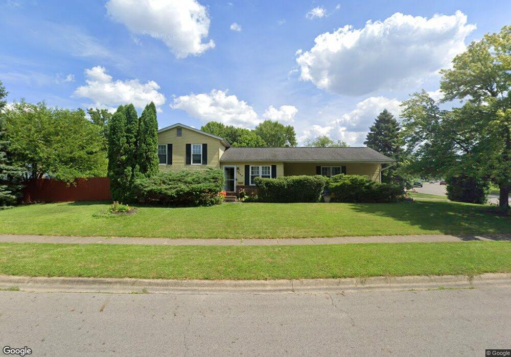
1963 Brittany Rd Columbus, OH 43229
Forest Park East NeighborhoodEstimated Value: $243,977 - $281,000
3
Beds
2
Baths
948
Sq Ft
$272/Sq Ft
Est. Value
About This Home
This home is located at 1963 Brittany Rd, Columbus, OH 43229 and is currently estimated at $257,994, approximately $272 per square foot. 1963 Brittany Rd is a home located in Franklin County with nearby schools including Northtowne Elementary School, Woodward Park Middle School, and Northland High School.
Ownership History
Date
Name
Owned For
Owner Type
Purchase Details
Closed on
Jun 4, 1985
Bought by
Smith Gary L
Current Estimated Value
Purchase Details
Closed on
Oct 1, 1983
Purchase Details
Closed on
May 1, 1983
Create a Home Valuation Report for This Property
The Home Valuation Report is an in-depth analysis detailing your home's value as well as a comparison with similar homes in the area
Home Values in the Area
Average Home Value in this Area
Purchase History
| Date | Buyer | Sale Price | Title Company |
|---|---|---|---|
| Smith Gary L | $65,500 | -- | |
| -- | -- | -- | |
| -- | -- | -- |
Source: Public Records
Tax History Compared to Growth
Tax History
| Year | Tax Paid | Tax Assessment Tax Assessment Total Assessment is a certain percentage of the fair market value that is determined by local assessors to be the total taxable value of land and additions on the property. | Land | Improvement |
|---|---|---|---|---|
| 2024 | $3,327 | $74,130 | $20,440 | $53,690 |
| 2023 | $3,284 | $74,130 | $20,440 | $53,690 |
| 2022 | $2,683 | $51,730 | $12,180 | $39,550 |
| 2021 | $2,688 | $51,730 | $12,180 | $39,550 |
| 2020 | $2,691 | $51,730 | $12,180 | $39,550 |
| 2019 | $2,510 | $41,370 | $9,730 | $31,640 |
| 2018 | $1,252 | $41,370 | $9,730 | $31,640 |
| 2017 | $2,461 | $41,370 | $9,730 | $31,640 |
| 2016 | $2,414 | $36,440 | $9,140 | $27,300 |
| 2015 | $1,096 | $36,440 | $9,140 | $27,300 |
| 2014 | $2,197 | $36,440 | $9,140 | $27,300 |
| 2013 | $1,141 | $38,360 | $9,625 | $28,735 |
Source: Public Records
Map
Nearby Homes
- 2033 Brittany Rd
- 4849 Heatherton Dr
- 2134 Trent Rd
- 4885 Northtowne Blvd
- 4714 Ascot Dr
- 2166 Waldorf Rd
- 2158 Kilbourne Ave
- 5124 Northcliff Loop W
- 2058 Northcliff Dr
- 5056 Northtowne Blvd Unit 5054
- 2244 Balmoral Rd
- 1704 Riverbirch Dr
- 5022 Sienna Ln
- 5204 Honeytree Loop W
- 4923 Karl Rd Unit 4925
- 4852 Colonel Perry Dr
- 5231 Arrowood Ct
- 1485 Norma Rd
- 2550 Minerva Ave
- 4816 Bourke Rd
- 4860 Heaton Rd
- 1975 Brittany Rd
- 4852 Heaton Rd
- 1985 Brittany Rd
- 1944 Coghill Dr
- 4865 Heaton Rd
- 4895 Dunlap Rd
- 4877 Heaton Rd
- 1974 Brittany Rd
- 1952 Dandridge Dr
- 1993 Brittany Rd
- 4844 Heaton Rd
- 1996 Cannington Ct
- 1939 Coghill Dr
- 4906 Dunlap Rd
- 1982 Brittany Rd
- 1938 Coghill Dr
- 2001 Brittany Rd
- 4836 Heaton Rd
- 1940 Dandridge Dr