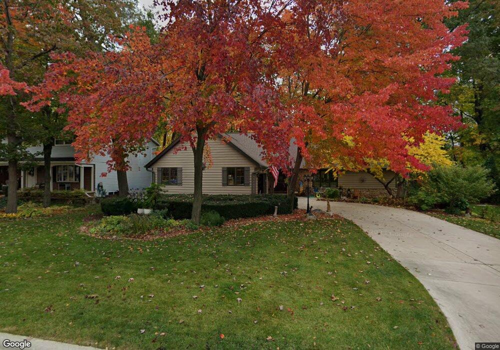
1963 Knotty Pine Dr Green Bay, WI 54304
MacArthur Heights NeighborhoodEstimated Value: $313,000 - $431,000
--
Bed
--
Bath
--
Sq Ft
10,062
Sq Ft Lot
About This Home
This home is located at 1963 Knotty Pine Dr, Green Bay, WI 54304 and is currently estimated at $379,372. 1963 Knotty Pine Dr is a home located in Brown County with nearby schools including MacArthur Elementary School, Lombardi Middle School, and Southwest High School.
Ownership History
Date
Name
Owned For
Owner Type
Purchase Details
Closed on
Nov 14, 2006
Sold by
Cumps Allan J and Lodl Sally S
Bought by
Allan J Cumps Family Trust and Sally S Lodl Family Trust
Current Estimated Value
Purchase Details
Closed on
Oct 13, 2003
Sold by
Breliant Harold L and Breliant Patricia L
Bought by
Lodl Sally S and Cumps Allan J
Home Financials for this Owner
Home Financials are based on the most recent Mortgage that was taken out on this home.
Original Mortgage
$149,600
Outstanding Balance
$71,150
Interest Rate
6.49%
Mortgage Type
Purchase Money Mortgage
Estimated Equity
$308,222
Create a Home Valuation Report for This Property
The Home Valuation Report is an in-depth analysis detailing your home's value as well as a comparison with similar homes in the area
Home Values in the Area
Average Home Value in this Area
Purchase History
| Date | Buyer | Sale Price | Title Company |
|---|---|---|---|
| Allan J Cumps Family Trust | -- | None Available | |
| Lodl Sally S | $187,000 | Land Office Title Corp |
Source: Public Records
Mortgage History
| Date | Status | Borrower | Loan Amount |
|---|---|---|---|
| Open | Lodl Sally S | $149,600 |
Source: Public Records
Tax History Compared to Growth
Tax History
| Year | Tax Paid | Tax Assessment Tax Assessment Total Assessment is a certain percentage of the fair market value that is determined by local assessors to be the total taxable value of land and additions on the property. | Land | Improvement |
|---|---|---|---|---|
| 2024 | $5,028 | $267,100 | $37,800 | $229,300 |
| 2023 | $4,814 | $267,100 | $37,800 | $229,300 |
| 2022 | $4,699 | $267,100 | $37,800 | $229,300 |
| 2021 | $4,506 | $194,100 | $33,600 | $160,500 |
| 2020 | $4,540 | $194,100 | $33,600 | $160,500 |
| 2019 | $4,406 | $194,100 | $33,600 | $160,500 |
| 2018 | $4,299 | $194,100 | $33,600 | $160,500 |
| 2017 | $4,234 | $194,100 | $33,600 | $160,500 |
| 2016 | $4,169 | $194,100 | $33,600 | $160,500 |
| 2015 | $4,260 | $194,100 | $33,600 | $160,500 |
| 2014 | $4,410 | $194,100 | $33,600 | $160,500 |
| 2013 | $4,410 | $194,100 | $33,600 | $160,500 |
Source: Public Records
Map
Nearby Homes
- 1973 Knotty Pine Dr
- 2466 Parkwood Dr
- 1921 Beech Tree Dr
- 1514 Ashley Ct
- 1471 Parkway Dr
- 2441 Matchwood Ln
- 1450 Woodmont Way
- 2031 Bradbury Ln
- 2044 Ann Ln
- 2439 W Point Rd
- 1570 Mesa Dr
- 2060 Wintergreen Ct
- 2550 He Nis Ra Ln
- 1307 Blue Ridge Dr
- 1306 Nelson St Unit 1308
- 1522 Argonne Dr
- 1779 9th St
- 1288 Canterbury Rd
- 1428 Argonne Dr
- 1680 Cormier Rd
- 1969 Knotty Pine Dr
- 1955 Knotty Pine Dr
- 1964 Treeland Dr
- 1968 Treeland Dr
- 1958 Treeland Dr
- 1951 Knotty Pine Dr
- 1964 Knotty Pine Dr
- 1956 Knotty Pine Dr
- 1974 Treeland Dr
- 1970 Knotty Pine Dr
- 1948 Treeland Dr
- 1950 Knotty Pine Dr
- 1941 Knotty Pine Dr
- 1974 Knotty Pine Dr
- 1946 Knotty Pine Dr
- 1961 Treeland Dr
- 1940 Treeland Dr
- 1963 Wood Ln
- 1967 Treeland Dr
- 1951 Wood Ln