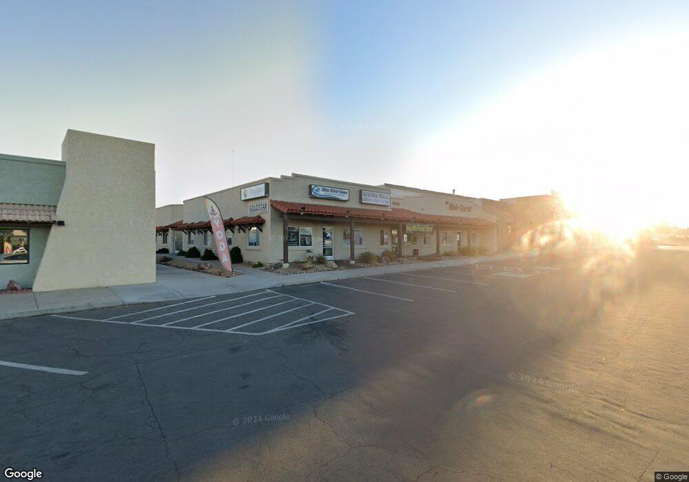
1963 Mcculloch Blvd N Unit 104 Lake Havasu City, AZ 86403
Estimated Value: $2,088,958
--
Bed
--
Bath
6,560
Sq Ft
$318/Sq Ft
Est. Value
About This Home
This home is located at 1963 Mcculloch Blvd N Unit 104, Lake Havasu City, AZ 86403 and is currently estimated at $2,088,958, approximately $318 per square foot. 1963 Mcculloch Blvd N Unit 104 is a home located in Mohave County with nearby schools including Smoketree Elementary School, Thunderbolt Middle School, and Lake Havasu High School.
Ownership History
Date
Name
Owned For
Owner Type
Purchase Details
Closed on
Jan 15, 2002
Sold by
Barrett Donald D and Barrett Becky L
Bought by
Chrzanowski Ronald C and Chrzanowski Betty J
Current Estimated Value
Purchase Details
Closed on
Aug 4, 2000
Sold by
Esmay Greg D
Bought by
Barrett Donald D and Barrett Becky L
Home Financials for this Owner
Home Financials are based on the most recent Mortgage that was taken out on this home.
Original Mortgage
$280,000
Interest Rate
7.67%
Mortgage Type
Commercial
Create a Home Valuation Report for This Property
The Home Valuation Report is an in-depth analysis detailing your home's value as well as a comparison with similar homes in the area
Home Values in the Area
Average Home Value in this Area
Purchase History
| Date | Buyer | Sale Price | Title Company |
|---|---|---|---|
| Chrzanowski Ronald C | $605,000 | -- | |
| Barrett Donald D | $560,000 | Capital Title Agency Inc |
Source: Public Records
Mortgage History
| Date | Status | Borrower | Loan Amount |
|---|---|---|---|
| Previous Owner | Barrett Donald D | $280,000 |
Source: Public Records
Tax History Compared to Growth
Tax History
| Year | Tax Paid | Tax Assessment Tax Assessment Total Assessment is a certain percentage of the fair market value that is determined by local assessors to be the total taxable value of land and additions on the property. | Land | Improvement |
|---|---|---|---|---|
| 2026 | -- | -- | -- | -- |
| 2025 | $10,176 | $242,477 | $0 | $0 |
| 2024 | $10,176 | $199,537 | $0 | $0 |
| 2023 | $10,176 | $145,550 | $0 | $0 |
| 2022 | $10,622 | $138,739 | $0 | $0 |
| 2021 | $11,264 | $116,129 | $0 | $0 |
| 2019 | $11,441 | $117,258 | $0 | $0 |
| 2018 | $11,020 | $121,915 | $0 | $0 |
| 2017 | $10,928 | $117,473 | $0 | $0 |
Source: Public Records
Map
Nearby Homes
- 1957 Mesquite Ave Unit 23B
- 1957 Mesquite Ave Unit 46A
- 1989 Mesquite Ave Unit 74
- 1989 Mesquite Ave Unit 32
- 1989 Mesquite Ave Unit 17
- 1989 Mesquite Ave Unit 46
- 1989 Mesquite Ave Unit 2
- 1989 Mesquite Ave Unit 29
- 0000 Sunrise Plan On Your Lot
- 1910 Swanson Ave Unit A22
- 1910 Swanson Ave Unit B11
- 1910 Swanson Ave Unit B19
- 1926 Swanson Ave
- 2094 Mesquite Ave Unit 113
- 2094 Mesquite Ave Unit 126
- 2085 Mesquite Ave Unit 64
- 2085 Mesquite Ave Unit 61
- 2030 Mimosa Dr
- 2095 Mesquite Ave Unit 19
- 1806 Swanson Ave Unit 205
- 1963 Mcculloch Blvd N Unit 101
- 1963 Mcculloch Blvd N Unit 102
- 1963 Mcculloch Blvd N Unit 103
- 1963 Mcculloch Blvd N
- 1963 Mcculloch Blvd N Unit 105
- 1971 Mcculloch Blvd N Unit 200
- 1971 Mcculloch Blvd N Unit 102
- 1971 Mcculloch Blvd N
- 1955 Mcculloch Blvd N
- 1955 Mcculloch Blvd N Unit 100
- 1979 Mcculloch Blvd N Unit 101/102
- 1979 Mcculloch Blvd N Unit 105/106
- 1979 Mcculloch Blvd N Unit 106
- 1979 Mcculloch Blvd N
- 1979 Mcculloch Blvd N Unit 104
- 1979 Mcculloch Blvd N Unit 102
- 1979 Mcculloch Blvd N Unit 203
- 1979 Mcculloch Blvd N Unit 201
- 1979 Mcculloch Blvd N Unit 101
- 1979 Mcculloch Blvd N Unit 103