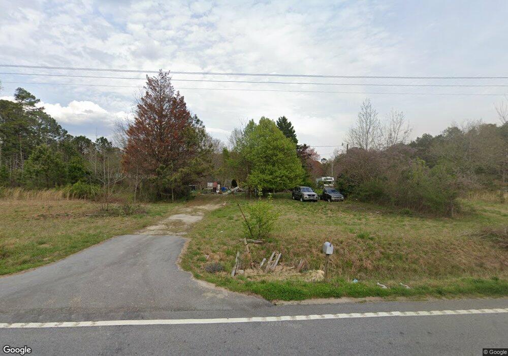
1963 N Highway 113 Temple, GA 30179
Estimated Value: $75,752 - $244,000
2
Beds
1
Bath
860
Sq Ft
$217/Sq Ft
Est. Value
About This Home
This home is located at 1963 N Highway 113, Temple, GA 30179 and is currently estimated at $186,917, approximately $217 per square foot. 1963 N Highway 113 is a home with nearby schools including Haralson County High School.
Ownership History
Date
Name
Owned For
Owner Type
Purchase Details
Closed on
Jul 29, 2010
Sold by
Wachovia Bank By Successor Wells Fargo B
Bought by
Guinn Cathy
Current Estimated Value
Purchase Details
Closed on
Apr 6, 2010
Sold by
Carroll Frances Estate
Bought by
Wachovia Bank
Purchase Details
Closed on
Jul 26, 1999
Sold by
Carroll Frances and Abercrombie Johnnie
Bought by
Carroll Frances
Purchase Details
Closed on
Aug 19, 1997
Sold by
Carroll Frances
Bought by
Carroll Frances and Abercrombie Johnn
Purchase Details
Closed on
May 24, 1996
Sold by
Carroll Albert
Bought by
Carroll Frances
Create a Home Valuation Report for This Property
The Home Valuation Report is an in-depth analysis detailing your home's value as well as a comparison with similar homes in the area
Home Values in the Area
Average Home Value in this Area
Purchase History
| Date | Buyer | Sale Price | Title Company |
|---|---|---|---|
| Guinn Cathy | $9,500 | -- | |
| Wachovia Bank | -- | -- | |
| Carroll Frances | -- | -- | |
| Carroll Frances | -- | -- | |
| Carroll Frances | -- | -- |
Source: Public Records
Tax History Compared to Growth
Tax History
| Year | Tax Paid | Tax Assessment Tax Assessment Total Assessment is a certain percentage of the fair market value that is determined by local assessors to be the total taxable value of land and additions on the property. | Land | Improvement |
|---|---|---|---|---|
| 2024 | $351 | $15,548 | $3,400 | $12,148 |
| 2023 | $43 | $16,405 | $3,400 | $13,005 |
| 2022 | $316 | $13,774 | $3,400 | $10,374 |
| 2021 | $379 | $15,557 | $3,400 | $12,157 |
| 2020 | $397 | $16,150 | $3,400 | $12,750 |
| 2019 | $414 | $16,214 | $3,400 | $12,814 |
| 2018 | $420 | $16,214 | $3,400 | $12,814 |
| 2017 | $386 | $13,881 | $3,400 | $10,481 |
| 2016 | $376 | $14,284 | $3,400 | $10,884 |
| 2015 | $374 | $14,208 | $3,400 | $10,808 |
| 2014 | $368 | $14,208 | $3,400 | $10,808 |
Source: Public Records
Map
Nearby Homes
- 1237 Morgan Rd
- 2050 Georgia 113
- 2475 Liberty Church Rd
- 2895 Morgan Rd
- 991 Waddell Rd
- 140 Suburban Dr
- 972 Seventh Court Ground Rd
- 329 Morgan Rd
- 2930 N Highway 113
- 658 Agan Rd
- 225 Hamrick Rd
- 300 Speight Rd
- 3395 Cashtown Rd
- 489 Bethany Woods Dr
- 169 Rachel Blvd
- 212 Webster Lake Dr
- 119 Meadowview Dr Unit 17
- 117 Meadowview Dr Unit 18
- 123 Meadowview Dr Unit 15
- 126 Meadowview Dr Unit 13
- 2041 N Highway 113
- 1925 N Highway 113
- 2039 N Highway 113
- 3215 Morgan Rd
- 1294 Morgan Rd
- 1905 N Highway 113
- 1234 Morgan Rd
- 0 Buchanan Hwy Unit 10218039
- 0 Buchanan Hwy Unit 10019973
- 0 Buchanan Hwy Unit 10130588
- 0 Buchanan Hwy Unit 7175317
- 0 Buchanan Hwy Unit 10005708
- 0 Buchanan Hwy Unit 9039551
- 0 Buchanan Hwy Unit 6935117
- 0 Buchanan Hwy Unit 8694710
- 0 Buchanan Hwy Unit 8871233
- 0 Buchanan Hwy
- 1295 Morgan Rd
- 3232 Morgan Rd
- 1984 N Highway 113
