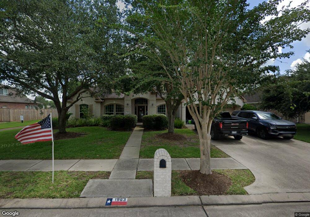
1963 Rolling Stone Dr Friendswood, TX 77546
Estimated Value: $594,504 - $663,000
3
Beds
3
Baths
3,298
Sq Ft
$191/Sq Ft
Est. Value
About This Home
This home is located at 1963 Rolling Stone Dr, Friendswood, TX 77546 and is currently estimated at $631,126, approximately $191 per square foot. 1963 Rolling Stone Dr is a home located in Galveston County with nearby schools including C.W. Cline Elementary School, Windsong Elementary School, and Friendswood Junior High School.
Ownership History
Date
Name
Owned For
Owner Type
Purchase Details
Closed on
May 31, 2017
Sold by
Duncan Andrew R and Duncan Jody Ann
Bought by
Short Taylor W and Short Madeline
Current Estimated Value
Home Financials for this Owner
Home Financials are based on the most recent Mortgage that was taken out on this home.
Original Mortgage
$365,750
Outstanding Balance
$304,228
Interest Rate
4.02%
Mortgage Type
New Conventional
Estimated Equity
$326,898
Purchase Details
Closed on
Jun 7, 2012
Sold by
Schrock Donald E
Bought by
Duncan Andrew R
Home Financials for this Owner
Home Financials are based on the most recent Mortgage that was taken out on this home.
Original Mortgage
$248,000
Interest Rate
3.86%
Mortgage Type
New Conventional
Purchase Details
Closed on
May 12, 2004
Sold by
Imperial Homes Texas Ltd
Bought by
Schrock Donald E and Schrock Helen L
Purchase Details
Closed on
Feb 2, 2003
Sold by
Eagle Creek Investments Llc
Bought by
Imperial Homes Texas Ltd
Home Financials for this Owner
Home Financials are based on the most recent Mortgage that was taken out on this home.
Original Mortgage
$205,000
Interest Rate
5.78%
Mortgage Type
Purchase Money Mortgage
Create a Home Valuation Report for This Property
The Home Valuation Report is an in-depth analysis detailing your home's value as well as a comparison with similar homes in the area
Home Values in the Area
Average Home Value in this Area
Purchase History
| Date | Buyer | Sale Price | Title Company |
|---|---|---|---|
| Short Taylor W | -- | Attorney | |
| Duncan Andrew R | -- | Stewart Title | |
| Schrock Donald E | -- | -- | |
| Imperial Homes Texas Ltd | -- | First Southwestern Title Co |
Source: Public Records
Mortgage History
| Date | Status | Borrower | Loan Amount |
|---|---|---|---|
| Open | Short Taylor W | $365,750 | |
| Previous Owner | Duncan Andrew R | $248,000 | |
| Previous Owner | Imperial Homes Texas Ltd | $205,000 |
Source: Public Records
Tax History Compared to Growth
Tax History
| Year | Tax Paid | Tax Assessment Tax Assessment Total Assessment is a certain percentage of the fair market value that is determined by local assessors to be the total taxable value of land and additions on the property. | Land | Improvement |
|---|---|---|---|---|
| 2025 | $9,186 | $580,640 | $70,790 | $509,850 |
| 2024 | $9,186 | $562,170 | -- | -- |
| 2023 | $9,186 | $511,064 | $0 | $0 |
| 2022 | $10,233 | $464,604 | $0 | $0 |
| 2021 | $9,865 | $472,650 | $70,790 | $401,860 |
| 2020 | $9,251 | $383,970 | $70,790 | $313,180 |
| 2019 | $9,571 | $376,920 | $70,790 | $306,130 |
| 2018 | $9,627 | $376,920 | $70,790 | $306,130 |
| 2017 | $9,789 | $376,920 | $70,790 | $306,130 |
| 2016 | $9,611 | $370,080 | $70,790 | $299,290 |
| 2015 | $3,091 | $342,710 | $70,790 | $271,920 |
| 2014 | $2,910 | $281,200 | $69,820 | $211,380 |
Source: Public Records
Map
Nearby Homes
- 1718 Avery Ln
- 1804 Anna Way
- 1305 Edgewater Dr
- 1564 River Point Dr
- 1536 River Point Dr
- 1572 River Point Dr
- 1568 River Point Dr
- 1588 River Point Dr
- 1804 Sandy Lake Dr
- 1556 River Point Dr
- 1532 River Point Dr
- 1302 Eagle Lakes Dr
- 2124 Lila Sky Ln
- 2220 Lila Sky Ln
- Jade Plan at Avalon at Friendswood - 60s
- Palladium Plan at Avalon at Friendswood - 70s
- Regatta Plan at Avalon at Friendswood - 60s
- Calypso Plan at Avalon at Friendswood - 70s
- Carnelian Plan at Avalon at Friendswood - 60s
- Larimar Plan at Avalon at Friendswood - 60s
- 1971 Rolling Stone Dr
- 1955 Rolling Stone Dr
- 1962 Rolling Stone Dr
- 1947 Rolling Stone Dr
- 1970 Rolling Stone Dr
- 1954 Rolling Stone Dr
- 2004 Sandy Lake Dr
- 1978 Rolling Stone Dr
- 1946 Rolling Stone Dr
- 1939 Rolling Stone Dr
- 2002 Sandy Lake Dr
- 1987 Rolling Stone Dr
- 1986 Rolling Stone Dr
- 1938 Rolling Stone Dr
- 2000 Sandy Lake Dr
- 1931 Rolling Stone Dr
- 1992 Rolling Stone Dr
- 111 Dunbar #703 Unit 703
- LOT 10 Estate Ln