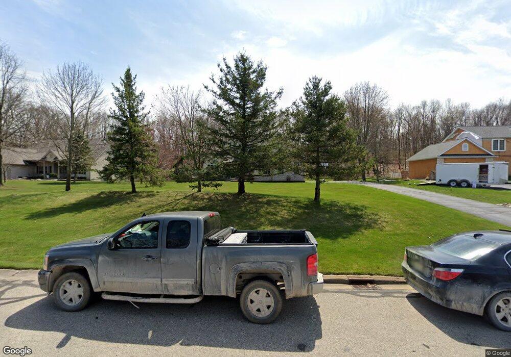
1963 Sundance Ridge Howell, MI 48843
Estimated Value: $560,101 - $632,000
4
Beds
3
Baths
2,740
Sq Ft
$215/Sq Ft
Est. Value
About This Home
This home is located at 1963 Sundance Ridge, Howell, MI 48843 and is currently estimated at $588,525, approximately $214 per square foot. 1963 Sundance Ridge is a home located in Livingston County with nearby schools including Parker Middle School and Howell High School.
Ownership History
Date
Name
Owned For
Owner Type
Purchase Details
Closed on
Dec 17, 2010
Sold by
Ehlert Richard R and Ehlert Lori M
Bought by
Anderson Robert C and Anderson Bonnie M
Current Estimated Value
Purchase Details
Closed on
May 29, 2002
Sold by
Progressive Homes Inc
Bought by
Ehlert Ii Richard R and Ehlert Lori M
Purchase Details
Closed on
Jun 21, 1999
Sold by
Fonson Inc
Bought by
New Corp
Purchase Details
Closed on
Jan 2, 1998
Sold by
New Corp
Bought by
Progressive Homes Inc
Purchase Details
Closed on
Dec 30, 1997
Sold by
Cox Malcolm
Bought by
New Corp
Create a Home Valuation Report for This Property
The Home Valuation Report is an in-depth analysis detailing your home's value as well as a comparison with similar homes in the area
Home Values in the Area
Average Home Value in this Area
Purchase History
| Date | Buyer | Sale Price | Title Company |
|---|---|---|---|
| Anderson Robert C | $210,000 | -- | |
| Ehlert Ii Richard R | $350,000 | -- | |
| New Corp | -- | Select Title Company | |
| Progressive Homes Inc | $34,000 | Select Title Company | |
| New Corp | $4,000 | Select Title Company |
Source: Public Records
Tax History Compared to Growth
Tax History
| Year | Tax Paid | Tax Assessment Tax Assessment Total Assessment is a certain percentage of the fair market value that is determined by local assessors to be the total taxable value of land and additions on the property. | Land | Improvement |
|---|---|---|---|---|
| 2025 | $3,826 | $268,300 | $0 | $0 |
| 2024 | $2,549 | $262,100 | $0 | $0 |
| 2023 | $2,434 | $221,300 | $0 | $0 |
| 2022 | $3,310 | $204,200 | $0 | $0 |
| 2021 | $3,228 | $204,200 | $0 | $0 |
| 2020 | $3,289 | $199,900 | $0 | $0 |
| 2019 | $3,241 | $194,900 | $0 | $0 |
| 2018 | $3,202 | $169,900 | $0 | $0 |
| 2017 | $3,160 | $161,900 | $0 | $0 |
| 2016 | $3,143 | $152,100 | $0 | $0 |
| 2014 | $2,803 | $153,000 | $0 | $0 |
| 2012 | $2,803 | $134,600 | $0 | $0 |
Source: Public Records
Map
Nearby Homes
- 2214 White Hawk Trail
- 4009 Cactus Flower Ct
- 2509 Rubbins Rd
- 1 Brighton Rd
- 0000 Brighton Rd
- 2763 Clivedon Rd
- 2921 Clivedon Rd
- 883 Hurley Dr
- 134 Amber Glen Dr
- 1286 Gray Fox Ct
- 945 Gray Fox Ct
- 4681 Roya Trail
- 05 Prince Edward Dr
- 04 Prince Edward Dr
- 1982 E Coon Lake Rd
- 3447 Mayberry Ln
- 3760 Southwick Dr
- 4789 Lakeshire Dr
- 3690 W Coon Lake Rd
- 2095 Brighton Shores Trail
- 1975 Sundance Ridge
- 1951 Sundance Ridge
- 1987 Sundance Ridge
- 1939 Sundance Ridge
- 4421 Sundance Cir Unit Bldg-Unit
- 4421 Sundance Cir
- 4428 Sundance Cir
- 4600 Sierra Dr
- 2027 Sundance Ridge
- 2027 Sundance Ridge Unit 9
- 1927 Sundance Ridge
- 4620 Sierra Dr
- 4416 Sundance Cir
- 1934 Sundance Ridge Unit Bldg-Unit
- 1934 Sundance Ridge
- 4399 Sundance Cir
- 2040 Sundance Ridge
- 2055 Sundance Ridge #10
- 2055 Sundance Ridge
- 2055 Sundance Ridge Unit 10
