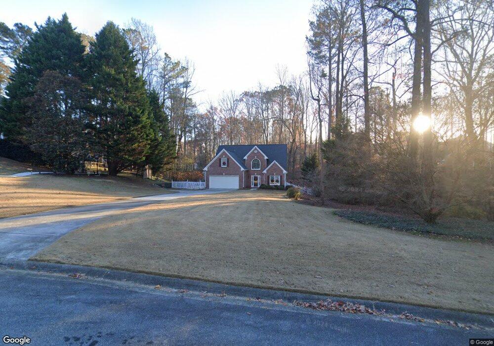
1963 Trestlebrook Way Buford, GA 30519
Estimated Value: $387,000 - $397,000
3
Beds
3
Baths
2,026
Sq Ft
$193/Sq Ft
Est. Value
About This Home
This home is located at 1963 Trestlebrook Way, Buford, GA 30519 and is currently estimated at $390,102, approximately $192 per square foot. 1963 Trestlebrook Way is a home with nearby schools including Freeman's Mill Elementary School, Twin Rivers Middle School, and Mountain View High School.
Ownership History
Date
Name
Owned For
Owner Type
Purchase Details
Closed on
Jun 27, 1997
Sold by
Gatewood Communities Inc
Bought by
Tapie Charles A and Tapie Patricia A
Current Estimated Value
Home Financials for this Owner
Home Financials are based on the most recent Mortgage that was taken out on this home.
Original Mortgage
$128,520
Outstanding Balance
$17,572
Interest Rate
7.98%
Mortgage Type
VA
Estimated Equity
$372,530
Create a Home Valuation Report for This Property
The Home Valuation Report is an in-depth analysis detailing your home's value as well as a comparison with similar homes in the area
Home Values in the Area
Average Home Value in this Area
Purchase History
| Date | Buyer | Sale Price | Title Company |
|---|---|---|---|
| Tapie Charles A | $126,000 | -- |
Source: Public Records
Mortgage History
| Date | Status | Borrower | Loan Amount |
|---|---|---|---|
| Open | Tapie Charles A | $128,520 |
Source: Public Records
Map
Nearby Homes
- 1948 Trestlebrook Way Unit 3
- 2004 Brittlebank Ln
- 1975 Wynfield Point Dr
- 2012 Arbor Springs Way
- 2053 Arbor Springs Way
- 2159 Sunny Hill Rd
- 2199 Sunny Hill Rd
- 1845 Hanover West Dr
- 1876 Hanover West Dr
- 2242 Rocksram Ct
- 2220 Sunny Hill Rd
- 1965 Holland Park Dr NE
- 1810 Sunset Harbour Pointe Unit 6
- 2317 Rocksram Ct
- 1798 Braselton Hwy
- 2297 Roberts View Trail
- 1834 Willoughby Dr
- 1846 Dorminey Ct Unit 2
- 1880 Rocksram Dr Unit 1
- 2085 Kings Valley Dr
- 1953 Trestlebrook Way
- 1973 Trestlebrook Way Unit 3
- 2073 Brittlebank Ln Unit 44
- 2073 Brittlebank Ln
- 2083 Brittlebank Ln
- 1983 Trestlebrook Way
- 2094 Brittlebank Ln Unit 42
- 2094 Brittlebank Ln
- 2084 Brittlebank Ln
- 1968 Trestlebrook Way Unit 3
- 1964 Firelight Ln
- 1974 Firelight Ln Unit 4
- 1943 Trestlebrook Way
- 2030 Wynfield Point Dr Unit 1
- 1984 Firelight Ln Unit 1
- 1954 Firelight Ln Unit Ga0031
- 1954 Firelight Ln
- 1954 Firelight Ln Unit GA00315
- 2094 Brittlebank Ln
- 2094 Brittlebank Ln Unit 42
Your Personal Tour Guide
Ask me questions while you tour the home.