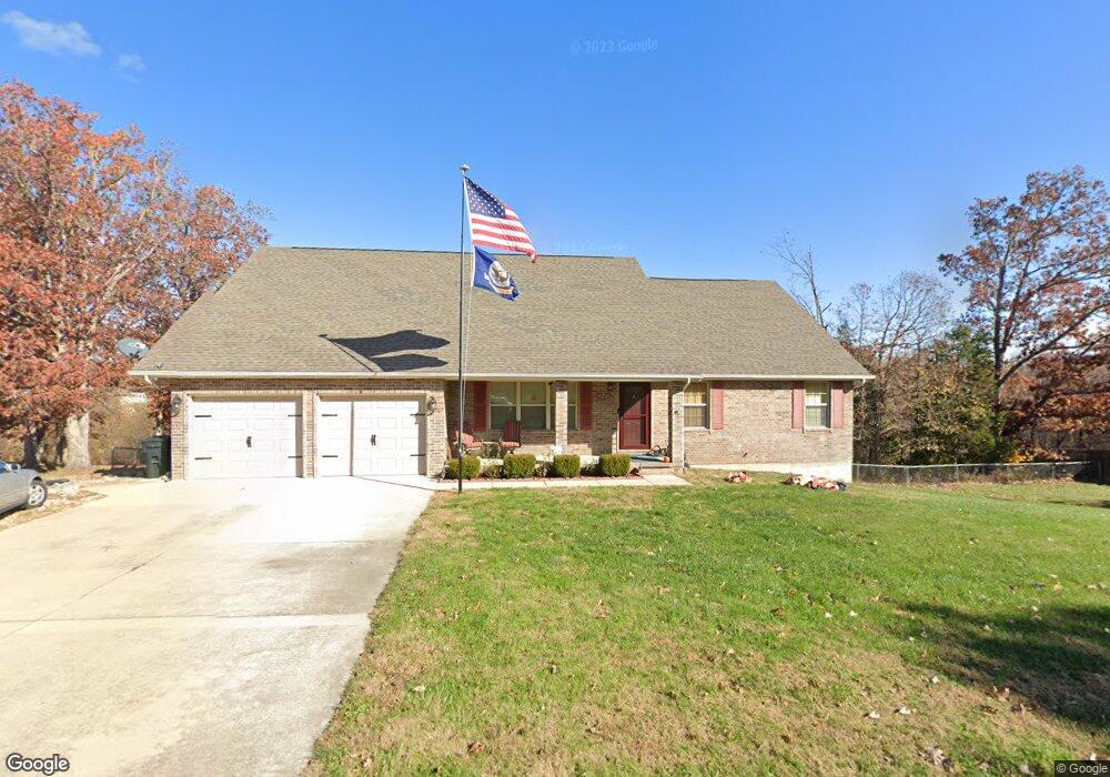
19630 Longview Rd Waynesville, MO 65583
Estimated Value: $340,000 - $415,000
4
Beds
3
Baths
3,800
Sq Ft
$97/Sq Ft
Est. Value
About This Home
This home is located at 19630 Longview Rd, Waynesville, MO 65583 and is currently estimated at $367,349, approximately $96 per square foot. 19630 Longview Rd is a home located in Pulaski County with nearby schools including Waynesville East Elementary School, Freedom Elementary School, and Waynesville Sixth Grade Center.
Ownership History
Date
Name
Owned For
Owner Type
Purchase Details
Closed on
Jun 25, 2007
Sold by
Four J Land And Cattle Co
Bought by
Mangini Elizabeth Jane and Mangini William D
Current Estimated Value
Home Financials for this Owner
Home Financials are based on the most recent Mortgage that was taken out on this home.
Original Mortgage
$238,928
Outstanding Balance
$146,912
Interest Rate
6.37%
Mortgage Type
VA
Estimated Equity
$220,437
Create a Home Valuation Report for This Property
The Home Valuation Report is an in-depth analysis detailing your home's value as well as a comparison with similar homes in the area
Home Values in the Area
Average Home Value in this Area
Purchase History
| Date | Buyer | Sale Price | Title Company |
|---|---|---|---|
| Mangini Elizabeth Jane | -- | None Available |
Source: Public Records
Mortgage History
| Date | Status | Borrower | Loan Amount |
|---|---|---|---|
| Open | Mangini Elizabeth Jane | $238,928 |
Source: Public Records
Tax History Compared to Growth
Tax History
| Year | Tax Paid | Tax Assessment Tax Assessment Total Assessment is a certain percentage of the fair market value that is determined by local assessors to be the total taxable value of land and additions on the property. | Land | Improvement |
|---|---|---|---|---|
| 2024 | $1,962 | $45,089 | $4,750 | $40,339 |
| 2023 | $1,916 | $45,089 | $4,750 | $40,339 |
| 2022 | $1,767 | $45,089 | $4,750 | $40,339 |
| 2021 | $1,748 | $45,089 | $4,750 | $40,339 |
| 2020 | $1,711 | $38,063 | $0 | $0 |
| 2019 | $1,711 | $43,168 | $0 | $0 |
| 2018 | $1,710 | $43,168 | $0 | $0 |
| 2017 | $1,709 | $38,063 | $0 | $0 |
| 2016 | $1,622 | $43,170 | $0 | $0 |
| 2015 | $1,621 | $43,170 | $0 | $0 |
| 2014 | $1,620 | $43,170 | $0 | $0 |
Source: Public Records
Map
Nearby Homes
- 000 Laduff Rd
- 19583 Ladera Rd
- 19958 Ladera Rd
- 21042 Larson Rd
- 21438 Lancaster Ln
- 19580 Lyle Ln
- 21805 Revere Ln
- 0 Tbd Address Unit 23071485
- 19182 Lonager Ln
- 20172 London Ln
- 19691 Lansing Ln
- 21093 Layla Rd
- 48 LOT Breckenridge Dr
- 508 Shoshone Dr
- 176 Teton Pass
- 208 Teton Pass
- 143 La Vista Dr
- 141 La Vista Dr
- 0 Bailey St
- 125 La Vista Dr
- 19636 Longview Rd
- 19637 Longview Rd
- 19624 Longview Rd
- 19643 Longview Rd
- 19642 Longview Rd
- 19623 Longview Rd
- 19618 Longview Rd
- 21321 Laduff Rd
- 19560 Lilly Ln
- 19550 Lilly Ln
- 19574 Lilly Ln
- 19648 Longview Rd
- 0xxx Lilly Ln
- 0x Lilly Ln
- 19617 Longview Rd
- 19570 Lilly Ln
- 19657 Longview Rd
- 19590 Lilly Ln
- 19654 Longview Rd
- 19535 Lilly Ln