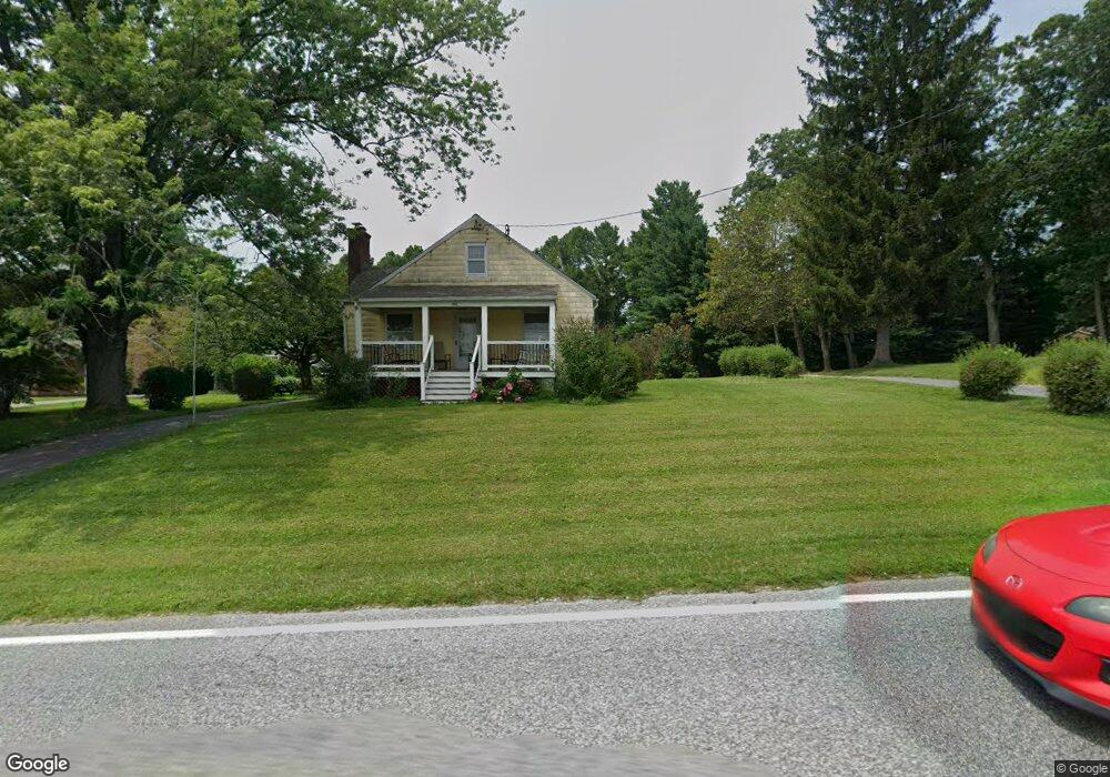
19632 Graystone Rd White Hall, MD 21161
Estimated Value: $280,797 - $437,000
--
Bed
1
Bath
1,410
Sq Ft
$264/Sq Ft
Est. Value
About This Home
This home is located at 19632 Graystone Rd, White Hall, MD 21161 and is currently estimated at $372,199, approximately $263 per square foot. 19632 Graystone Rd is a home located in Baltimore County with nearby schools including Seventh District Elementary School, Hereford Middle School, and Hereford High School.
Ownership History
Date
Name
Owned For
Owner Type
Purchase Details
Closed on
Oct 5, 2011
Sold by
Hampton Wade
Bought by
Hampton Wade
Current Estimated Value
Purchase Details
Closed on
Sep 23, 2011
Sold by
Hampton Wade and Hampton Erin
Bought by
Hampton Wade and Hampton Wade H
Purchase Details
Closed on
Jun 21, 1995
Sold by
Thompson George H
Bought by
Hampton Wade
Home Financials for this Owner
Home Financials are based on the most recent Mortgage that was taken out on this home.
Original Mortgage
$108,500
Interest Rate
7.82%
Purchase Details
Closed on
Jun 20, 1969
Sold by
Hartman Donald R
Bought by
Thompson George H
Create a Home Valuation Report for This Property
The Home Valuation Report is an in-depth analysis detailing your home's value as well as a comparison with similar homes in the area
Home Values in the Area
Average Home Value in this Area
Purchase History
| Date | Buyer | Sale Price | Title Company |
|---|---|---|---|
| Hampton Wade | $24,543 | -- | |
| Hampton Wade | $24,542 | Home Title Company Of Md | |
| Hampton Wade | $24,543 | -- | |
| Hampton Wade | $123,500 | -- | |
| Thompson George H | $18,500 | -- |
Source: Public Records
Mortgage History
| Date | Status | Borrower | Loan Amount |
|---|---|---|---|
| Previous Owner | Hampton Wade | $108,500 |
Source: Public Records
Tax History Compared to Growth
Tax History
| Year | Tax Paid | Tax Assessment Tax Assessment Total Assessment is a certain percentage of the fair market value that is determined by local assessors to be the total taxable value of land and additions on the property. | Land | Improvement |
|---|---|---|---|---|
| 2025 | $2,656 | $262,200 | $92,800 | $169,400 |
| 2024 | $2,656 | $240,400 | $0 | $0 |
| 2023 | $939 | $218,600 | $0 | $0 |
| 2022 | $2,424 | $196,800 | $61,800 | $135,000 |
| 2021 | $2,433 | $196,300 | $0 | $0 |
| 2020 | $2,433 | $195,800 | $0 | $0 |
| 2019 | $2,427 | $195,300 | $61,800 | $133,500 |
| 2018 | $2,385 | $191,833 | $0 | $0 |
| 2017 | $1,172 | $188,367 | $0 | $0 |
| 2016 | $1,997 | $184,900 | $0 | $0 |
| 2015 | $1,997 | $184,900 | $0 | $0 |
| 2014 | $1,997 | $184,900 | $0 | $0 |
Source: Public Records
Map
Nearby Homes
- 19701 Old York Rd
- 3 Twig Ct
- 3 Old Garrett Ct
- 6 Deer Haven Ln
- 2212 River Bend Ct
- 11 Zelda Ct
- 2202 River Bend Ct
- 117 Graystone Farm Rd
- 7 Applewood Ct
- 19902 Mikes Way
- 4720 Norrisville Rd
- 905 Miller Rd
- 5217 Deer Trail
- 2910 Hunter Mill Rd
- 211 Kali Ct
- 5330 Long Corner Rd
- 2430 Harris Mill Rd
- 20814 York Rd
- 4861 Norrisville Rd
- 1014 Bernoudy Rd
- 19630 Graystone Rd
- 19638 Graystone Rd
- 19631 Graystone Rd
- 19628 Graystone Rd
- 19640 Graystone Rd
- 19642 Graystone Rd
- 19641 Graystone Rd
- 19701 Graystone Rd
- 19700 Graystone Rd
- 19627 Graystone Rd
- 19703 Graystone Rd
- 19535 Graystone Rd
- 19714 Graystone Rd
- 19636 Graystone Rd
- 19705 Graystone Rd
- 19601 Graystone Rd
- 19720 Graystone Rd
- 19527 Graystone Rd
- 19732 Graystone Rd
- 19525 Graystone Rd