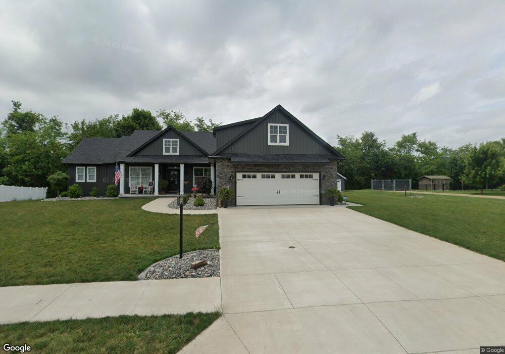
1964 Brookside Dr NE New Philadelphia, OH 44663
Estimated Value: $343,000 - $400,000
3
Beds
2
Baths
1,910
Sq Ft
$195/Sq Ft
Est. Value
About This Home
This home is located at 1964 Brookside Dr NE, New Philadelphia, OH 44663 and is currently estimated at $372,161, approximately $194 per square foot. 1964 Brookside Dr NE is a home with nearby schools including New Philadelphia High School, Quaker Preparatory Academy, and Quaker Digital Academy.
Ownership History
Date
Name
Owned For
Owner Type
Purchase Details
Closed on
Sep 25, 2023
Sold by
Unknown
Bought by
Moore Daniel L and Moore Tracy S
Current Estimated Value
Purchase Details
Closed on
Sep 4, 2020
Sold by
M & P Development Of Tuscarawas Cnty Ltd
Bought by
Moore Daniel
Purchase Details
Closed on
Nov 25, 2019
Sold by
Tci Ltd
Bought by
M & P Development Of Tuscarawas Cnty Ltd
Create a Home Valuation Report for This Property
The Home Valuation Report is an in-depth analysis detailing your home's value as well as a comparison with similar homes in the area
Home Values in the Area
Average Home Value in this Area
Purchase History
| Date | Buyer | Sale Price | Title Company |
|---|---|---|---|
| Moore Daniel L | -- | None Listed On Document | |
| Moore Daniel | $55,000 | None Available | |
| M & P Development Of Tuscarawas Cnty Ltd | -- | None Available |
Source: Public Records
Tax History Compared to Growth
Tax History
| Year | Tax Paid | Tax Assessment Tax Assessment Total Assessment is a certain percentage of the fair market value that is determined by local assessors to be the total taxable value of land and additions on the property. | Land | Improvement |
|---|---|---|---|---|
| 2024 | $3,626 | $92,127 | $22,075 | $70,053 |
| 2023 | $3,626 | $263,220 | $63,070 | $200,150 |
| 2022 | $529 | $13,244 | $13,244 | $0 |
| 2021 | $484 | $11,375 | $11,375 | $0 |
| 2020 | $486 | $11,375 | $11,375 | $0 |
| 2019 | $486 | $11,375 | $11,375 | $0 |
| 2018 | $445 | $9,930 | $9,930 | $0 |
| 2017 | $441 | $9,930 | $9,930 | $0 |
| 2016 | $127 | $2,830 | $2,830 | $0 |
Source: Public Records
Map
Nearby Homes
- 2006 Buckeye St NE
- 268 Schoenbrunn Dr NE
- 247 Kent Cir NE
- 221 Sea Gull Dr SE
- 0 Goshen Hill Rd SE
- 1224 Goshen Ave SE
- 641 Crider Ave NE
- 1273 Concord Cir SE
- 231 4th St SE
- 451 Mill Ave SE
- 1451 Ridge Rd NE
- 1892 Roxford St
- 1354 Independence Cir SE
- 1149 Jefferson St SE
- 2709 Backwater Rd SE
- 1577 State Route 39 NE
- 428 Kaserman Ave NE
- 1166 S Broadway St
- 1734 Barnhill Rd
- 239 E High Ave Unit A
- 1972 Brookside Dr NE
- 1952 Brookside Dr NE
- 0 Brookside Dr NE Unit 3850698
- 0 Brookside Dr NE Unit 3860315
- 0 Brookside Dr NE Unit 3860312
- 0 Brookside Dr NE Unit 3859770
- 0 Brookside Dr NE Unit 3860307
- 0 Brookside Dr NE Unit 3860302
- 0 Brookside Dr NE Unit 3860297
- 11 Corral Dr NE
- 9 Corral Dr NE
- 7 Corral Dr NE
- 1980 Brookside Dr NE
- 1973 Brookside Dr NE
- 1946 Brookside Dr NE
- 511 Corral Dr NE
- 12 Corral Dr NE
- 10 Corral Dr NE
- 8 Corral Dr NE
- 1983 Brookside Dr NE