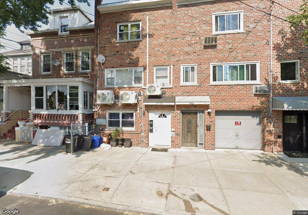
1964 Matthews Ave Bronx, NY 10462
Morris Park NeighborhoodEstimated Value: $685,441 - $872,000
Studio
--
Bath
1,776
Sq Ft
$428/Sq Ft
Est. Value
About This Home
This home is located at 1964 Matthews Ave, Bronx, NY 10462 and is currently estimated at $760,814, approximately $428 per square foot. 1964 Matthews Ave is a home located in Bronx County with nearby schools including P.S. 083 The Donald Hertz School, Bronx Excellence 2, and Bronx Charter School For Excellence 2.
Ownership History
Date
Name
Owned For
Owner Type
Purchase Details
Closed on
Oct 30, 2025
Sold by
Chu Eric and Chu Lillian
Bought by
Bluesaphire Llc Trustee and Marcasite Trust
Current Estimated Value
Purchase Details
Closed on
Jan 18, 2012
Sold by
Hsbc Bank Usa N A
Bought by
Chu Eric and Chu Lillian
Purchase Details
Closed on
Jul 12, 2010
Sold by
Castro-Arce Yolanda Esq
Bought by
Hsbc Bank Usa N A As Truestee
Purchase Details
Closed on
Nov 30, 2005
Sold by
Martins Aleghe
Bought by
Opide Moses
Home Financials for this Owner
Home Financials are based on the most recent Mortgage that was taken out on this home.
Original Mortgage
$448,000
Interest Rate
6.35%
Mortgage Type
Purchase Money Mortgage
Create a Home Valuation Report for This Property
The Home Valuation Report is an in-depth analysis detailing your home's value as well as a comparison with similar homes in the area
Home Values in the Area
Average Home Value in this Area
Purchase History
| Date | Buyer | Sale Price | Title Company |
|---|---|---|---|
| Bluesaphire Llc Trustee | -- | -- | |
| Chu Eric | $237,199 | -- | |
| Chu Eric | $237,199 | -- | |
| Hsbc Bank Usa N A As Truestee | $528,050 | -- | |
| Hsbc Bank Usa N A As Truestee | $528,050 | -- | |
| Opide Moses | $560,000 | -- | |
| Opide Moses | $560,000 | -- |
Source: Public Records
Mortgage History
| Date | Status | Borrower | Loan Amount |
|---|---|---|---|
| Previous Owner | Opide Moses | $448,000 |
Source: Public Records
Tax History
| Year | Tax Paid | Tax Assessment Tax Assessment Total Assessment is a certain percentage of the fair market value that is determined by local assessors to be the total taxable value of land and additions on the property. | Land | Improvement |
|---|---|---|---|---|
| 2025 | $6,142 | $32,413 | $6,248 | $26,165 |
| 2024 | $6,142 | $30,578 | $6,444 | $24,134 |
| 2023 | $5,859 | $28,848 | $5,953 | $22,895 |
| 2022 | $5,140 | $39,060 | $8,940 | $30,120 |
| 2021 | $5,728 | $32,160 | $8,940 | $23,220 |
| 2020 | $5,717 | $34,440 | $8,940 | $25,500 |
| 2019 | $5,331 | $27,780 | $8,940 | $18,840 |
| 2018 | $4,901 | $24,040 | $6,708 | $17,332 |
| 2017 | $4,623 | $22,680 | $8,940 | $13,740 |
| 2016 | $4,882 | $24,422 | $8,365 | $16,057 |
| 2015 | -- | $23,040 | $9,960 | $13,080 |
| 2014 | -- | $21,751 | $8,850 | $12,901 |
Source: Public Records
Map
Nearby Homes
- 1961 Wallace Ave
- 1916 Barnes Ave
- 1913 Barnes Ave
- 762 Brady Ave Unit 221
- 758 Brady Ave Unit 214
- 758 Brady Ave Unit 411
- 760 Brady Ave Unit 417
- 760 Brady Ave Unit 217
- 1914 Holland Ave
- 2004 Bogart Ave
- 754 Brady Ave Unit 303
- 756 Brady Ave Unit 507
- 2075 Wallace Ave Unit 546
- 1918 Hunt Ave
- 2090 Barnes Ave Unit 3G
- 1858 Wallace Ave
- 2080 Barnes Ave Unit 5B
- 2080 Barnes Ave Unit 4A
- 2080 Barnes Ave Unit 4C
- 2080 Barnes Ave Unit 4-E
- 1962 Matthews Ave
- 1966 Matthews Ave
- 1960 Matthews Ave
- 1968 Matthews Ave
- 1942 Bronxdale Ave
- 1940 Bronxdale Ave
- 1972 Matthews Ave
- 1938 Bronxdale Ave
- 1921 Muliner Ave
- 1923 Muliner Ave
- 1919 Muliner Ave
- 1919 Muliner Ave Unit 2
- 1936 Bronxdale Ave
- 1925 Muliner Ave
- 1917 Muliner Ave
- 1974 Matthews Ave
- 1950 Bronxdale Ave
- 1935 Muliner Ave
- 1915 Muliner Ave
- 1934 Bronxdale Ave
Your Personal Tour Guide
Ask me questions while you tour the home.