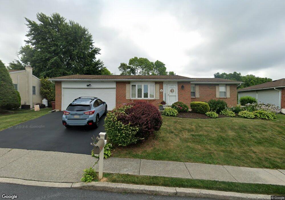
1964 Ronald Dr Whitehall, PA 18052
Fullerton NeighborhoodEstimated Value: $348,406 - $378,000
3
Beds
1
Bath
1,312
Sq Ft
$274/Sq Ft
Est. Value
About This Home
This home is located at 1964 Ronald Dr, Whitehall, PA 18052 and is currently estimated at $359,602, approximately $274 per square foot. 1964 Ronald Dr is a home located in Lehigh County with nearby schools including Zephyr Elementary School, Clarence M Gockley Elementary School, and George D Steckel Elementary School.
Ownership History
Date
Name
Owned For
Owner Type
Purchase Details
Closed on
Nov 25, 1988
Sold by
Strobel James E and Strobel Maryanne P
Bought by
Macaluso Joseph L and Macaluso Rosemary A
Current Estimated Value
Purchase Details
Closed on
May 26, 1983
Sold by
Strobel James E
Bought by
Strobel James E and Strobel Maryanne P
Purchase Details
Closed on
Aug 15, 1979
Bought by
Strobel James E
Create a Home Valuation Report for This Property
The Home Valuation Report is an in-depth analysis detailing your home's value as well as a comparison with similar homes in the area
Home Values in the Area
Average Home Value in this Area
Purchase History
| Date | Buyer | Sale Price | Title Company |
|---|---|---|---|
| Macaluso Joseph L | $139,900 | -- | |
| Strobel James E | -- | -- | |
| Strobel James E | $65,500 | -- |
Source: Public Records
Tax History Compared to Growth
Tax History
| Year | Tax Paid | Tax Assessment Tax Assessment Total Assessment is a certain percentage of the fair market value that is determined by local assessors to be the total taxable value of land and additions on the property. | Land | Improvement |
|---|---|---|---|---|
| 2025 | $5,172 | $176,400 | $33,100 | $143,300 |
| 2024 | $4,998 | $176,400 | $33,100 | $143,300 |
| 2023 | $4,895 | $176,400 | $33,100 | $143,300 |
| 2022 | $4,784 | $176,400 | $143,300 | $33,100 |
| 2021 | $4,705 | $176,400 | $33,100 | $143,300 |
| 2020 | $4,524 | $176,400 | $33,100 | $143,300 |
| 2019 | $4,172 | $176,400 | $33,100 | $143,300 |
| 2018 | $4,063 | $176,400 | $33,100 | $143,300 |
| 2017 | $3,989 | $176,400 | $33,100 | $143,300 |
| 2016 | -- | $176,400 | $33,100 | $143,300 |
| 2015 | -- | $176,400 | $33,100 | $143,300 |
| 2014 | -- | $176,400 | $33,100 | $143,300 |
Source: Public Records
Map
Nearby Homes
- 1733 Elmhurst Dr
- 1924 Alberta Dr
- 2101 Van Buren Dr
- 109 Johnson Ct
- 36 Peachtree Cir
- 195 Shiloh Ct
- 1844 Schadt Ave
- 2 Grantarthur #Franklin Ct
- 1590 Abigail Ln Unit LOT 59
- 1 Grantartur #Taylor Ct
- 4 Grantarthur #Morris Ct
- 3 Grantarthur #Liberty Ct
- 1573 Abigail Ln
- 1 Grantarthur #Taylor Ct
- 1313 Hemlock Dr
- 2020 Whitehall Ave
- 1640 Alta Dr
- 1739 N 21st St
- 1575 Creekside Rd Unit 21
- 1553 Creekside Rd Unit B23
- 1962 Ronald Dr
- 1968 Ronald Dr
- 1707 Elmhurst Dr
- 1958 Ronald Dr
- 1965 Ronald Dr
- 1959 Ronald Dr
- 1967 Ronald Dr
- 76 Madison Ln
- 78 Madison Ln
- 74 Madison Ln
- 1708 Elmhurst Dr
- 1710 Elmhurst Dr
- 1951 Ronald Dr
- 1706 Elmhurst Dr
- 72 Madison Ln
- 1980 Linden Ln
- 1978 Linden Ln
- 1982 Linden Ln
- 1704 Elmhurst Dr
- 80 Madison Ln