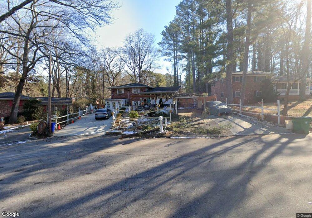
1964 Shannon Ridge Ct Decatur, GA 30032
Estimated Value: $228,000 - $327,000
5
Beds
2
Baths
2,411
Sq Ft
$119/Sq Ft
Est. Value
About This Home
This home is located at 1964 Shannon Ridge Ct, Decatur, GA 30032 and is currently estimated at $286,446, approximately $118 per square foot. 1964 Shannon Ridge Ct is a home located in DeKalb County with nearby schools including Toney Elementary School, Columbia Middle School, and Columbia High School.
Ownership History
Date
Name
Owned For
Owner Type
Purchase Details
Closed on
Aug 18, 1999
Sold by
Atteck Cynthia P
Bought by
Atteck Cynthia P and Atteck Sherry A
Current Estimated Value
Purchase Details
Closed on
Jul 22, 1999
Sold by
Harry Sheldon
Bought by
Atteck Cynthia P
Purchase Details
Closed on
Aug 21, 1996
Sold by
Fleet Finance Inc Ga
Bought by
Atteck Cynthia Sherry
Purchase Details
Closed on
Dec 5, 1995
Sold by
Cooke James W
Bought by
Fleet Finance Inc
Create a Home Valuation Report for This Property
The Home Valuation Report is an in-depth analysis detailing your home's value as well as a comparison with similar homes in the area
Home Values in the Area
Average Home Value in this Area
Purchase History
| Date | Buyer | Sale Price | Title Company |
|---|---|---|---|
| Atteck Cynthia P | -- | -- | |
| Atteck Cynthia P | -- | -- | |
| Atteck Cynthia P | -- | -- | |
| Atteck Cynthia Sherry | $54,900 | -- | |
| Fleet Finance Inc | $54,800 | -- |
Source: Public Records
Mortgage History
| Date | Status | Borrower | Loan Amount |
|---|---|---|---|
| Closed | Atteck Cynthia Sherry | $0 |
Source: Public Records
Tax History Compared to Growth
Tax History
| Year | Tax Paid | Tax Assessment Tax Assessment Total Assessment is a certain percentage of the fair market value that is determined by local assessors to be the total taxable value of land and additions on the property. | Land | Improvement |
|---|---|---|---|---|
| 2025 | $618 | $104,760 | $24,560 | $80,200 |
| 2024 | $634 | $92,000 | $24,560 | $67,440 |
| 2023 | $634 | $101,040 | $24,560 | $76,480 |
| 2022 | $533 | $73,200 | $14,040 | $59,160 |
| 2021 | $533 | $70,720 | $14,040 | $56,680 |
| 2020 | $588 | $57,840 | $12,000 | $45,840 |
| 2019 | $579 | $55,680 | $12,000 | $43,680 |
| 2018 | $732 | $42,800 | $12,000 | $30,800 |
| 2017 | $1,033 | $30,960 | $3,200 | $27,760 |
| 2016 | $828 | $24,680 | $3,200 | $21,480 |
| 2014 | $584 | $14,440 | $640 | $13,800 |
Source: Public Records
Map
Nearby Homes
- 2962 Mcafee Rd
- 1973 Glendale Dr
- 2952 Mcafee Rd
- 3110 Mcafee Rd
- 2922 Dale Place
- 2003 Rosewood Rd
- 1996 Meadow Ln
- 1875 Creekside Ct
- 2917 Mcafee Rd
- 2048 Glendale Dr
- 1968 Rosewood Rd
- 1932 Rosewood Rd
- 1981 Meadow Ln
- 2024 Rosewood Rd
- 1923 Rosewood Rd
- 1884 Meadow Ln
- 1909 Meadow Ln
- 2099 Yucca Dr
- 1911 Rosewood Rd
- 1903 Meadow Ln
- 1970 Shannon Ridge Ct
- 1960 Shannon Ridge Ct
- 1976 Shannon Ridge Ct
- 1965 Crestmoore Dr
- 1959 Crestmoore Dr
- 1956 Shannon Ridge Ct
- 1969 Crestmoore Dr
- 1953 Crestmoore Dr
- 1982 Shannon Ridge Ct
- 1955 Shannon Ridge Ct
- 1969 Shannon
- 1969 Shannon Ridge Ct
- 1963 Shannon Ridge Ct
- 1947 Crestmoore Dr
- 1977 Shannon Ridge Ct
- 1959 Shannon Ridge Ct
- 1973 Crestmoore Dr
- 0 Crestmoore Dr Unit 7137909
- 0 Crestmoore Dr Unit 7074197
- 0 Crestmoore Dr Unit 8240186