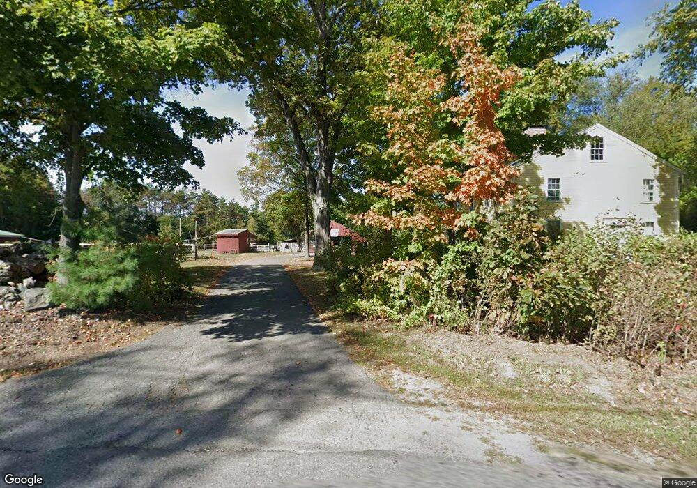
1964 Shirley Rd Lancaster, MA 01523
Estimated Value: $784,837 - $988,000
5
Beds
3
Baths
2,968
Sq Ft
$294/Sq Ft
Est. Value
About This Home
This home is located at 1964 Shirley Rd, Lancaster, MA 01523 and is currently estimated at $871,959, approximately $293 per square foot. 1964 Shirley Rd is a home located in Worcester County with nearby schools including Mary Rowlandson Elementary School, Luther Burbank Middle School, and Nashoba Regional High School.
Ownership History
Date
Name
Owned For
Owner Type
Purchase Details
Closed on
Aug 15, 2008
Sold by
Mears Perley B C and Altucher Sandy R
Bought by
Dugan Kathleen M and Barrett Michael C
Current Estimated Value
Home Financials for this Owner
Home Financials are based on the most recent Mortgage that was taken out on this home.
Original Mortgage
$300,000
Interest Rate
6.4%
Mortgage Type
Purchase Money Mortgage
Purchase Details
Closed on
Jun 16, 1995
Sold by
Jamison Mark and Jamison Ann
Bought by
Altucher Sandy and Mears Perley
Purchase Details
Closed on
Jul 15, 1993
Sold by
Wilson Allan M and Wilson Judith
Bought by
Jamison Mark and Jamison Ann
Create a Home Valuation Report for This Property
The Home Valuation Report is an in-depth analysis detailing your home's value as well as a comparison with similar homes in the area
Home Values in the Area
Average Home Value in this Area
Purchase History
| Date | Buyer | Sale Price | Title Company |
|---|---|---|---|
| Dugan Kathleen M | $397,500 | -- | |
| Dugan Kathleen M | $397,500 | -- | |
| Altucher Sandy | $230,000 | -- | |
| Altucher Sandy | $230,000 | -- | |
| Jamison Mark | $235,000 | -- | |
| Jamison Mark | $235,000 | -- |
Source: Public Records
Mortgage History
| Date | Status | Borrower | Loan Amount |
|---|---|---|---|
| Open | Jamison Mark | $300,000 | |
| Closed | Dugan Kathleen M | $300,000 | |
| Previous Owner | Jamison Mark | $189,000 |
Source: Public Records
Tax History Compared to Growth
Tax History
| Year | Tax Paid | Tax Assessment Tax Assessment Total Assessment is a certain percentage of the fair market value that is determined by local assessors to be the total taxable value of land and additions on the property. | Land | Improvement |
|---|---|---|---|---|
| 2025 | $10,371 | $641,800 | $140,800 | $501,000 |
| 2024 | $10,488 | $600,700 | $130,800 | $469,900 |
| 2023 | $9,824 | $571,500 | $121,100 | $450,400 |
| 2022 | $9,579 | $492,500 | $110,300 | $382,200 |
| 2021 | $9,498 | $475,400 | $110,300 | $365,100 |
| 2020 | $8,718 | $439,200 | $110,300 | $328,900 |
| 2019 | $8,346 | $422,600 | $110,300 | $312,300 |
| 2018 | $8,142 | $407,500 | $110,300 | $297,200 |
| 2016 | $7,400 | $378,500 | $109,300 | $269,200 |
| 2015 | $7,059 | $376,300 | $109,300 | $267,000 |
| 2014 | $6,378 | $337,300 | $109,300 | $228,000 |
Source: Public Records
Map
Nearby Homes
- 0 Windsor Rd
- 95 Old Union Turnpike
- 27 Lancaster Rd
- 7 Lawson Ave
- 3 Mill St
- 25 Front St
- 30 Ayer Rd
- 40 Ayer Rd
- 3 Ambrose Way Unit 3
- 6 Ambrose Way Unit 3
- 19 Ambrose Way Unit 19
- 9 Ambrose Way Unit 9
- 1 Ambrose Way Unit 1
- 7 Ambrose Way Unit 5
- 4 Ambrose Way Unit 4
- 5 Ambrose Way Unit 5
- 13 Ambrose Way Unit 13
- 35 Mcgovern Blvd
- 45 Clark Rd
- 1497 Lunenburg Rd
- 1930 Shirley Rd
- 1990 Shirley Rd
- 1922 Shirley Rd
- 25 Chisholm Trail
- 29 Chisholm Trail
- Lot 49 Chisholm Trail
- 49 Chisholm Trail
- 1907 Shirley Rd
- 1000 Mt Laurel Cir Unit 3
- 1000 Mount Laurel Cir
- 1000 Mount Laurel Cir Unit 1
- 14 Chisholm Trail
- 130 Lancaster Rd
- 1891 Shirley Rd
- 258 Grant Way
- 255 Grant Way
- 1883 Shirley Rd
- 1870 Shirley Rd
- 1871 Shirley Rd
- 1858 Shirley Rd