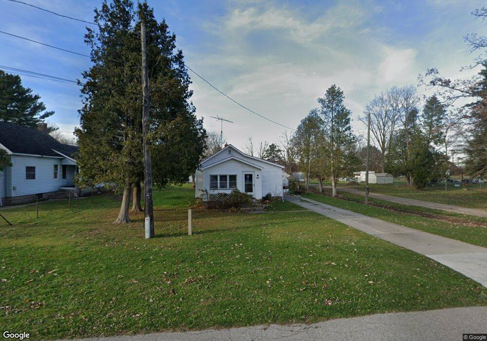
1964 Yeager St Port Huron, MI 48060
Estimated Value: $103,000 - $176,000
3
Beds
1
Bath
1,140
Sq Ft
$126/Sq Ft
Est. Value
About This Home
This home is located at 1964 Yeager St, Port Huron, MI 48060 and is currently estimated at $143,787, approximately $126 per square foot. 1964 Yeager St is a home located in St. Clair County with nearby schools including H.D. Crull Elementary School, Holland Woods Middle School, and Port Huron High School.
Ownership History
Date
Name
Owned For
Owner Type
Purchase Details
Closed on
Mar 31, 2025
Sold by
Bernard Arnold Holdings Llc
Bought by
David Arnold Holdings Llc
Current Estimated Value
Purchase Details
Closed on
Dec 20, 2022
Sold by
Jones Diana
Bought by
Bernard Arnold Holdings Llc
Purchase Details
Closed on
Aug 21, 2019
Sold by
Reichenbach Linda
Bought by
Bernard Arnold Holdings Llc
Purchase Details
Closed on
Jun 2, 2011
Sold by
Bernard B Arnold Revocable Trust
Bought by
Bernard Arnold Holdings Llc
Create a Home Valuation Report for This Property
The Home Valuation Report is an in-depth analysis detailing your home's value as well as a comparison with similar homes in the area
Home Values in the Area
Average Home Value in this Area
Purchase History
| Date | Buyer | Sale Price | Title Company |
|---|---|---|---|
| David Arnold Holdings Llc | -- | None Listed On Document | |
| Bernard Arnold Holdings Llc | -- | -- | |
| Bernard Arnold Holdings Llc | -- | None Available | |
| Bernard Arnold Holdings Llc | -- | None Available |
Source: Public Records
Tax History Compared to Growth
Tax History
| Year | Tax Paid | Tax Assessment Tax Assessment Total Assessment is a certain percentage of the fair market value that is determined by local assessors to be the total taxable value of land and additions on the property. | Land | Improvement |
|---|---|---|---|---|
| 2025 | $1,617 | $54,300 | $0 | $0 |
| 2024 | $1,112 | $57,200 | $0 | $0 |
| 2023 | $1,042 | $52,500 | $0 | $0 |
| 2022 | $1,457 | $42,600 | $0 | $0 |
| 2021 | $1,353 | $36,400 | $0 | $0 |
| 2020 | $1,353 | $34,500 | $34,500 | $0 |
| 2019 | $1,328 | $26,000 | $0 | $0 |
| 2018 | $1,297 | $26,000 | $0 | $0 |
| 2017 | $1,269 | $24,400 | $0 | $0 |
| 2016 | $869 | $24,400 | $0 | $0 |
| 2015 | -- | $24,900 | $24,900 | $0 |
| 2014 | -- | $30,400 | $30,400 | $0 |
| 2013 | -- | $29,500 | $0 | $0 |
Source: Public Records
Map
Nearby Homes
- 0000 Manuel St
- 00 Campau Ave
- 0000 Henry St
- 0000 Water St
- V/L #4 Water St
- V/L #6 Water St
- V/L #5 Water St
- V/L #8 Water St
- V/L #3 Water St
- 146 Taylor St
- 0000 Campau Ave
- 1825 Kern St
- 1819 Kern St
- 2636 Locust St
- 2838 Elmwood St
- 1819 Riverside Dr
- 2566 Lewis Dr
- 3255 Harrington Rd
- 2549 Riverwood Dr
- 3335 W Water St
- 1954 Yeager St
- 1972 Yeager St
- 2000 Yeager St
- 1920 Yeager St Unit Bldg-Unit
- 1920 Yeager St
- 1971 Yeager St
- 1955 Yeager St
- 9711 Crawford
- 2855 & 2867 20th Ave
- 3531 & 3529 Williamsburg Dr
- 926 Edison Shores
- 00 Michigan Rd
- 6684, 6680 6682 Lakeshore Rd
- 1925 Yeager St
- 2011 Yeager St
- 1880 Yeager St
- 1907 Yeager St
- 2029 Yeager St
- 2036 Yeager St
- 1858 Yeager St