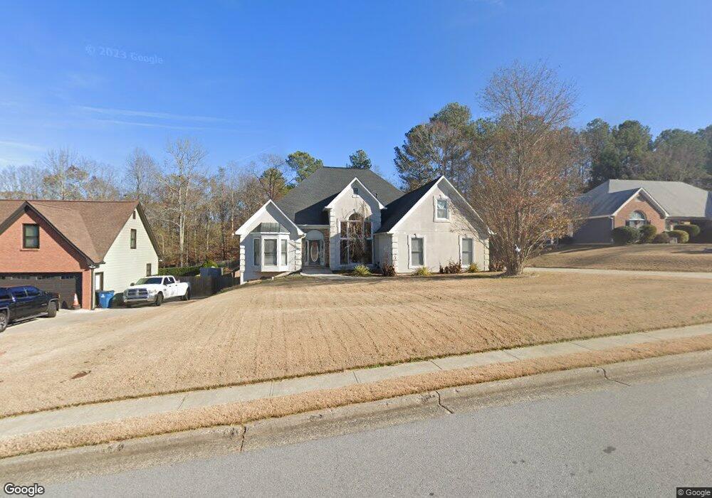
1965 Ashton Pointe Dr Dacula, GA 30019
Estimated Value: $448,000 - $615,619
3
Beds
3
Baths
2,441
Sq Ft
$217/Sq Ft
Est. Value
About This Home
This home is located at 1965 Ashton Pointe Dr, Dacula, GA 30019 and is currently estimated at $530,655, approximately $217 per square foot. 1965 Ashton Pointe Dr is a home located in Gwinnett County with nearby schools including Fort Daniel Elementary School, Frank N. Osborne Middle School, and Mill Creek High School.
Ownership History
Date
Name
Owned For
Owner Type
Purchase Details
Closed on
May 12, 2008
Sold by
Wells Fargo Sarm 2005-15
Bought by
Maciel Gerardo and Maciel Alejandra
Current Estimated Value
Home Financials for this Owner
Home Financials are based on the most recent Mortgage that was taken out on this home.
Original Mortgage
$229,643
Outstanding Balance
$145,200
Interest Rate
6.02%
Mortgage Type
FHA
Estimated Equity
$385,455
Purchase Details
Closed on
Feb 5, 2008
Sold by
Watson Frank and Watson Patty
Bought by
Wells Fargo Bank 2005-15
Purchase Details
Closed on
Sep 30, 1998
Sold by
Parker Ii Conrad Ruman
Bought by
Watson Patty Jean
Home Financials for this Owner
Home Financials are based on the most recent Mortgage that was taken out on this home.
Original Mortgage
$175,750
Interest Rate
6.8%
Mortgage Type
New Conventional
Purchase Details
Closed on
Aug 16, 1996
Sold by
K A S Constr Inc Alan
Bought by
Parker Conrad Marie
Create a Home Valuation Report for This Property
The Home Valuation Report is an in-depth analysis detailing your home's value as well as a comparison with similar homes in the area
Home Values in the Area
Average Home Value in this Area
Purchase History
| Date | Buyer | Sale Price | Title Company |
|---|---|---|---|
| Maciel Gerardo | $231,500 | -- | |
| Wells Fargo Bank 2005-15 | $224,010 | -- | |
| Watson Patty Jean | $185,000 | -- | |
| Parker Conrad Marie | $162,500 | -- |
Source: Public Records
Mortgage History
| Date | Status | Borrower | Loan Amount |
|---|---|---|---|
| Open | Maciel Gerardo | $229,643 | |
| Previous Owner | Watson Patty Jean | $175,750 | |
| Closed | Parker Conrad Marie | $0 |
Source: Public Records
Tax History
| Year | Tax Paid | Tax Assessment Tax Assessment Total Assessment is a certain percentage of the fair market value that is determined by local assessors to be the total taxable value of land and additions on the property. | Land | Improvement |
|---|---|---|---|---|
| 2025 | $6,699 | $236,760 | $44,000 | $192,760 |
| 2024 | $4,804 | $134,840 | $22,400 | $112,440 |
| 2023 | $4,804 | $134,840 | $22,400 | $112,440 |
| 2022 | $4,765 | $134,840 | $22,400 | $112,440 |
| 2021 | $4,462 | $117,360 | $22,400 | $94,960 |
| 2020 | $4,488 | $117,360 | $22,400 | $94,960 |
| 2019 | $4,329 | $117,360 | $22,400 | $94,960 |
| 2018 | $4,545 | $117,360 | $22,400 | $94,960 |
| 2016 | $3,550 | $88,520 | $14,400 | $74,120 |
| 2015 | $3,588 | $88,520 | $14,400 | $74,120 |
| 2014 | $3,607 | $88,520 | $14,400 | $74,120 |
Source: Public Records
Map
Nearby Homes
- 2044 Lakeland Dr
- 1944 William Glen St
- 2970 Waverly Place Dr
- 2070 Trinity Mill Dr
- 3268 Trinity Mill Cir
- 2455 Millwater Crossing
- 3170 Lakecrest Dr
- 1979 Trinity Mill Dr
- 1969 Trinity Mill Dr
- 2950 Hampton Grove Trace
- 2085 Mount Grove Ct
- 3973 Tridens Place
- 0 Hog Mountain Church Road and Auburn Rd
- 2996 Cambridge Hill Dr
- 3104 Brooksong Way Unit 5
- 1722 Laurel Song Trail Unit 1
- 3119 Tadmore Ct
- 1920 Hamilton Mill Pkwy
- 3134 Mill Grove Terrace
- 3053 Cambridge Hill Dr
- 1975 Ashton Pointe Dr Unit 1
- 1955 Ashton Pointe Dr
- 1985 Ashton Pointe Dr
- 1970 Ashton Pointe Dr
- 1945 Ashton Pointe Dr Unit 1
- 3000 Ashton Pointe Cir Unit 1
- 1995 Ashton Pointe Dr
- 2020 Ashton Pointe Dr
- 1935 Ashton Pointe Dr
- 2990 Ashton Pointe Cir Unit 1
- 3033 Hog Mountain Rd
- 2015 Ashton Pointe Dr Unit 1
- 2030 Ashton Pointe Dr
- 1925 Ashton Pointe Dr
- 1930 Ashton Pointe Dr
- 2980 Ashton Pointe Cir Unit 1
- 2980 Ashton Point
- 2025 Ashton Pointe Dr
- 3053 Hog Mountain Rd
- 1920 Ashton Pointe Dr
Your Personal Tour Guide
Ask me questions while you tour the home.