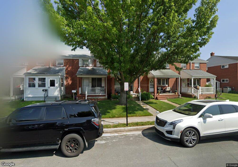
1965 Denbury Dr Dundalk, MD 21222
Estimated Value: $189,322 - $231,000
--
Bed
1
Bath
896
Sq Ft
$231/Sq Ft
Est. Value
About This Home
This home is located at 1965 Denbury Dr, Dundalk, MD 21222 and is currently estimated at $206,831, approximately $230 per square foot. 1965 Denbury Dr is a home located in Baltimore County with nearby schools including Grange Elementary School, General John Stricker Middle School, and Patapsco High & Center for Arts.
Ownership History
Date
Name
Owned For
Owner Type
Purchase Details
Closed on
Jun 2, 2005
Sold by
Ostmann Floyd A
Bought by
Dymowski Leo W
Current Estimated Value
Home Financials for this Owner
Home Financials are based on the most recent Mortgage that was taken out on this home.
Original Mortgage
$136,000
Interest Rate
5.94%
Mortgage Type
New Conventional
Purchase Details
Closed on
Apr 3, 2000
Sold by
Rosenberg Samuel I
Bought by
Ostmann Floyd A and Ostmann Marianne E
Purchase Details
Closed on
Aug 10, 1999
Sold by
Festerman Donald Lee
Bought by
Rosenberg Samuel I
Create a Home Valuation Report for This Property
The Home Valuation Report is an in-depth analysis detailing your home's value as well as a comparison with similar homes in the area
Home Values in the Area
Average Home Value in this Area
Purchase History
| Date | Buyer | Sale Price | Title Company |
|---|---|---|---|
| Dymowski Leo W | $136,036 | -- | |
| Ostmann Floyd A | $70,300 | -- | |
| Rosenberg Samuel I | $44,000 | -- |
Source: Public Records
Mortgage History
| Date | Status | Borrower | Loan Amount |
|---|---|---|---|
| Closed | Dymowski Leo W | $136,000 |
Source: Public Records
Tax History Compared to Growth
Tax History
| Year | Tax Paid | Tax Assessment Tax Assessment Total Assessment is a certain percentage of the fair market value that is determined by local assessors to be the total taxable value of land and additions on the property. | Land | Improvement |
|---|---|---|---|---|
| 2025 | $2,293 | $155,967 | -- | -- |
| 2024 | $2,293 | $143,433 | $0 | $0 |
| 2023 | $1,213 | $130,900 | $36,000 | $94,900 |
| 2022 | $2,129 | $128,167 | $0 | $0 |
| 2021 | $2,136 | $125,433 | $0 | $0 |
| 2020 | $2,136 | $122,700 | $36,000 | $86,700 |
| 2019 | $2,151 | $121,633 | $0 | $0 |
| 2018 | $2,070 | $120,567 | $0 | $0 |
| 2017 | $1,907 | $119,500 | $0 | $0 |
| 2016 | $1,391 | $119,500 | $0 | $0 |
| 2015 | $1,391 | $119,500 | $0 | $0 |
| 2014 | $1,391 | $138,700 | $0 | $0 |
Source: Public Records
Map
Nearby Homes
- 2743 Kirkleigh Rd
- 1940 Wareham Rd
- 1935 Stanhope Rd
- 2746 Moorgate Rd
- 9 Vista Mobile Dr
- 7807 Rockbourne Rd
- 7252 Meadow Ln
- 1894 Church Rd
- 1907 Wills Rd
- 1940H Robinwood Rd
- 2953 Yorkway
- 3135 Sollers Point Rd
- 7839 Harold Rd
- 2970 Yorkway
- 1914 Armco Way
- 2007 Dineen Dr
- 1943 Dineen Dr
- 1614 Lynch Rd
- 8427 Stansbury Lake Dr
- 98 Kentway
- 1967 Denbury Dr
- 1963 Denbury Dr
- 1961 Denbury Dr
- 1969 Denbury Dr
- 1959 Denbury Dr
- 1971 Denbury Dr
- 1957 Denbury Dr
- 1973 Denbury Dr
- 1975 Denbury Dr
- 1955 Denbury Dr
- 1977 Denbury Dr
- 1953 Denbury Dr
- 1951 Denbury Dr
- 1960 Denbury Dr
- 1958 Denbury Dr
- 1962 Denbury Dr
- 1956 Denbury Dr
- 1954 Denbury Dr
- 1952 Denbury Dr
- 2814 Kirkleigh Rd